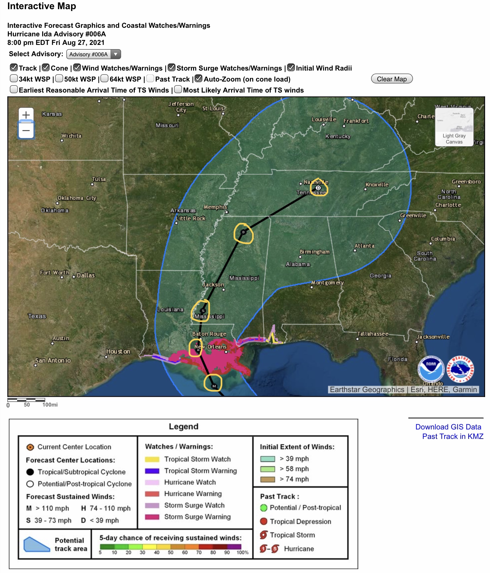
8:00 pm update from NHC and NWS on Hurricane Ida…
Sidney Sperry 28 Aug 2021 00:48 UTC
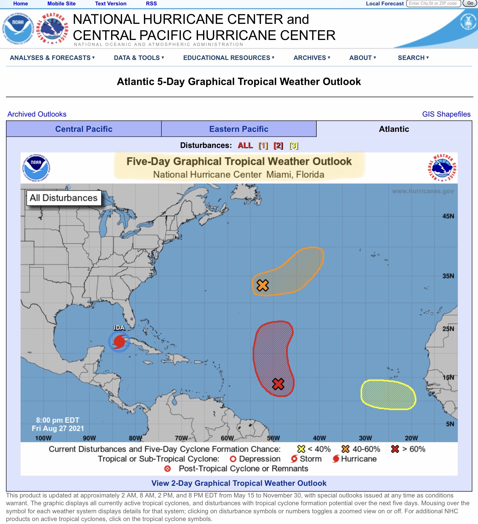
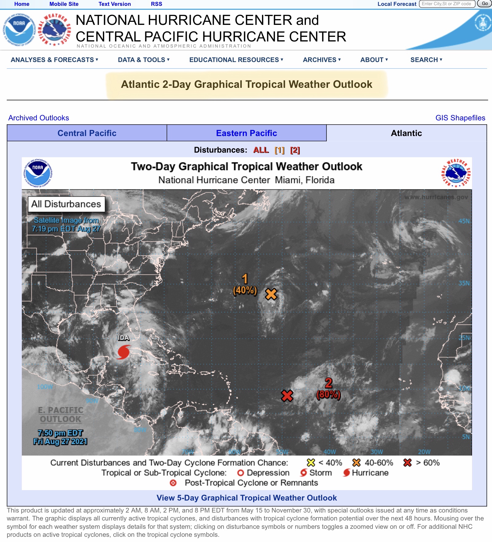
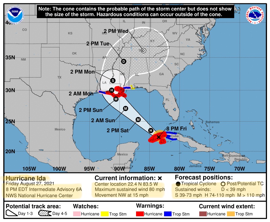
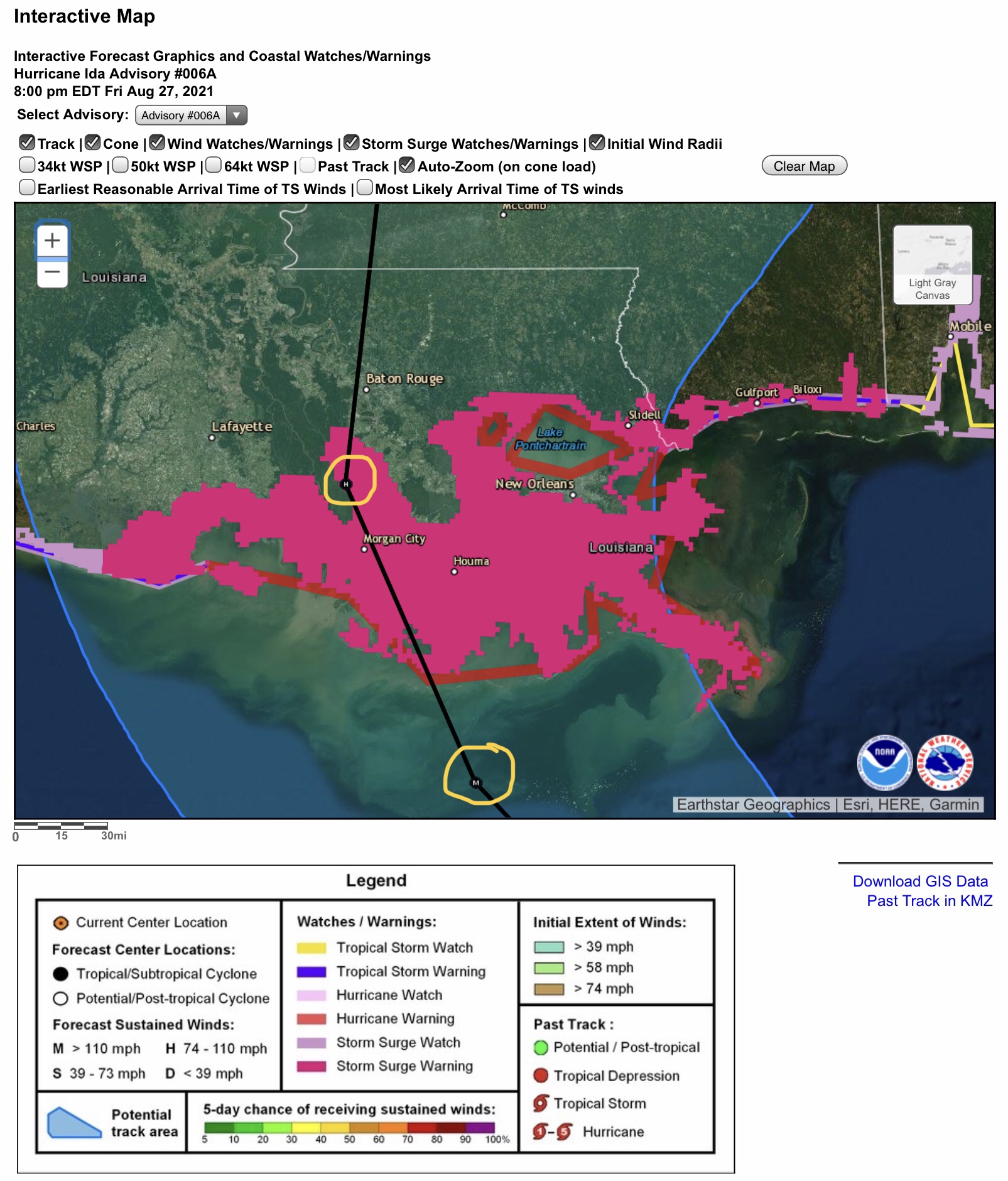
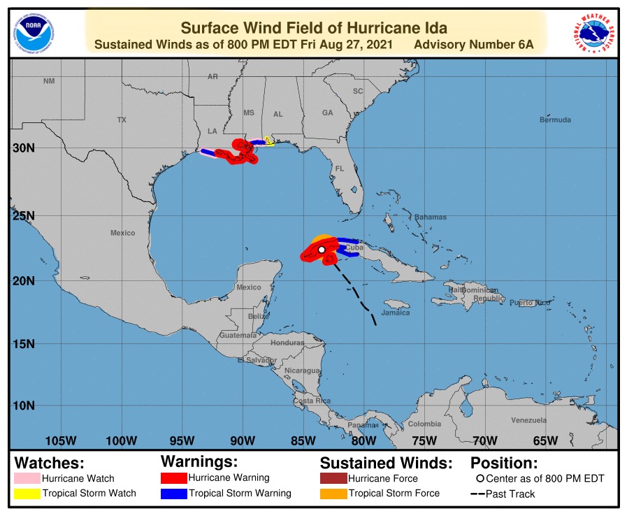
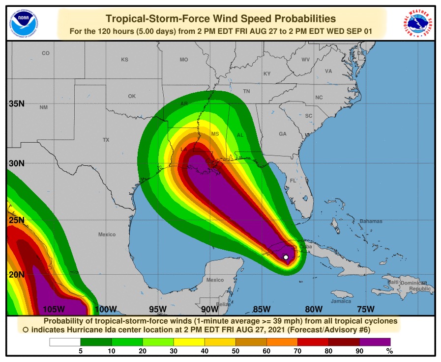
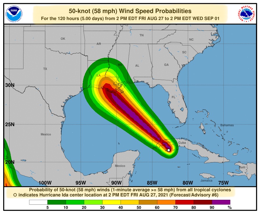
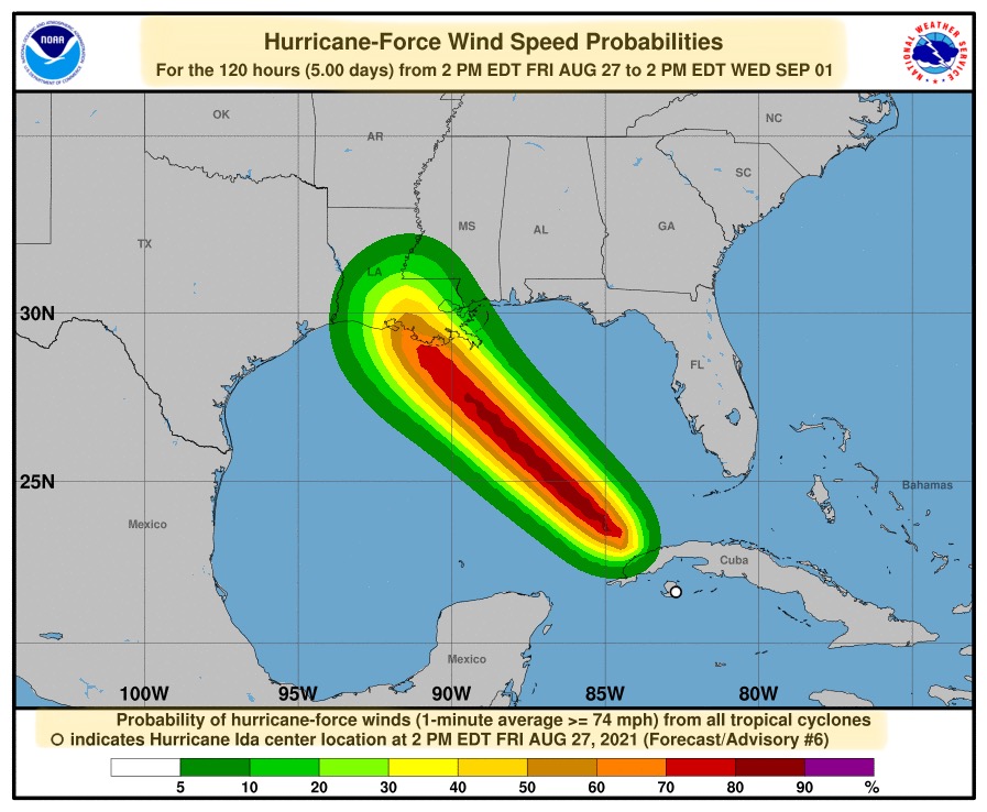
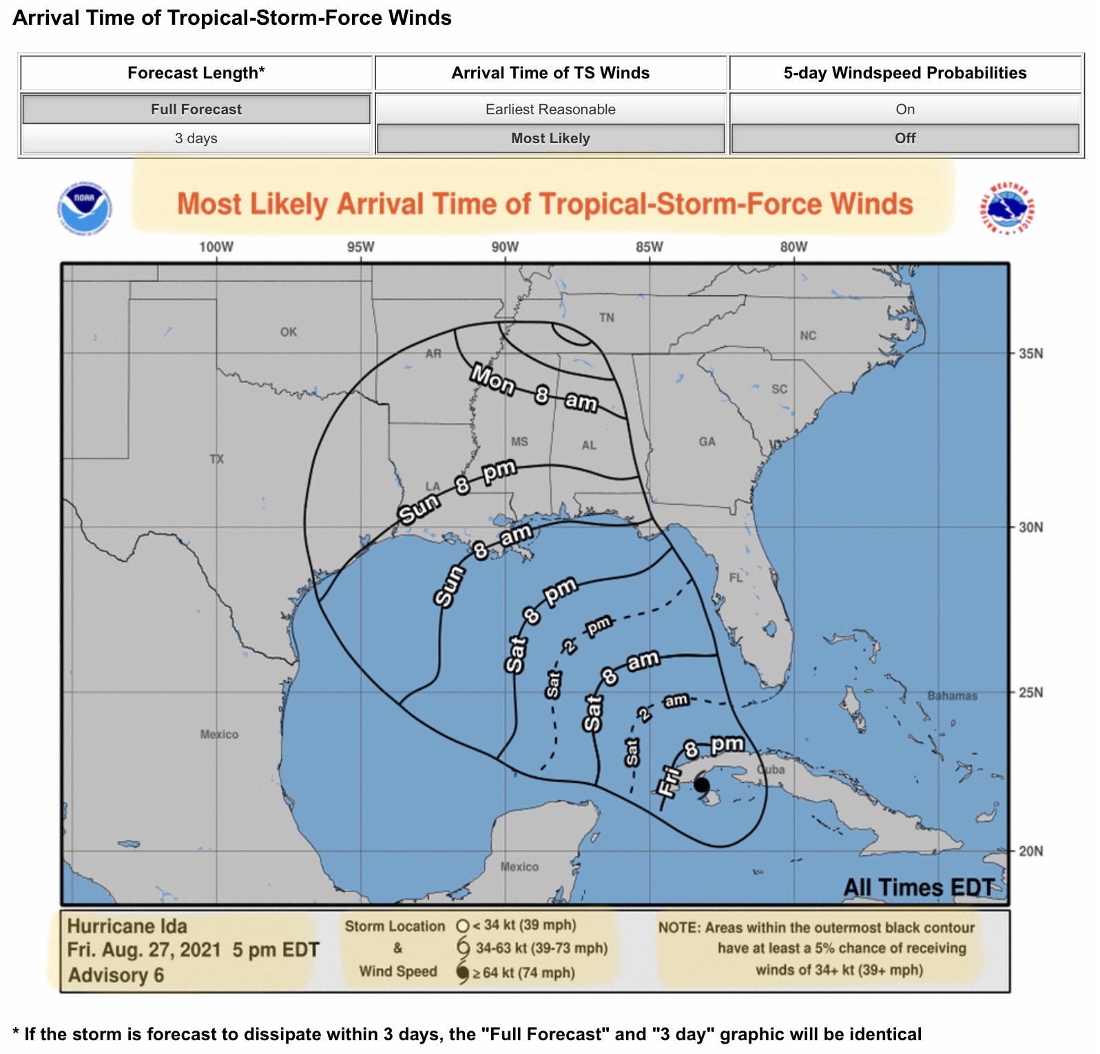
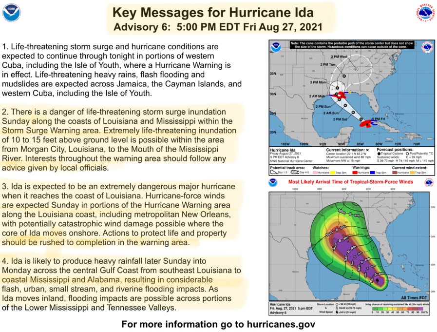
Hurricane Ida is now very close to the northwest peninsula of Cuba, and continues to gain strength as it moves to the northwest at 15 mph. It is expected to gain forward speed and strengthen in intensity as it enters the extremely warm waters of the Gulf of Mexico later tonight and during the early Saturday morning hours. Forecasters are now predicting that Ida will make landfall as a Category 4 major hurricane, with winds close to 140 mph. The 8:00pm NHC forecast track has remained unchanged from earlier this afternoon - areas to the east and northeast of Ida’s eyewall will see the strongest sustained winds, and wind gusts. Ida will still have hurricane force winds (=/> 74 mph) well inland throughout the day on Monday, and will not likely reach subtropical winds
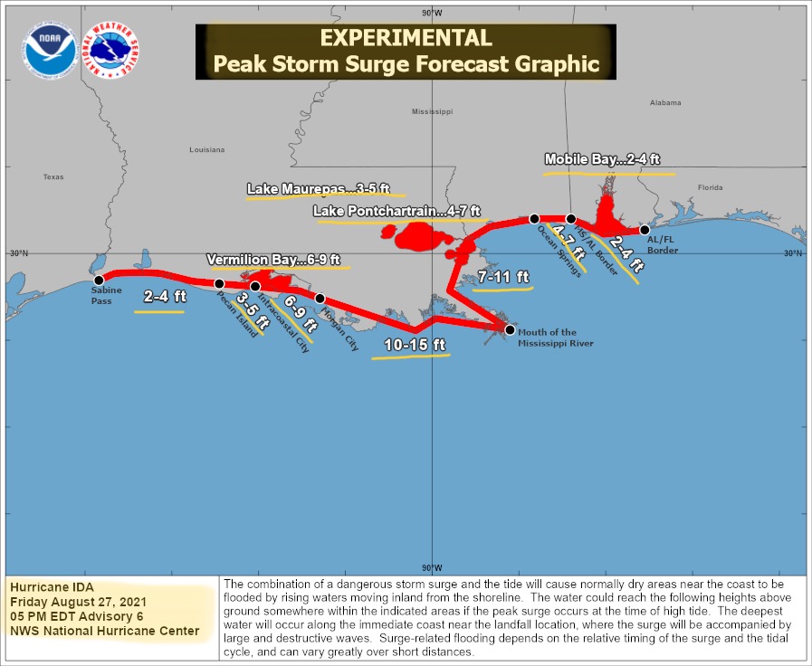
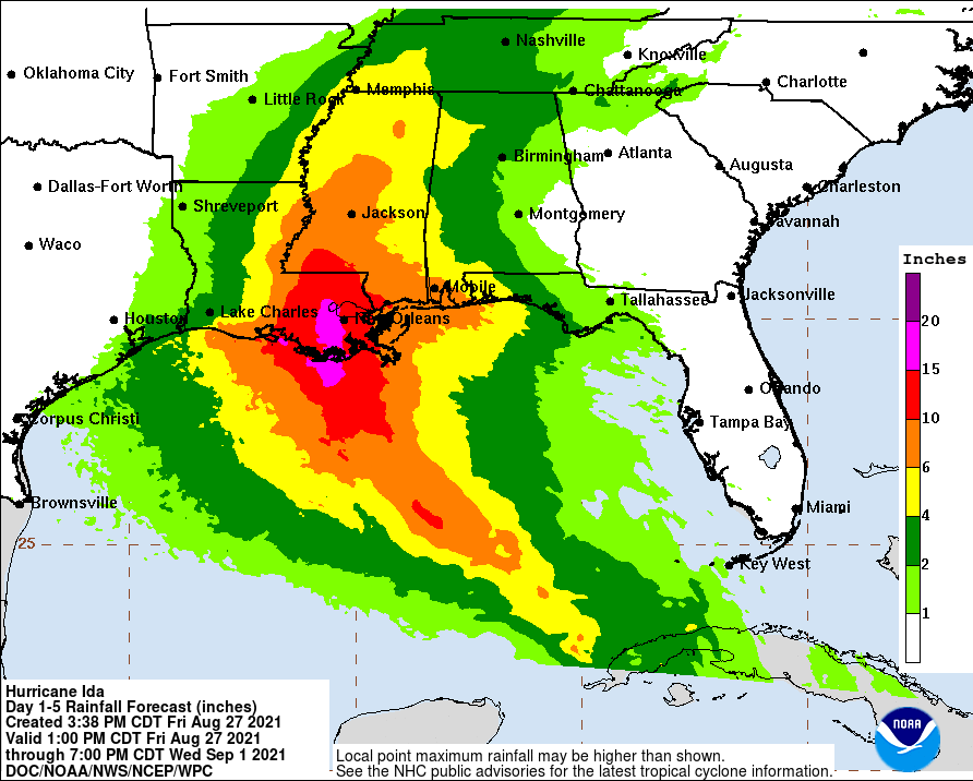
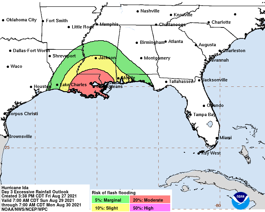
(< 39 mph) until Tuesday morning. Heavy rainfall from 10” to 20”+ is possible across much of eastern and southeastern LA, and from 6” to 12”+ could be expected across much of southern and west-central MS. Storm surge is projected up to 15’ in some areas near the mouth of the Mississippi River in southeastern LA. - Sid Sperry

 Show/hide attachments