Morning Update from NHC on Tropical Storm “Ida”…
Sidney Sperry 27 Aug 2021 15:06 UTC
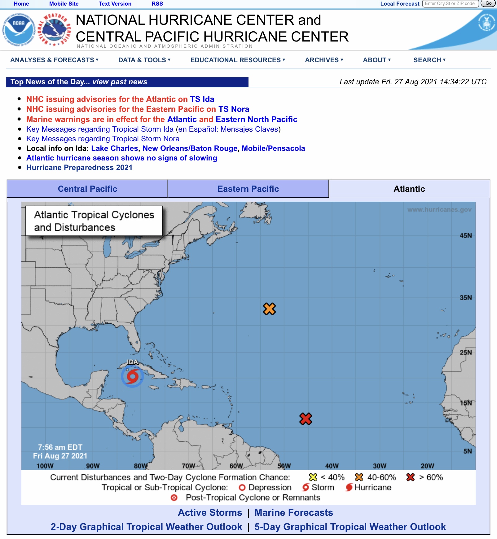
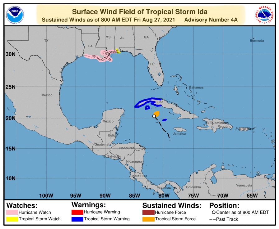
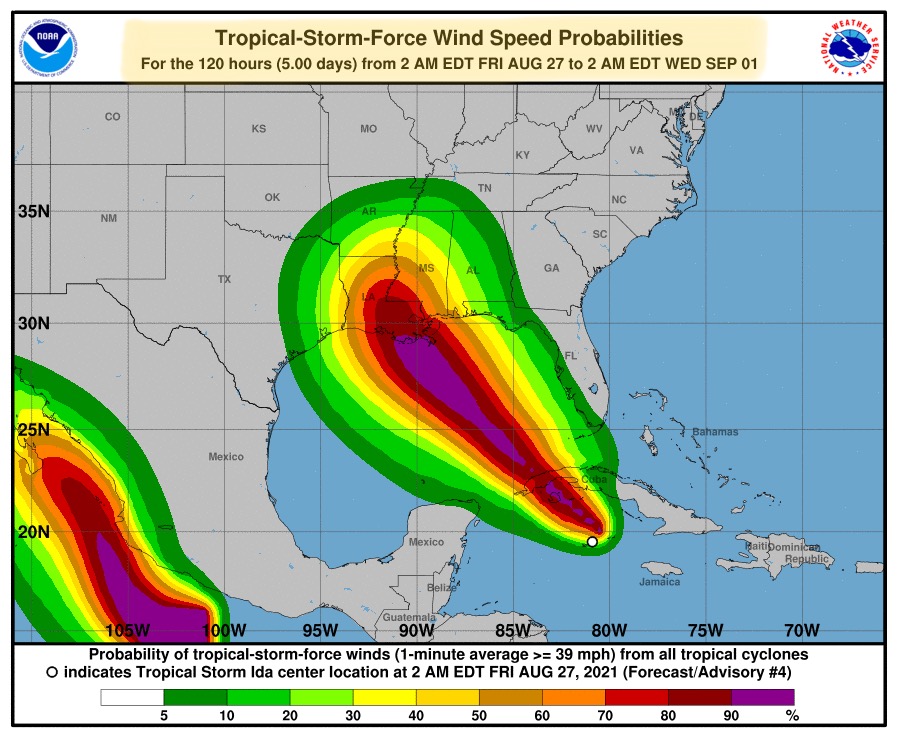
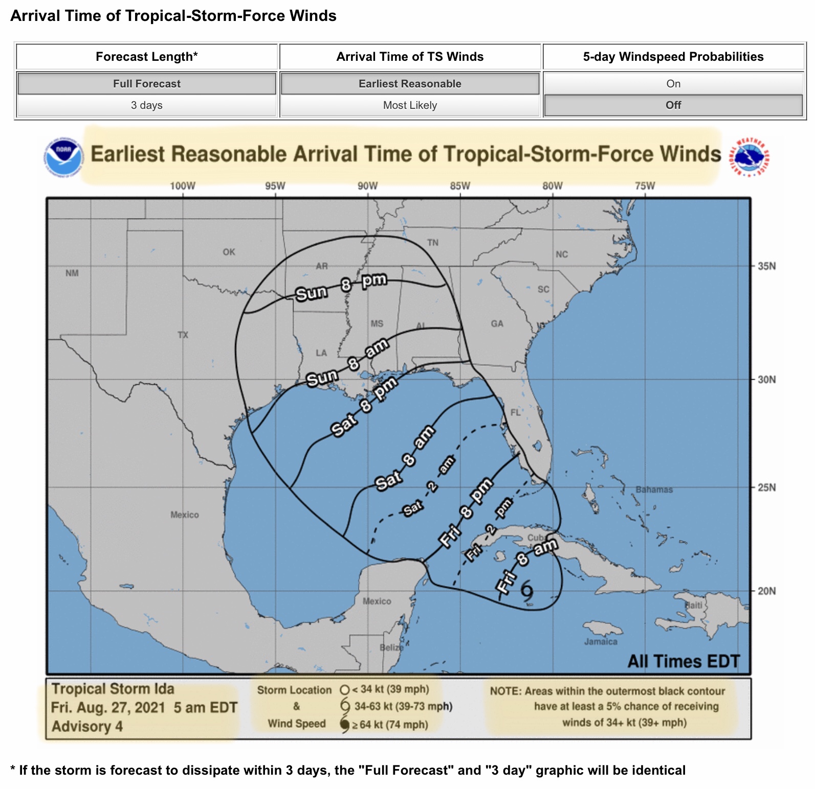
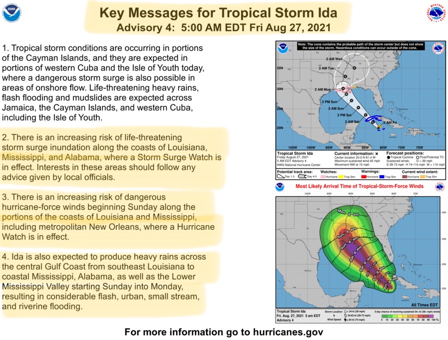
As of 8am Eastern Time, Tropical Storm Ida continues to strengthen. It is located about 200 miles south of northwestern Cuba, its movement is west-northwest at 15 mph. Ida’s current maximum sustained winds are at 60 mph, up from 45 mph late last night.
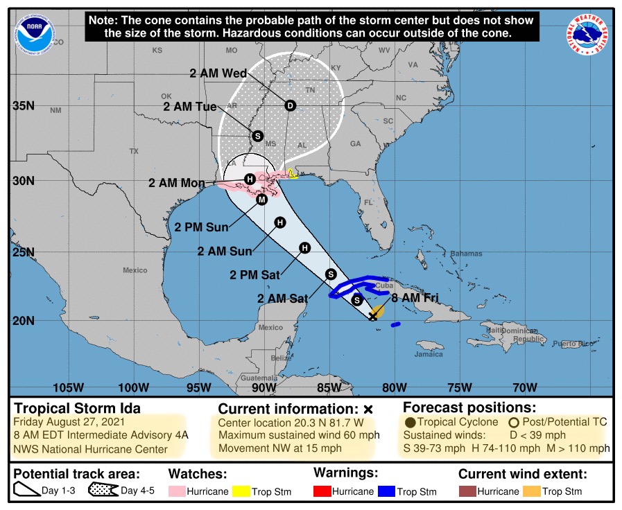
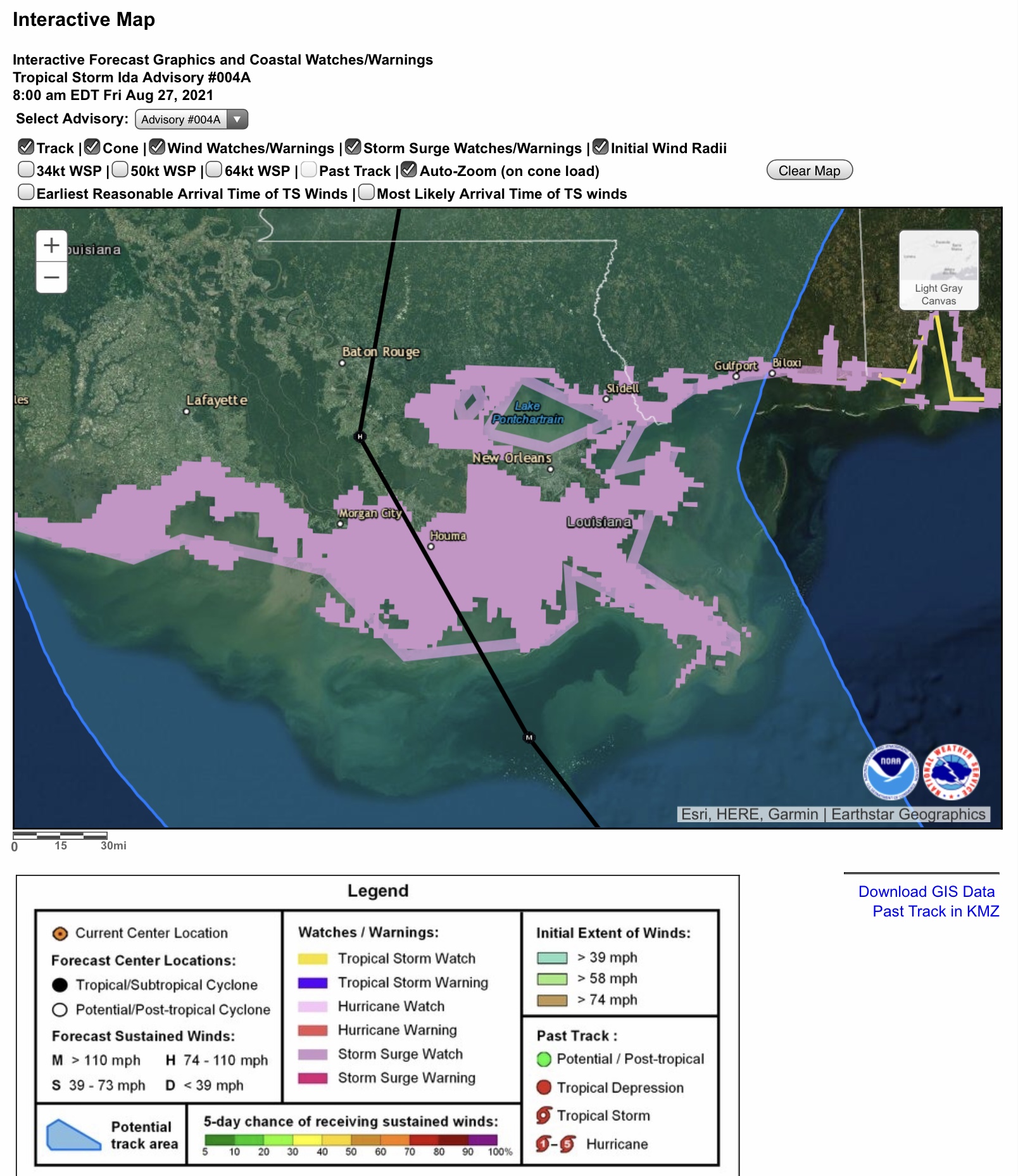
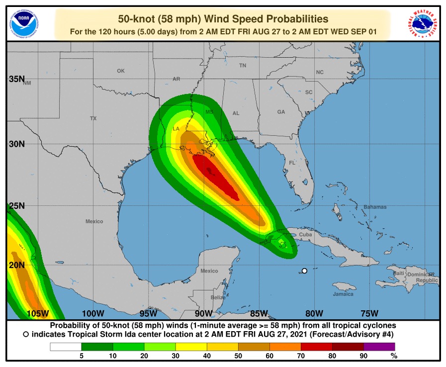
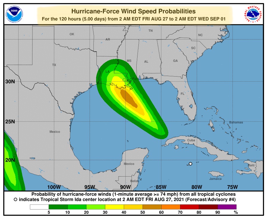
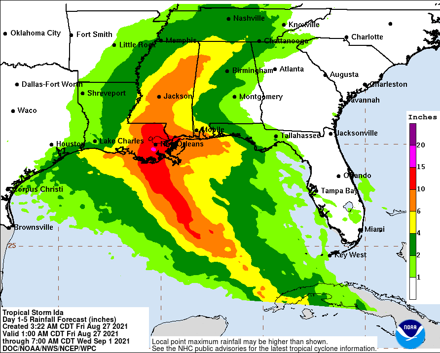
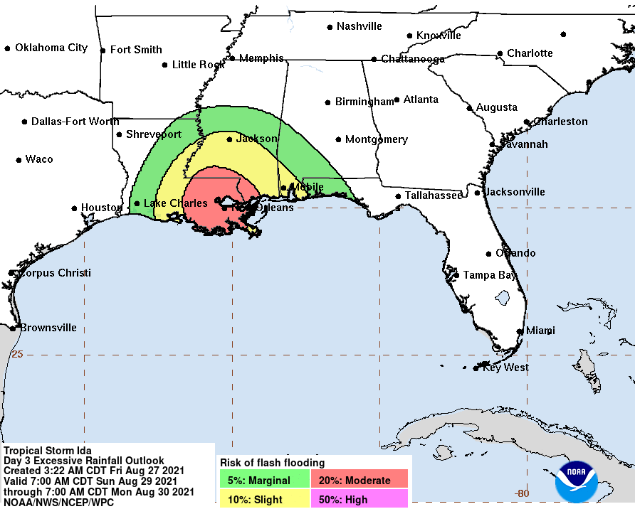
Ida’s forecast track continues to narrow, however, there can still be considerable impacts outside of the forecast “cone”. Ida is projected to become a hurricane (sustained winds of at least 74 mph) after it crosses northwestern Cuba early Saturday morning. It is forecast to become a major hurricane (winds of at least 110 mph) and could be a Category 3 or Category 4 hurricane at landfall, which is currently forecast to be late Sunday night or during the early morning hours on Monday. The current track has Ida making landfall just west of Houma, LA. The current track also has Ida’s eyewall being east Baton Rouge but west of New Orleans and Lake Pontchartrain. As most of you know, the strongest winds in a Gulf of Mexico-born hurricane are typically in its northeast and eastern quadrant, as are the heaviest rainfall amounts. National Weather Service forecasters are currently predicting that some areas near New Orleans could receive up to 20” of rainfall as Ida comes ashore. This obviously would mean potentially devastating flooding impacts to those areas.
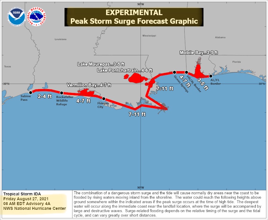
Storm surge estimates are still in the 2’ to 11’ range for much of the Louisiana coast, and the Mississippi coastal areas. More updates this afternoon during the scheduled Conference Call with Aarron Graham from the Louisiana Statewide (3:00pm Central).
- Sid Sperry

 Show/hide attachments