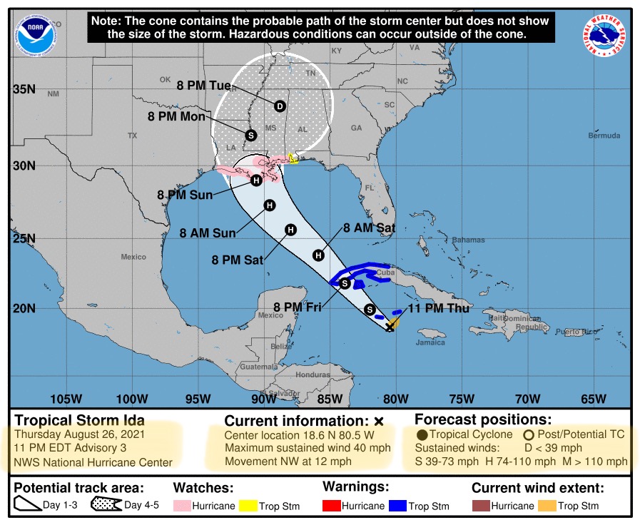
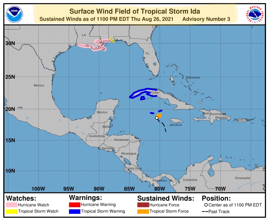
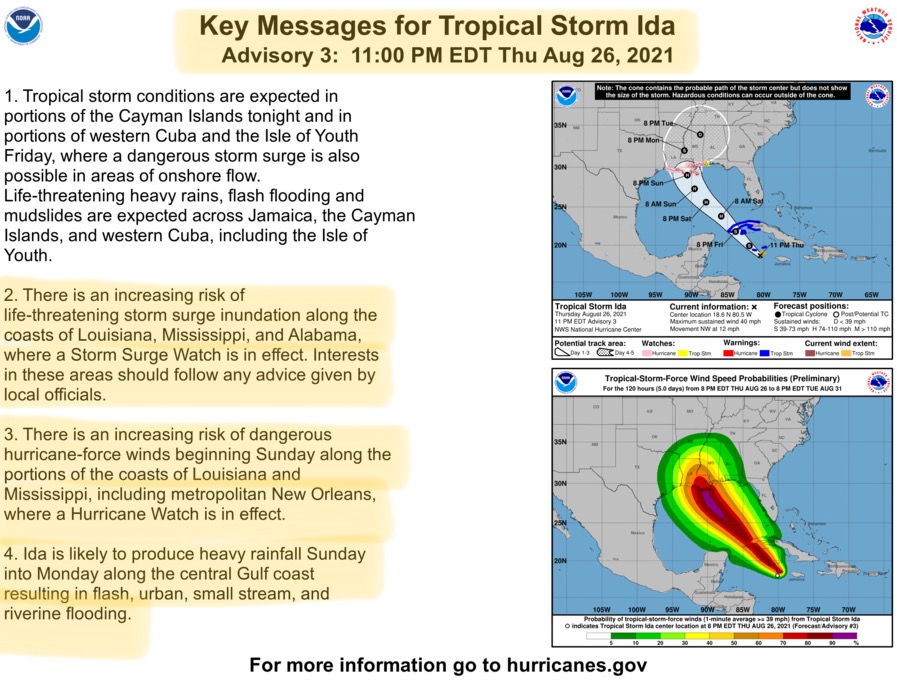
11:00pm Forecast from NHC on Tropical Storm “Ida”…
Sidney Sperry 27 Aug 2021 04:20 UTC
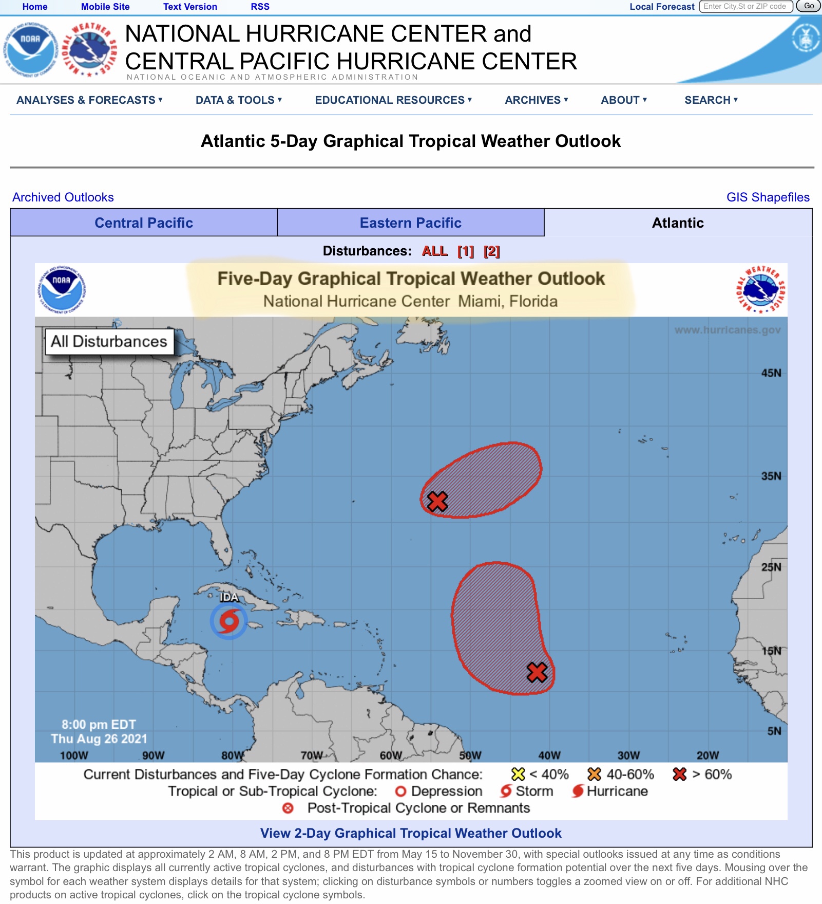
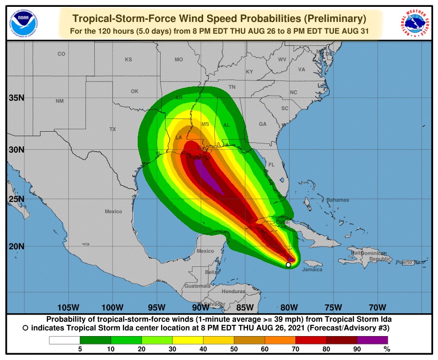
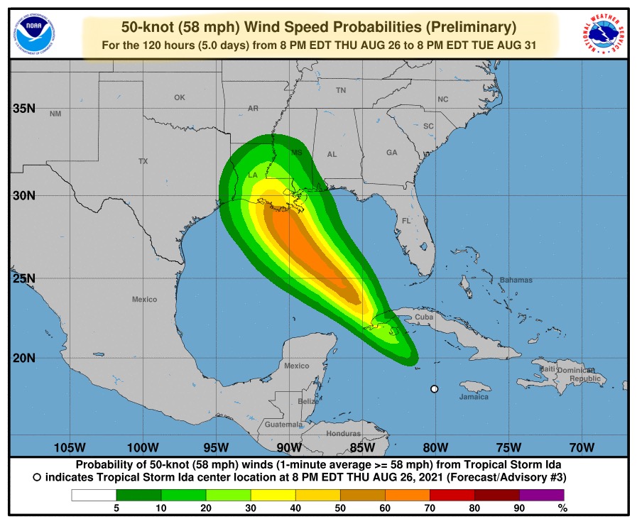
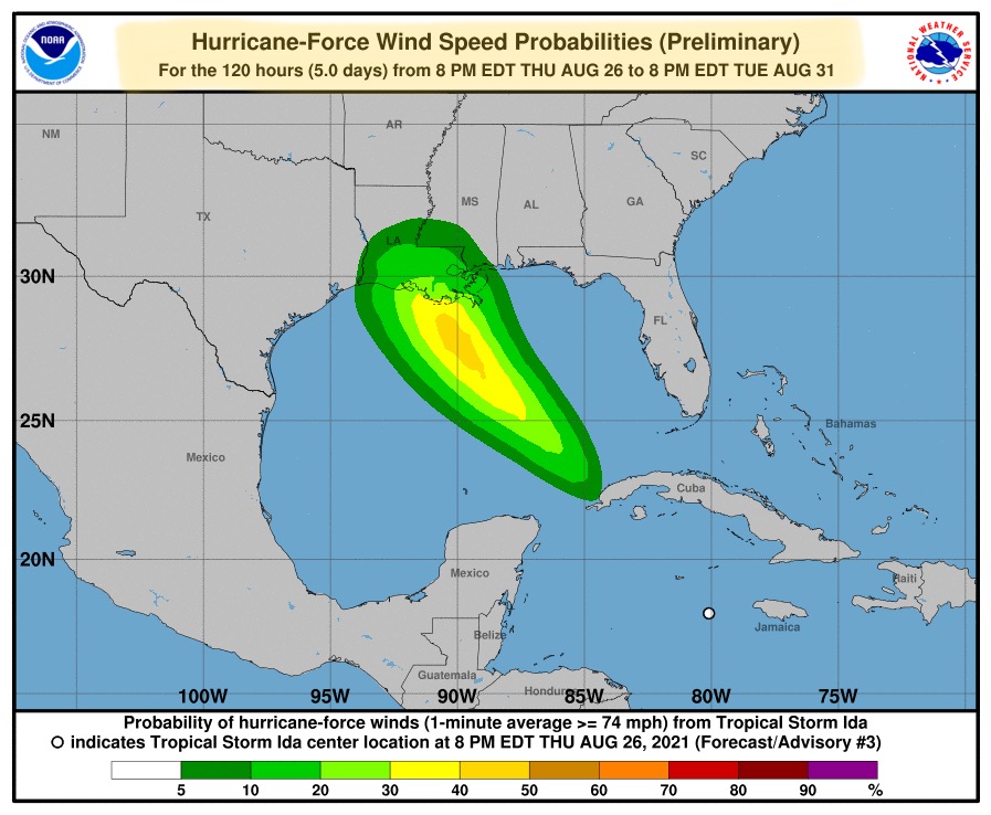
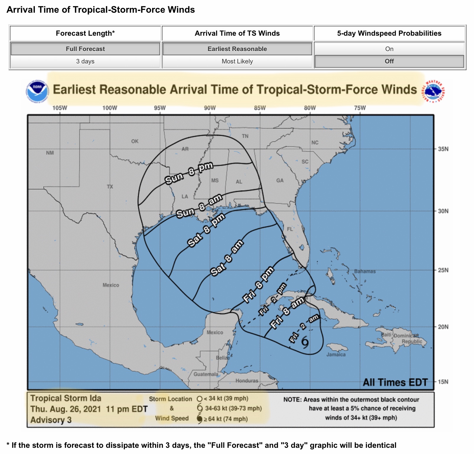
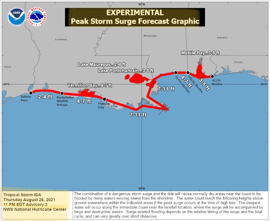
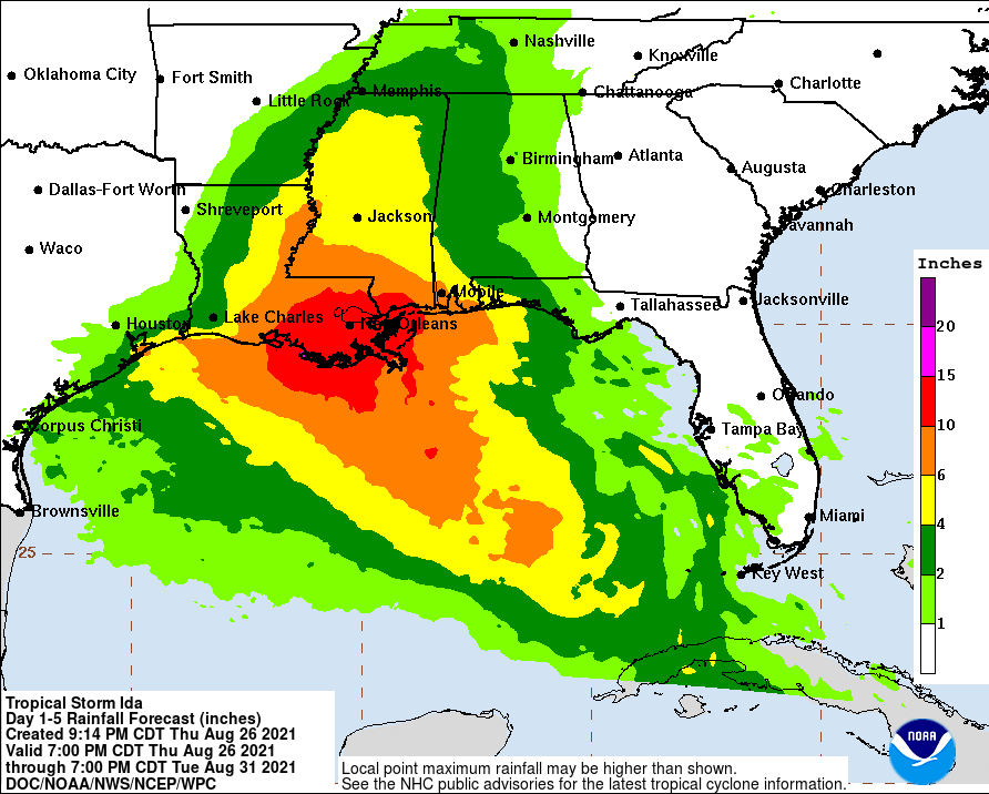
FYI… latest models have the “center” of the NHC forecast track very near Houma, LA, east of Baton Rouge, and west of New Orleans and west of Lake Pontchartrain at this time, but that centerline track could change over the next 3 days. Ida is expected to be a fast-moving, Category 3 or Category 4 hurricane at landfall, sometime late Sunday night or during the early morning hours on Monday. A “Hurricane Watch” has been issued for all of the Louisiana coast and Mississippi coast. A “Tropical Storm Watch” has been issued for parts of the Alabama coastline. After crossing northwestern Cuba on Friday night, Ida is expected to develop into a major hurricane upon entering the southeastern Gulf of Mexico. Storm surge from 2’ up to 11’ is projected at this time, stretching from the TX-LA border to near the AL- FL border. Storm total rainfall of up to 15” is possible for a large area of southeastern LA and southern MS. More info tomorrow morning with the latest forecast updates from the NHC. - Sid Sperry

 Show/hide attachments