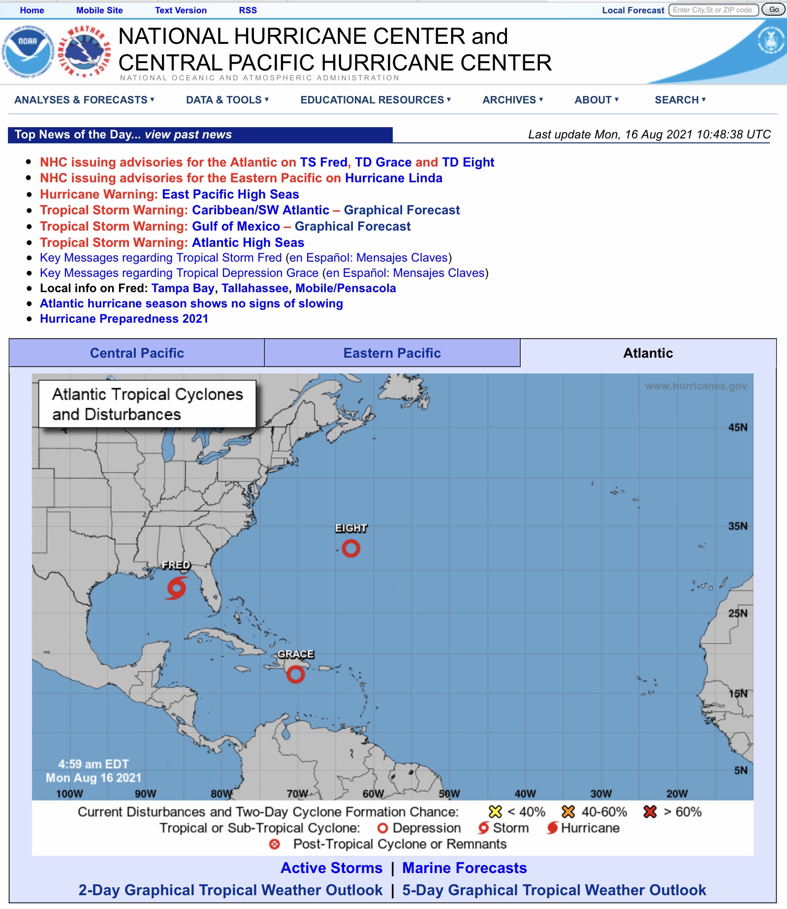
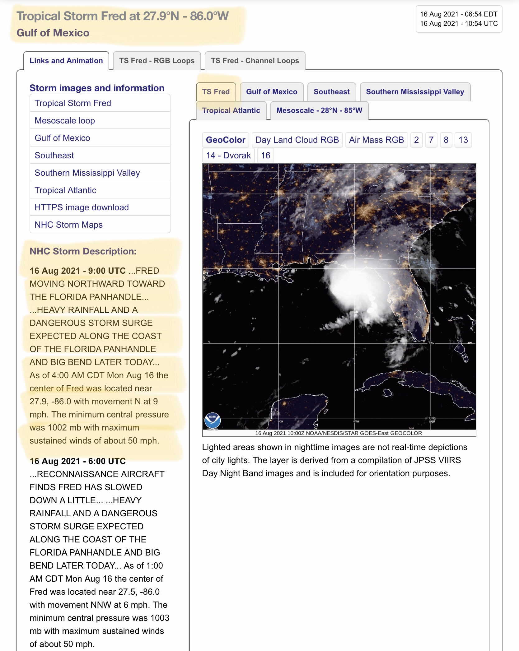
Tropical Storm Fred continues to impact parts of western FL peninsula this morning with heavy rain; impacts to FL Panhandle, se AL, sw GA later today & tonight…
Sidney Sperry 16 Aug 2021 11:41 UTC
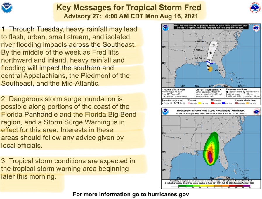
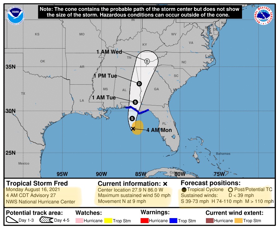
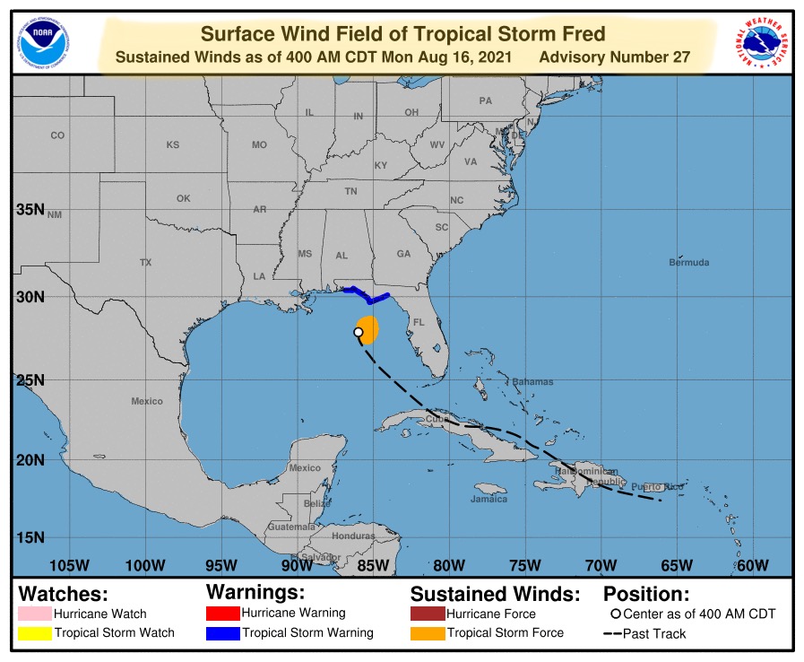
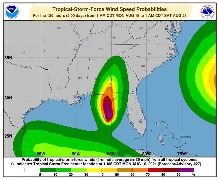
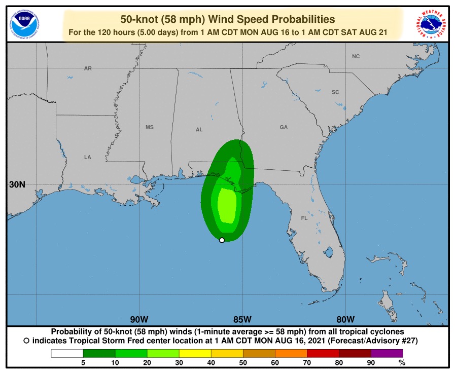
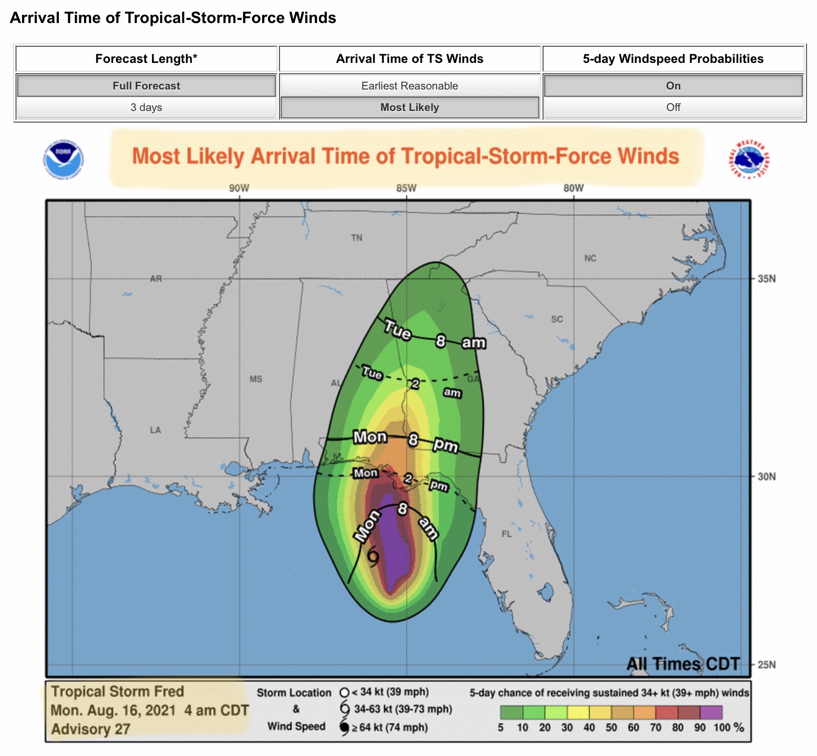
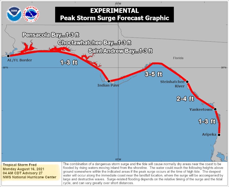
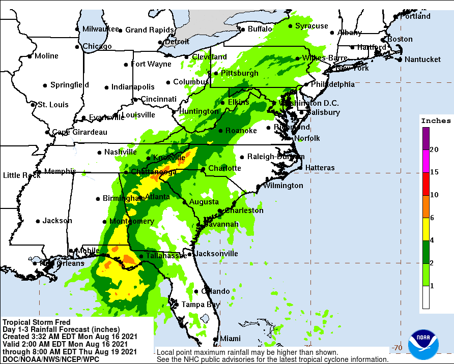
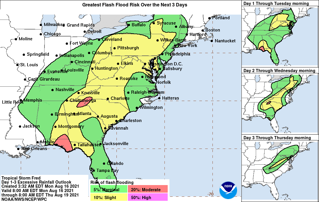
FYI… morning update from NHC on Tropical Storm Fred. Max sustained winds now at 50 mph. TS Fred has slowed to only 9 mph and continues moving to the north, toward the FL Panhandle. Note the projected storm surge and total rainfall graphics below. Storm surge is forecast to be up to 5’ in some areas. Storm total rainfall is forecast to be in the 4” to 10” range from the central FL Panhandle into southeastern AL, northern and northeastern GA, far northwestern SC, and western NC. Flash flooding is also possible in some areas over the next 3 to 5 days as this storm makes landfall and moves northeast.

Sid Sperry

 Show/hide attachments