First of 2 emails. First email on Tropical Storm “Fred,” which has re-generated into a Tropical Storm with Sustained Winds of 40+ mph… potential landfall on Monday pm.
Sidney Sperry 15 Aug 2021 20:38 UTC
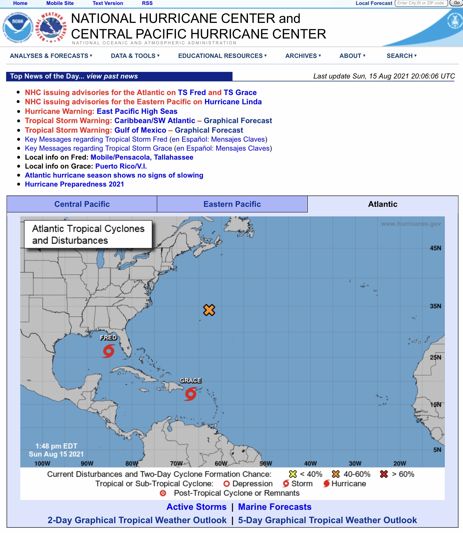
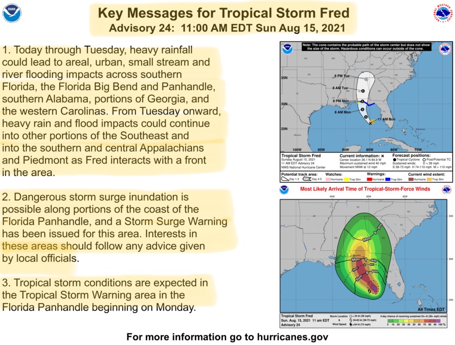
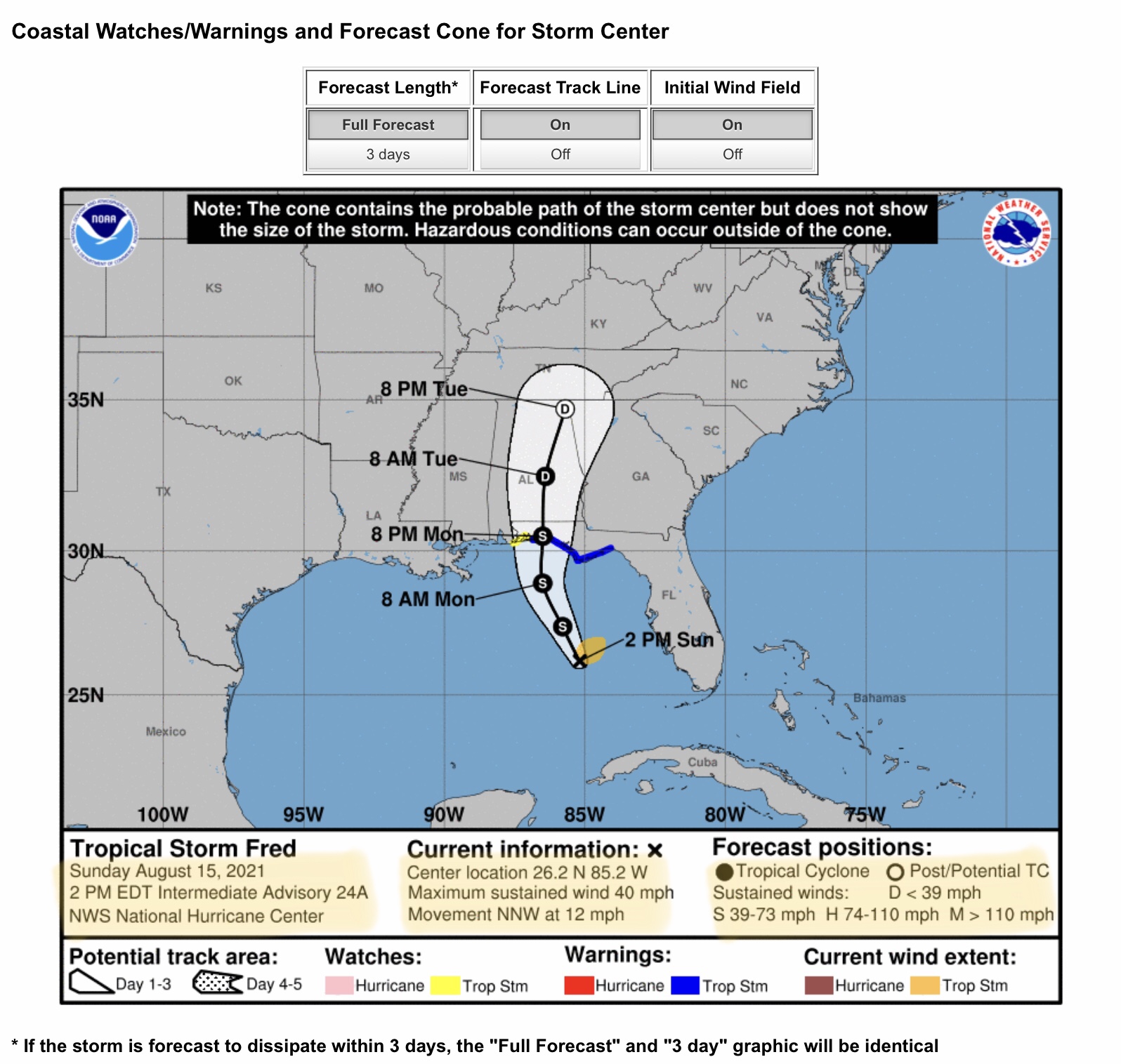
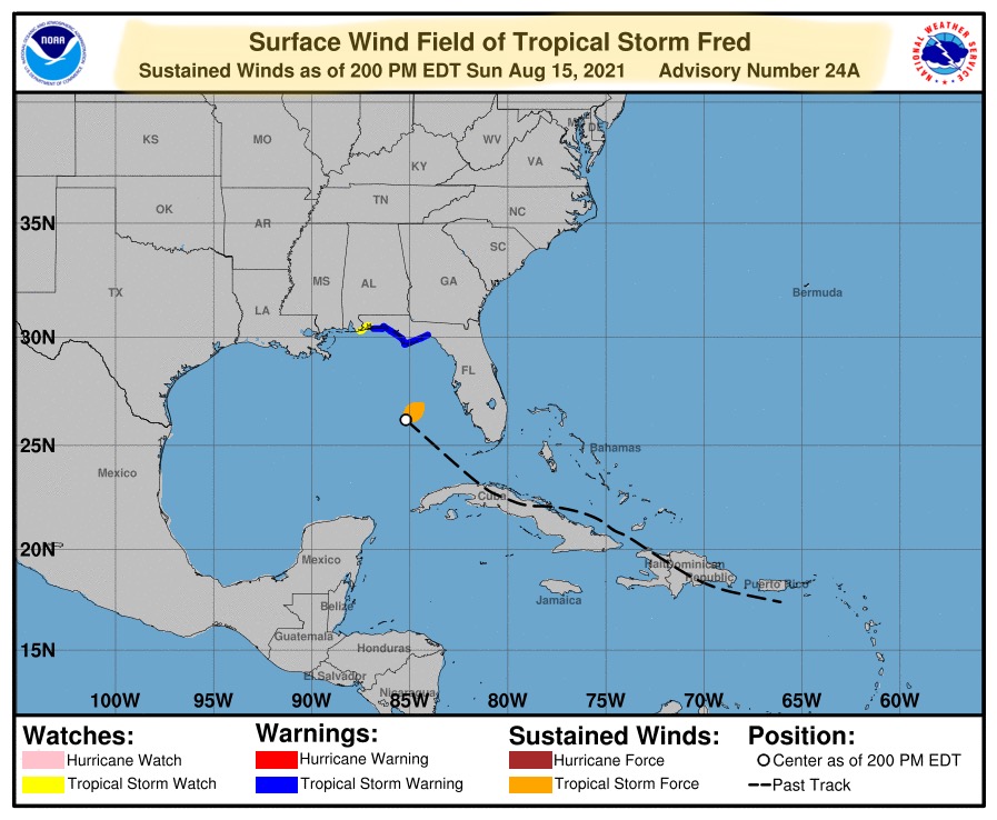
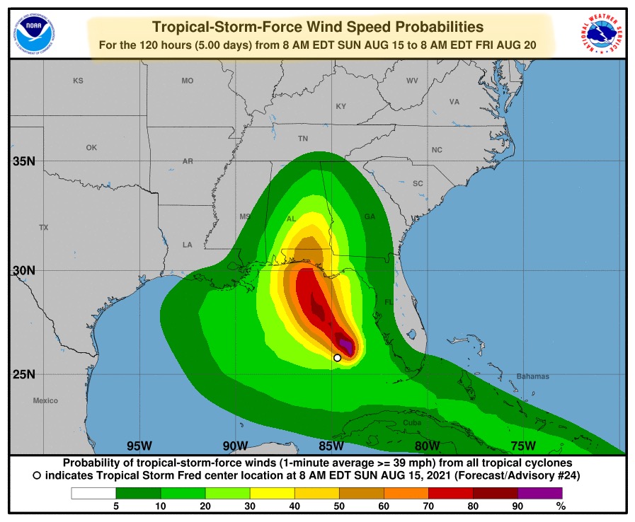
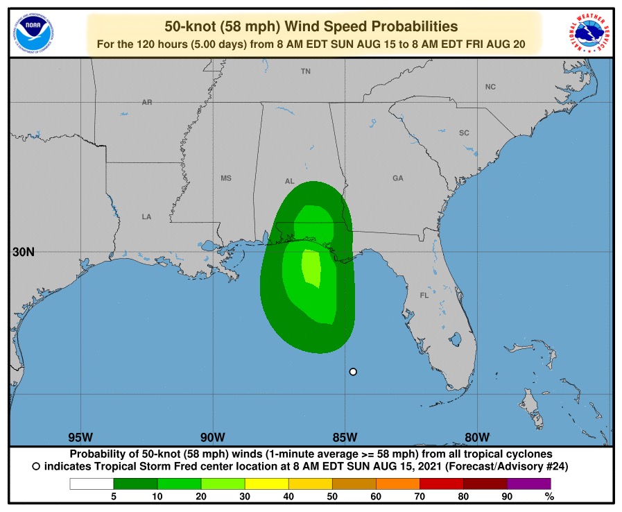
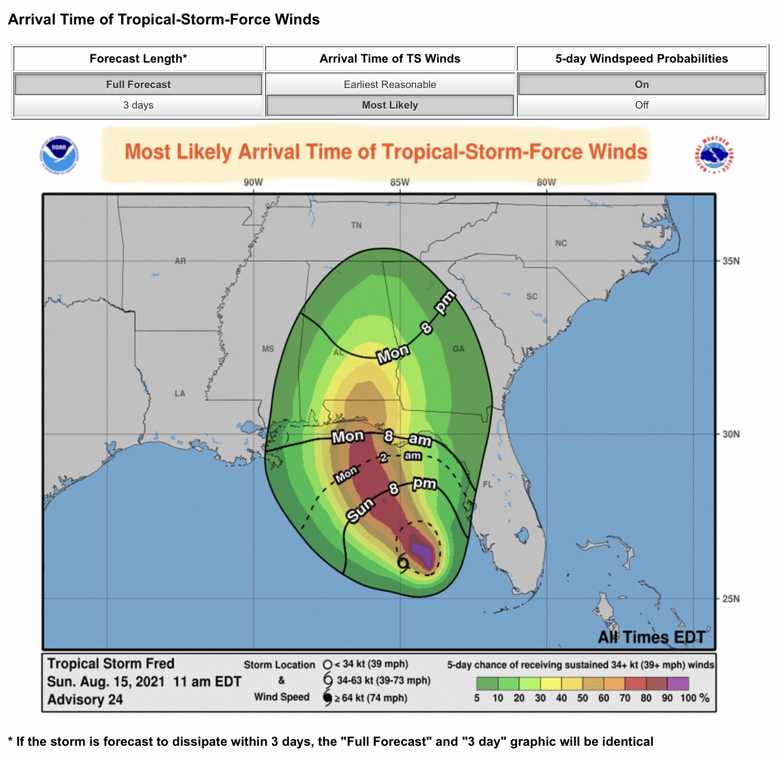
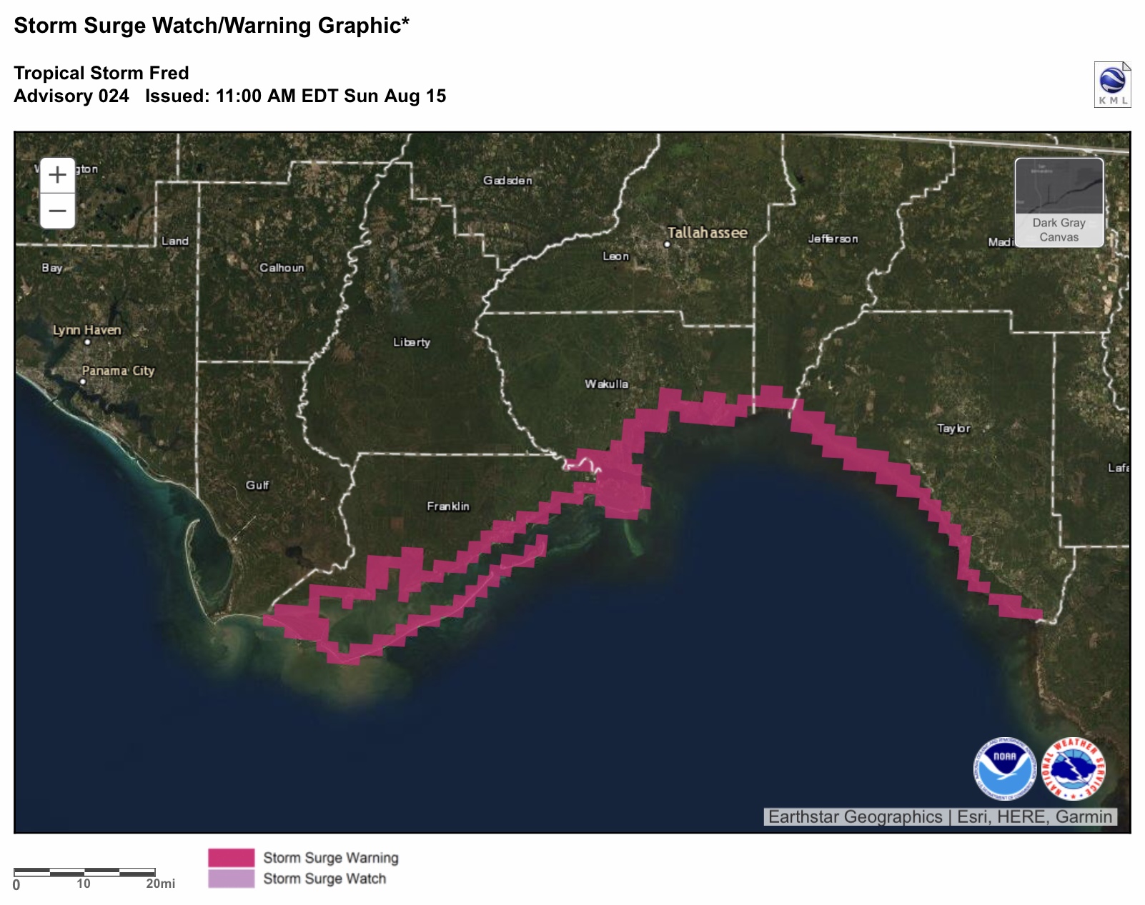
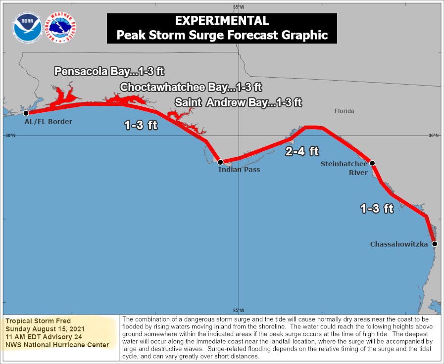
FYI… the remnants of Tropical Depression “Fred” have re-generated now that the storm system has moved deeper into the Gulf of Mexico. Fred is now a Tropical Storm once again, and is gaining strength the longer it stays over the very warm waters of the Gulf. It is quite possible that Fred could be a high-end Tropical Storm (sustained winds between 39 and 73 mph) OR it could possibly reach Category 1 hurricane strength, with sustained winds reaching 74+ mph. Heavy rainfall will also be associated with this storm. Landfall is currently projected in the far western FL Panhandle late Monday afternoon or early evening. Main impact will be on the right-hand side of the storm, or east/northeast side. Areas of the FL Panhandle, southeastern AL, and southwestern GA are likely to receive the most impacts from Fred as currently forecast by the NHC. - Sid Sperry

2nd email to come: Tropical Storm “Grace” and Invest 96L…

 Show/hide attachments