Potential Cyclone #6 likely to become Tropical Storm “Fred” later today…
Sidney Sperry 10 Aug 2021 13:20 UTC
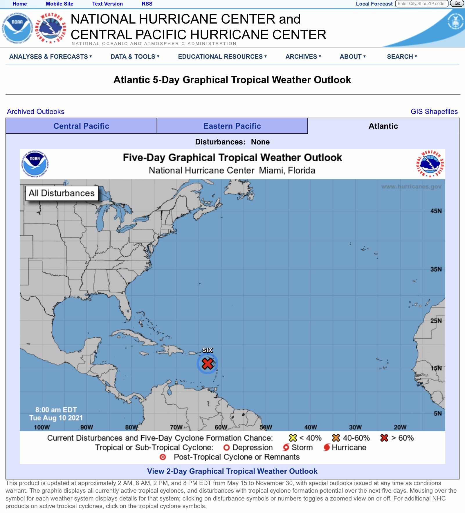
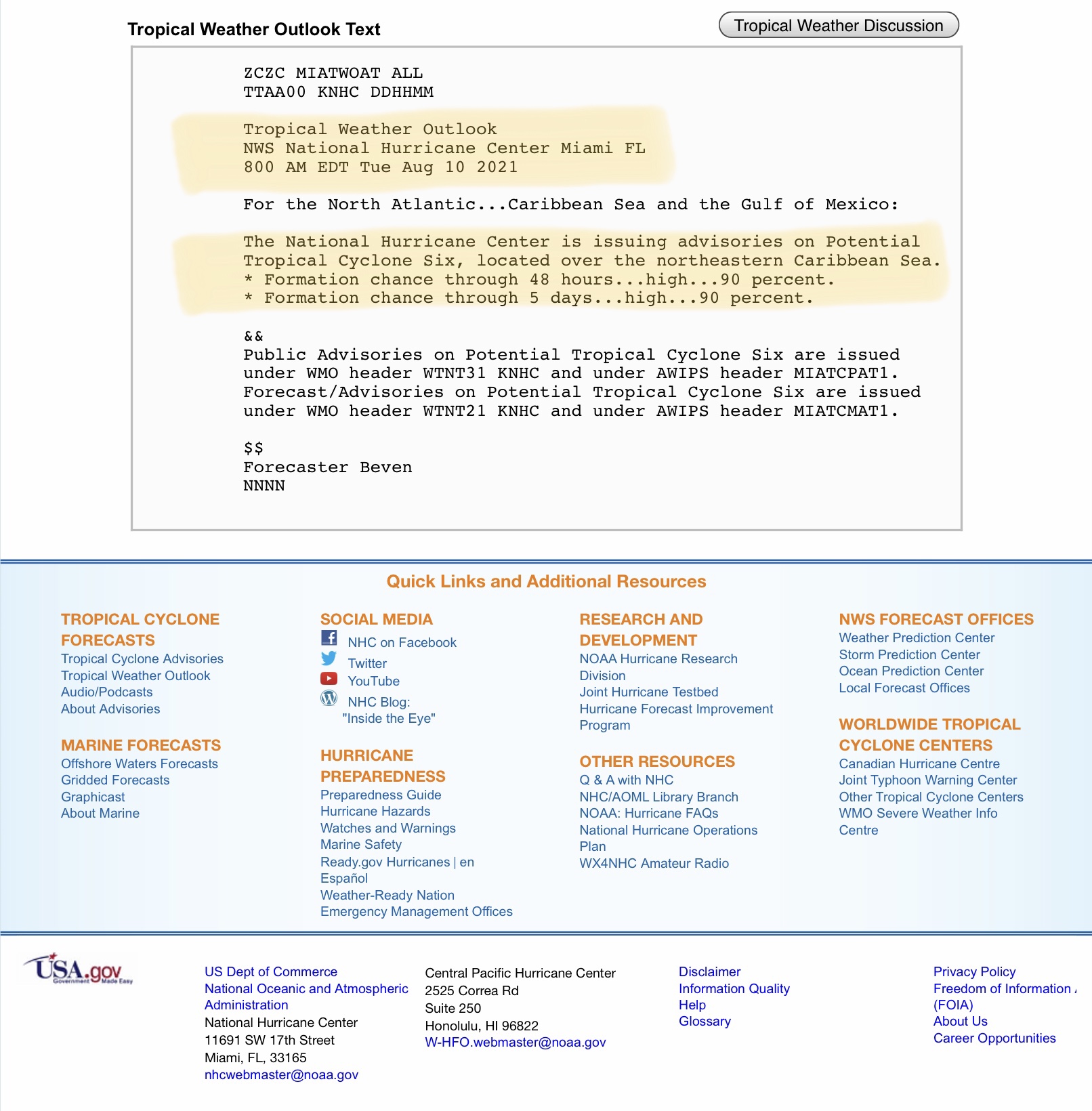
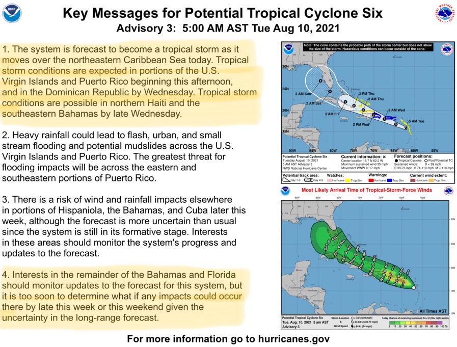
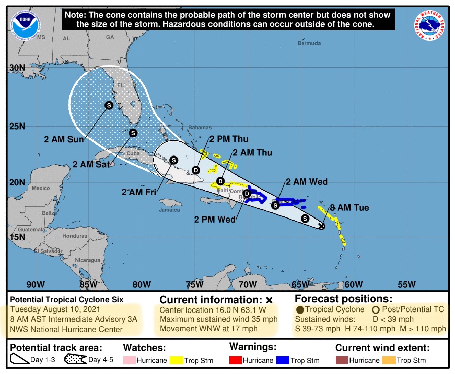
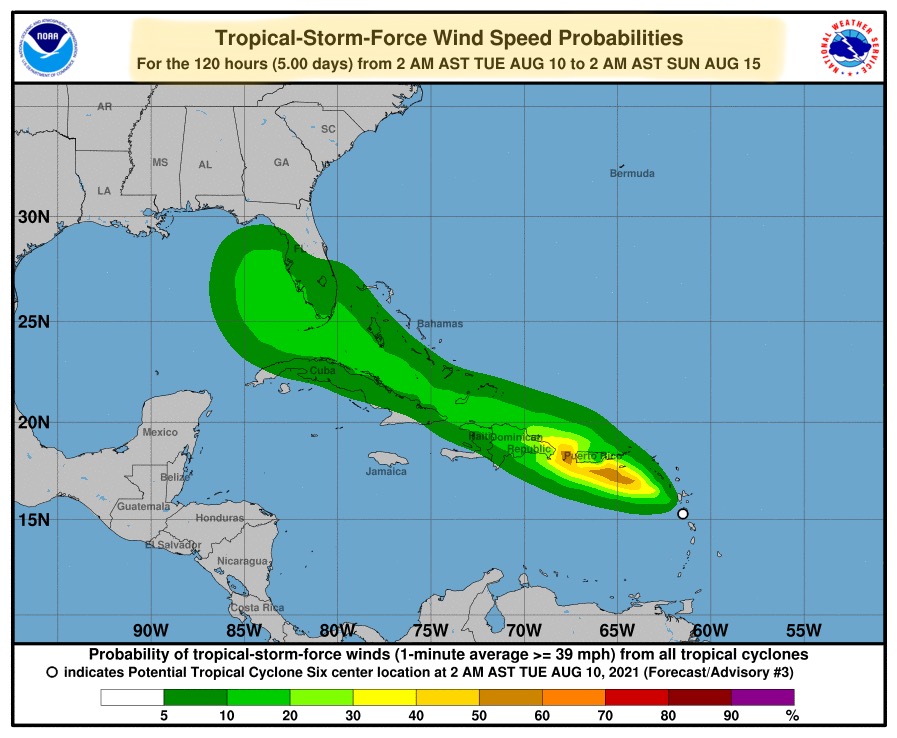
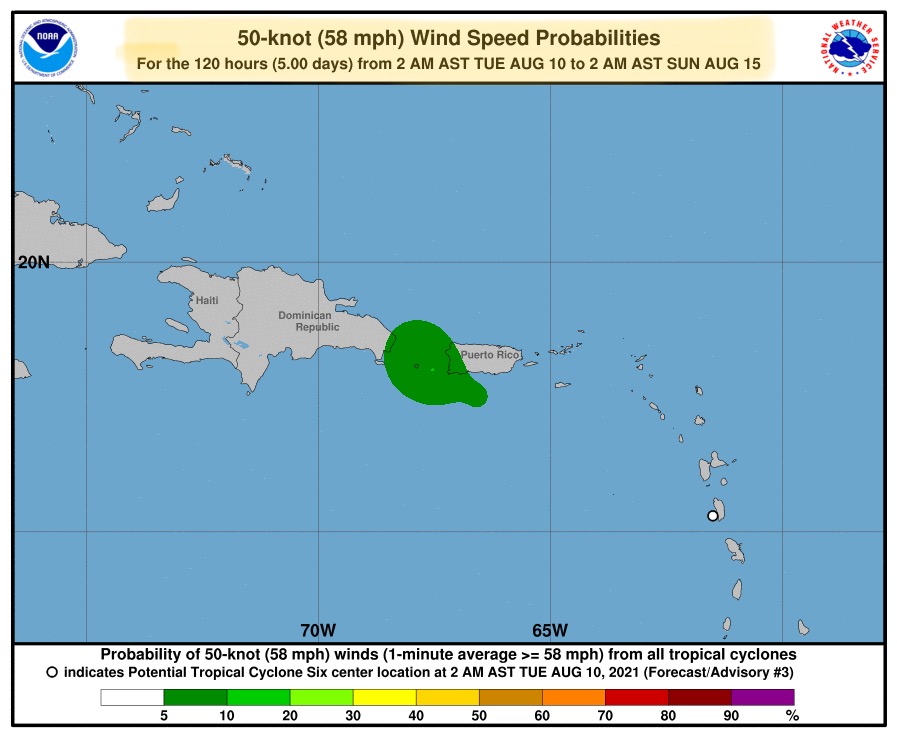
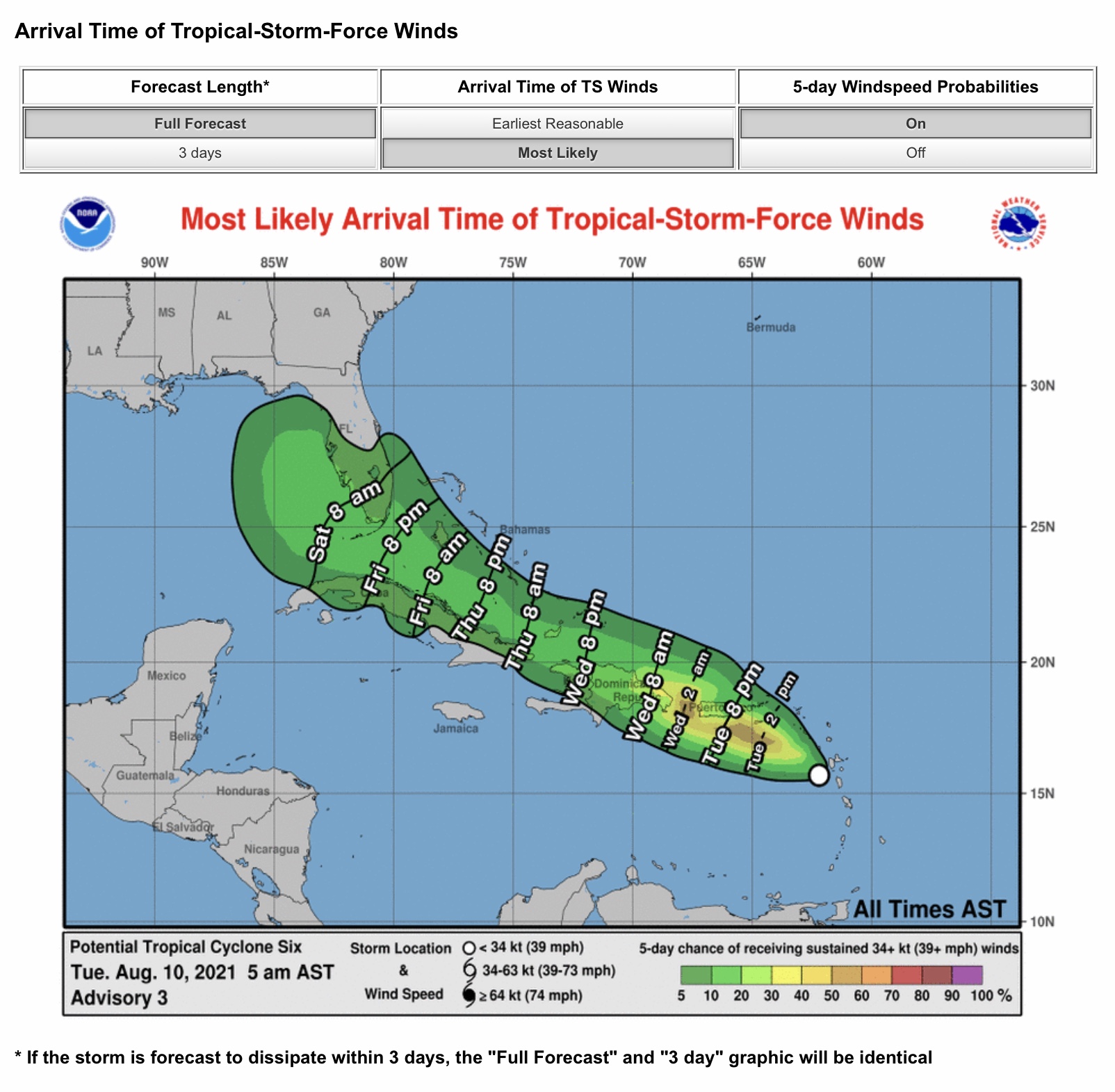
FYI… here is the latest (8am EST) forecast data from the National Hurricane Center. Potential Cyclone #6 has now moved past the Lesser Antilles and is continuing to strengthen as it moves west-northwest at about 17 miles miles per hour. Tropical Storm Warnings are now posted for parts of Puerto Rico and the Dominican Republic, and a Tropical Storm Watch has been issued for parts of the Virgin Islands, southeastern Bahama Islands, Haiti, and northwestern Dominican Republic. Should sustained winds increase to at least 39 mph (currently at 35 mph), this storm system will become Tropical Storm “Fred,” and that could happen later today.

Wind and rain impacts could begin to impact parts of southern Florida by Friday night or early Saturday morning. The current forecast track by the NHC has this storm moving into the far eastern Gulf of Mexico by Sunday, and could have Tropical Storm Force Wind impacts and rainfall from 3” to 6”+ along the western Florida coastline Sunday into Monday. At this time, this storm is not expected to develop into a major hurricane, but it is still a system to watch closely. - Sid Sperry

 Show/hide attachments