Some potentially severe thunderstorms to continue across the South & Southeast today and tomorrow; Hurricane Season preparations underway early with “Andres”
Sidney Sperry 10 May 2021 12:09 UTC
Good Monday morning to all!
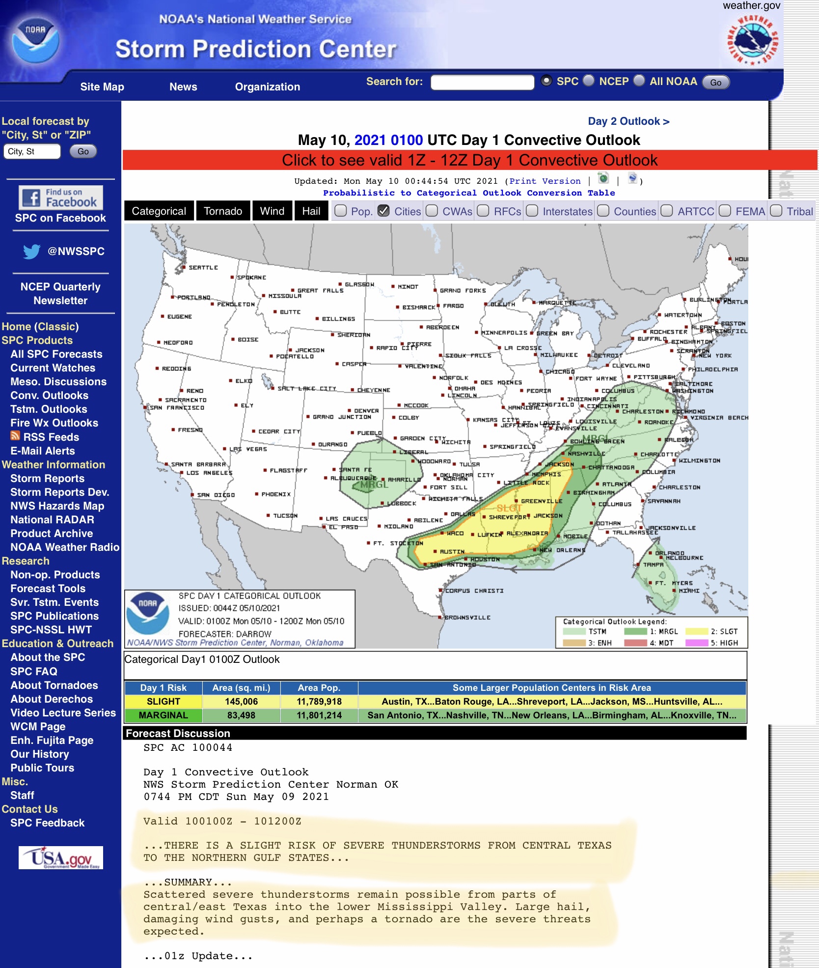
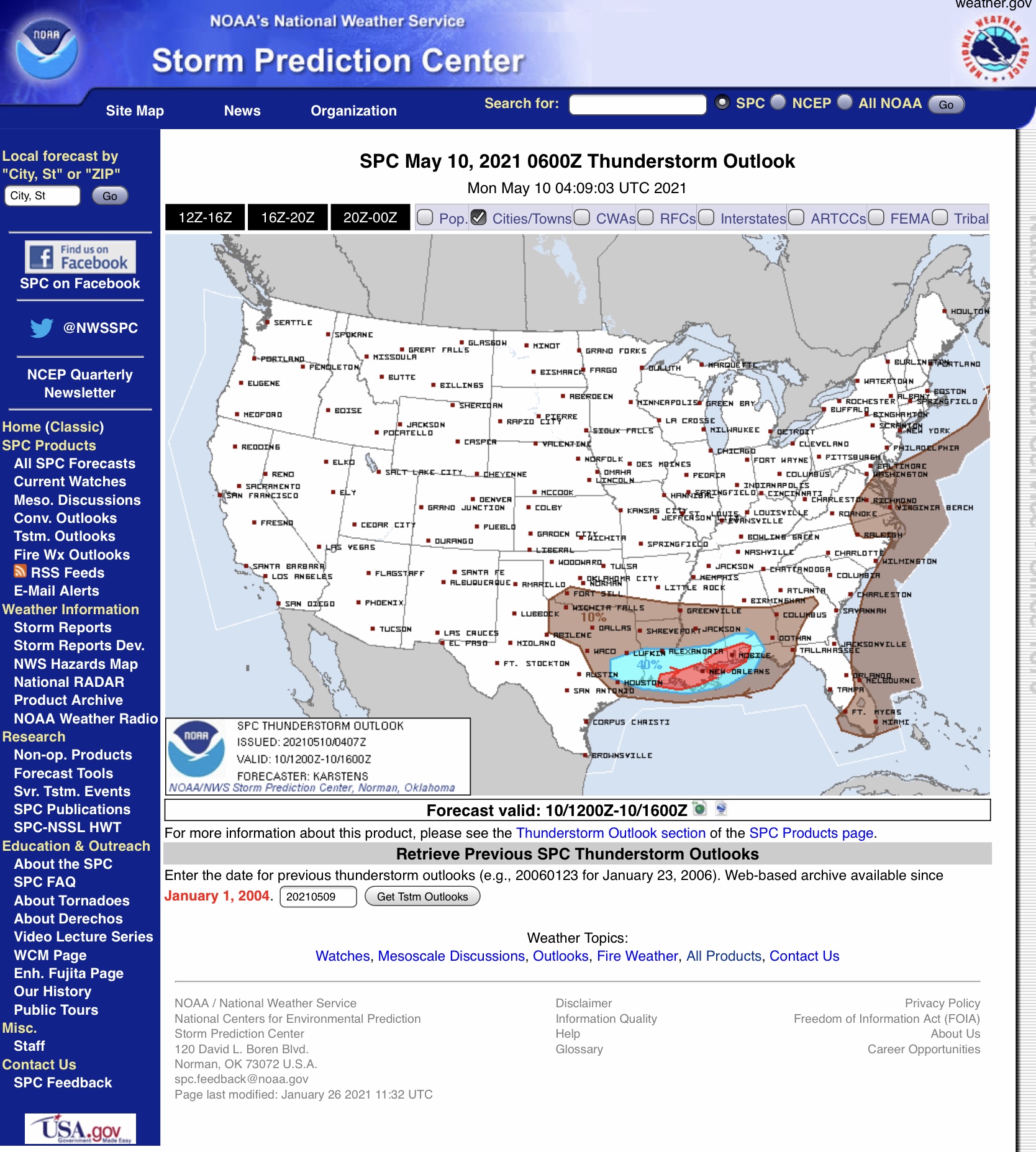
Here are today’s and tomorrow’s outlooks for potentially severe thunderstorms across the U.S., per the NOAA Storm Prediction Center (SPC). There will continue to be severe thunderstorm risks from east TX, LA, southern AR, most of MS, northern and western AL, and south-central TN today and tomorrow. Risks include strong winds and wind gusts, hail, and the possibility of tornadoes.
With this year’s Hurricane Season officially beginning May 15, now is the time to be reviewing restoration and recovery plans, crew staging, and mutual aid response. In anticipation of an active hurricane season (hopefully NOT as “active” as last year’s!), I’m sharing below the latest forecast track for Tropical Storm “Andres,” the first named storm to appear, and which will soon harmlessly dissipate off the southwestern coast of Mexico.
Also, from the National Hurricane Center, here is this year’s list of the Atlantic Basin named hurricanes, should they materialize. Let’s hope they don’t!
Sid Sperry
President & CEO
SPIDI Technologies, LLC
Guthrie, OK
Sent from my iPad

Sent from my iPad

 Show/hide attachments