Good morning all. I hope everyone had a nice weekend - at least you weren’t in Wyoming, where some areas there received more than 52” of snow! Wow!
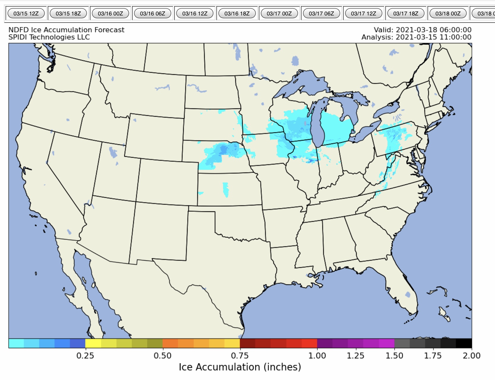
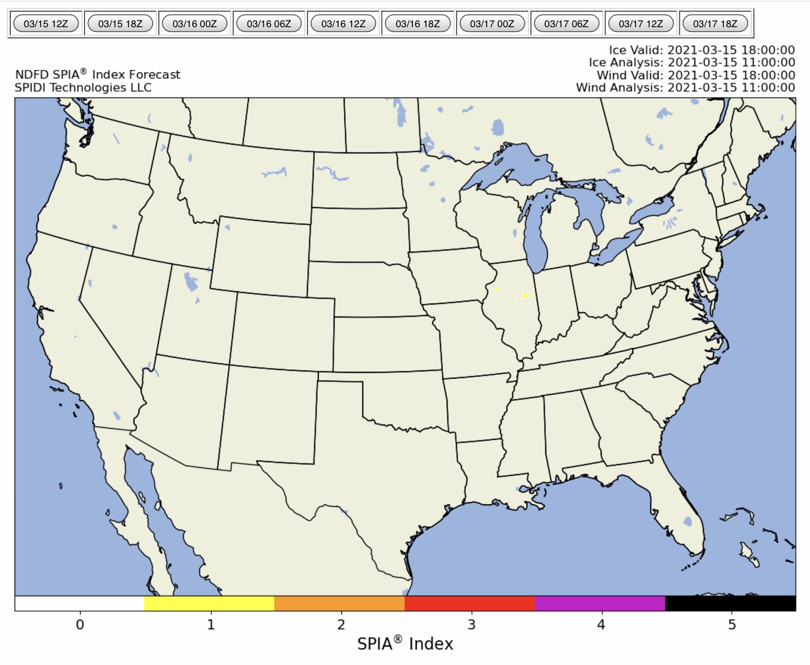
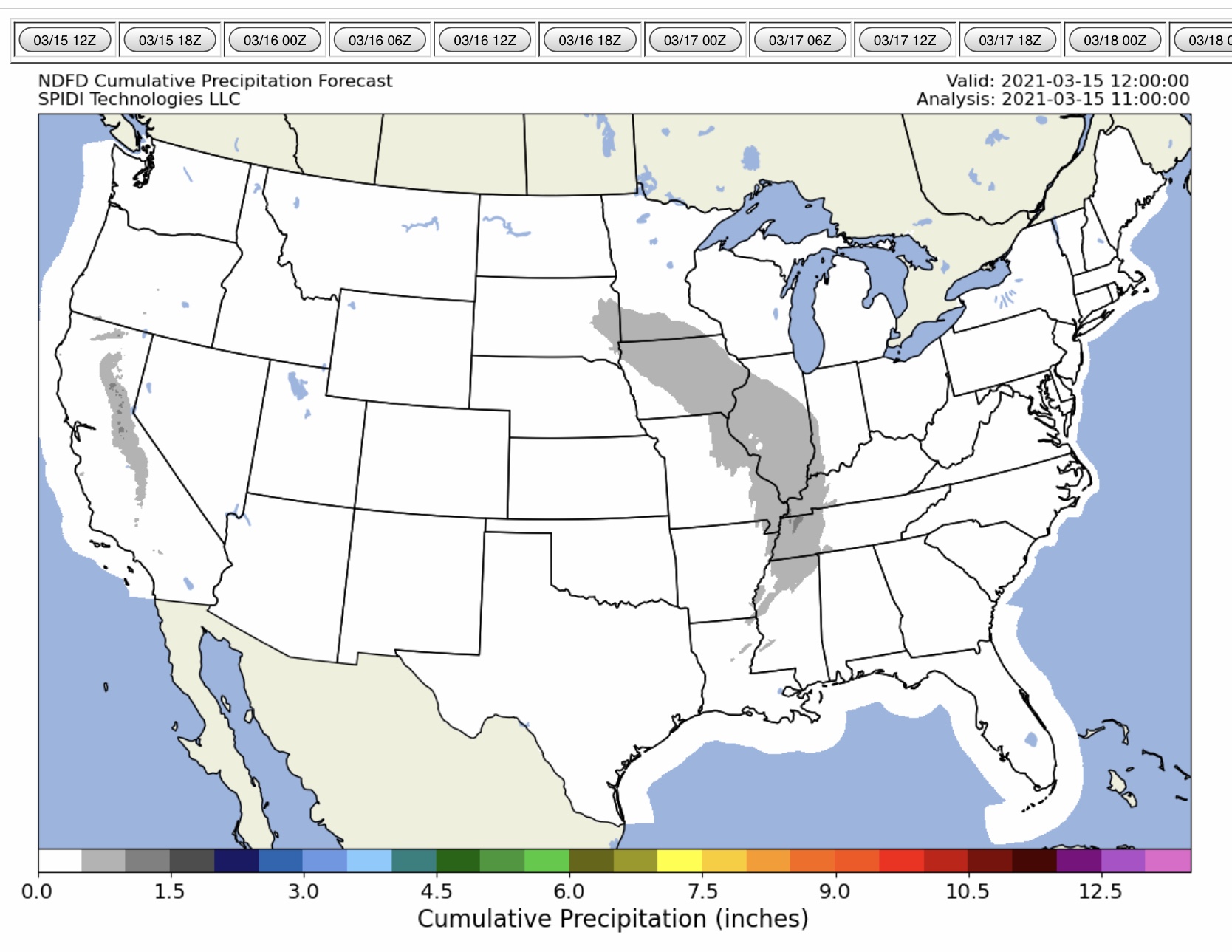
The next 72-hours are forecast to bring light icing to several states, although no major impacts to utility infrastructure are expected. Max ice in the NWS grids is 0.244” in parts of northern IL, where the SPIA Index is forecast to reach Levels 1 & 2. Some outages may occur in IL, mainly due to the winds there today.
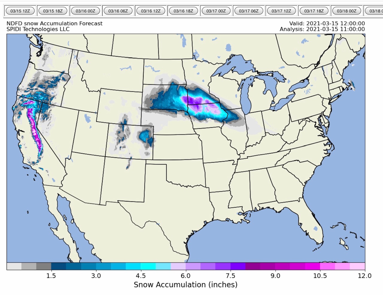
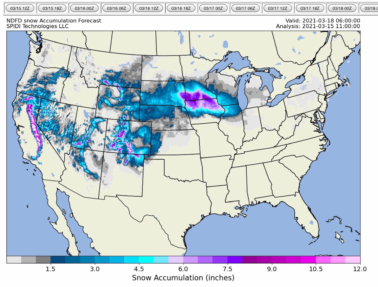
Snowfall is ongoing in eastern SD, southern MN, northern IA, and northwestern IL, with more snow by mid-week in parts of southern SD, western and northern NE, western KS, southern WI, and northern IL.
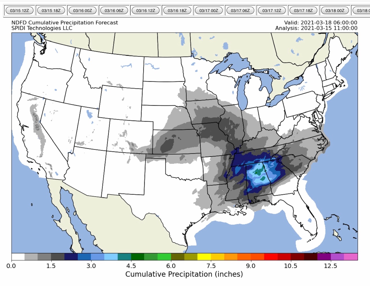
Severe storms bringing the threat of damaging winds, large hail, heavy rainfall, lightning, and yes - tornadoes - will be a major concern across the Southern and Southeastern states of AR, LA, MS, AL, TN, GA, SC & NC from Tuesday night through Thursday morning. Of particular concern are severe thunderstorms that are forecast to develop on Wednesday for much of AL. These storms will move into northern and western GA, southeastern TN, northwestern SC, and far western NC on Thursday. Stay safe, everyone! - Sid Sperry

 Show/hide attachments