Euro Model and GFS Model Coming Into Further Agreement - Except for Timing of Winter Storm...
Sid Sperry 28 Nov 2020 02:02 UTC
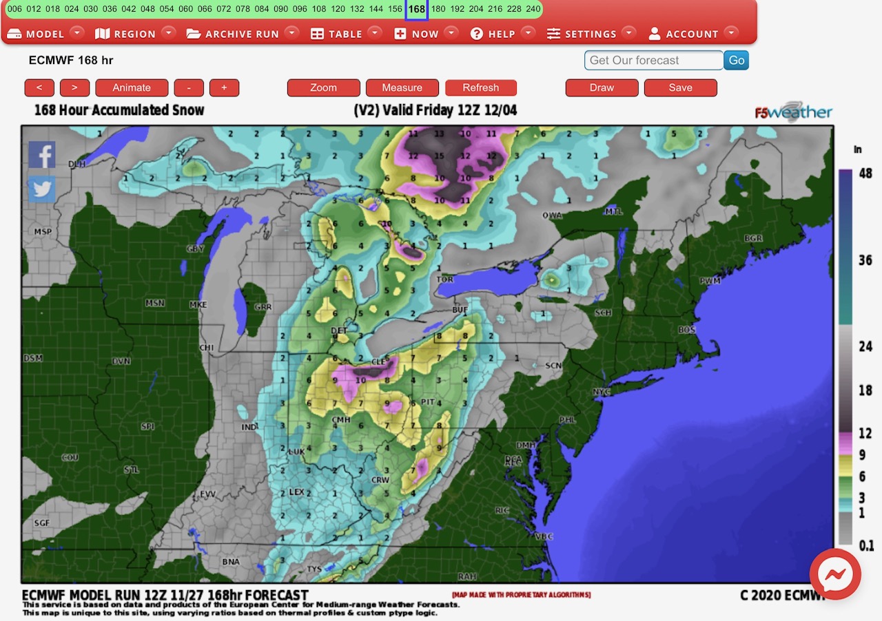
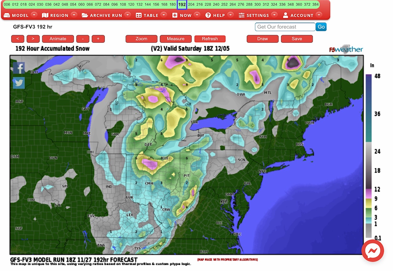
Euro Model and GFS Model have both pretty much come into agreement on the footprint path of this incoming winter storm, but the Euro has snow starting late Monday, while the GFS has snow starting Tuesday afternoon. Still, the locations and amounts are similar. From 2” to 3” in the MI Upper Peninsula; from 2” to 6”+ in northern MI & the MI “thumb;” From 2” up to 12”+ across central & northern OH; and from 2” up to 8” across western PA, eastern WV, and far western NY. From 1” to 3” snow possible parts eastern IN, northeastern TN, western MI, western VA, southwestern WV, far western NC, and northeastern NY. Again, timing is still the only issue separating agreement of these two Forecast Models. - Sid Sperry

 Show/hide attachments