5 to 7 day Forecast Models on Winter Storm Next Week Begin to Congeal...
Sid Sperry 26 Nov 2020 23:46 UTC
All,
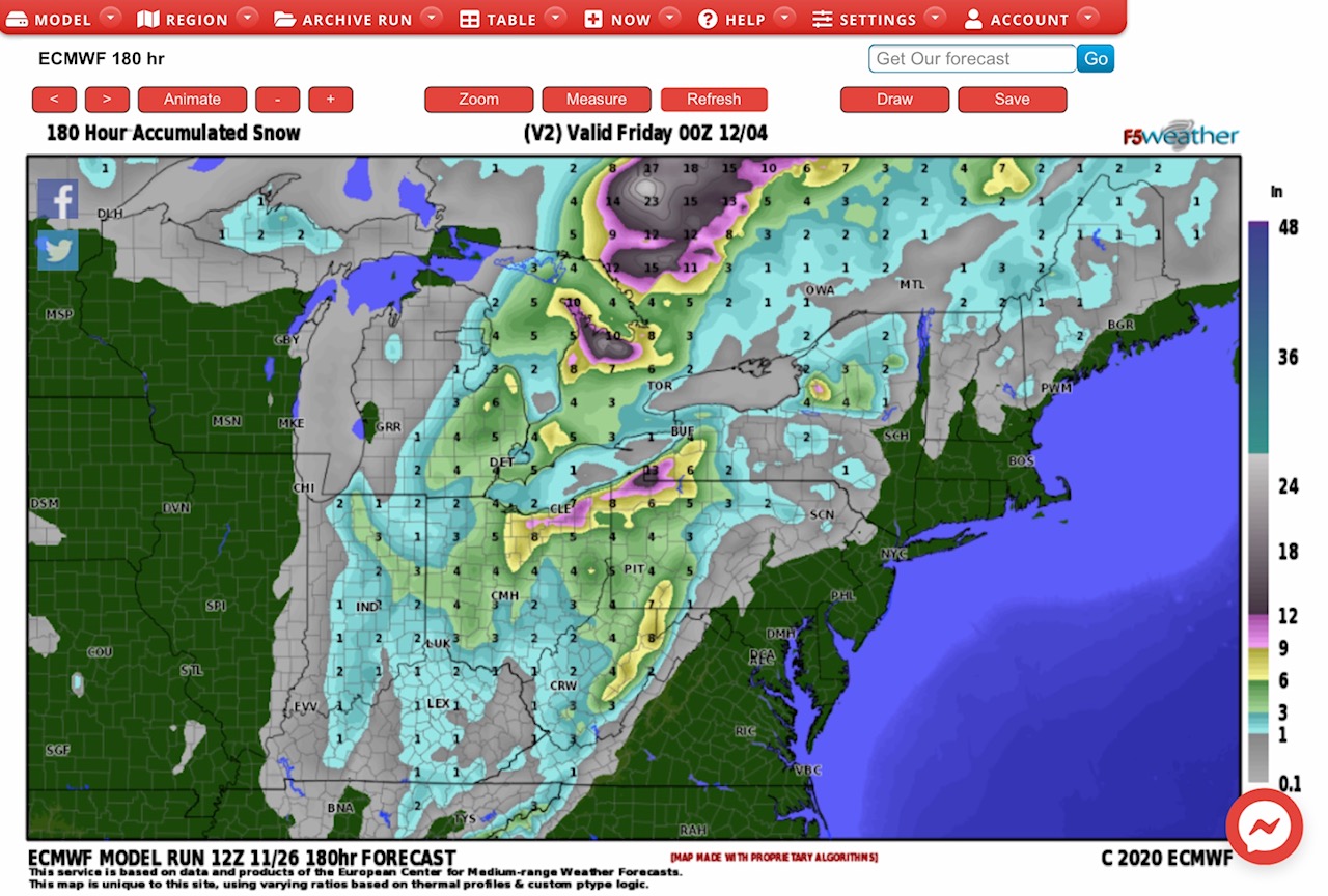
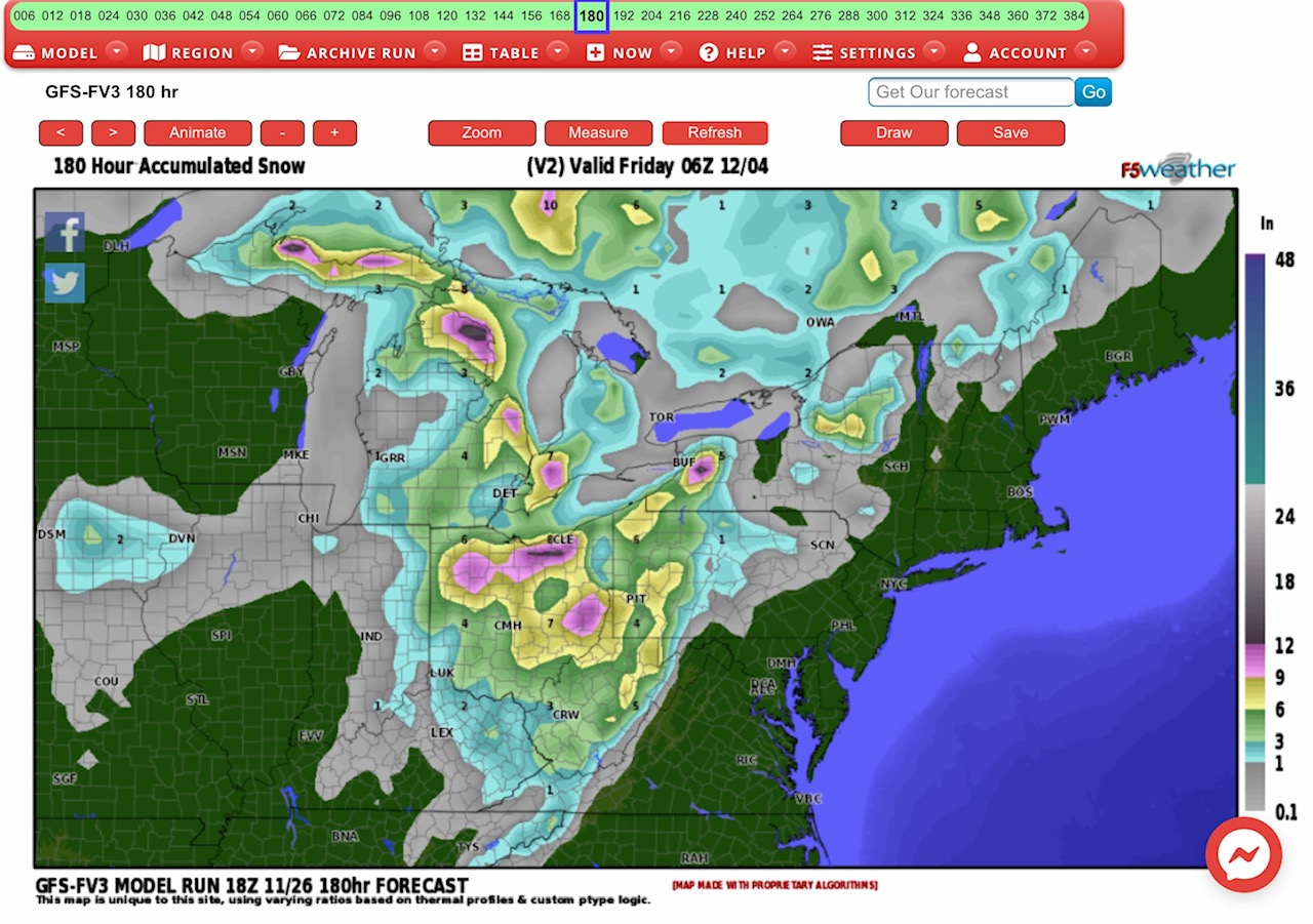
Here is an update on the potential Winter Storm in the Midwest & Ohio Valley states next week. The latest 5 to 7 day out Forecast Models from both the Euro and GFS seem to be coming into agreement, the only difference being the timing of the storm. And yes, as is typical for long-term models, the snow amounts have begun to decline.
Both the Euro Model (top graphic) and the GFS Model (second graphic) have fairly significant snow totals of from 4” to 12”+ in parts of OH, WV, PA, western NY and the MI “thumb.” The difference in timing? The Euro has this winter storm beginning late Monday, November 30, and continuing through late Thursday, December 3. The GFS has the storm beginning on Tuesday, December 1 and continuing through Friday, December 4. These models will likely continue to congeal as we get closer to the event.
- Sid Sperry

 Show/hide attachments