All,
I wanted to share the two graphics below primarily with those of you in the Midwest states of PA, OH, IN, WV, MI and KY. As I always remind everyone when I send out “long-term” Forecast Models (from 7 to 10 days out), these Models are definitely subject to change over the next several days, so know that what you’re seeing here will no doubt change some as this winter storm system approaches.
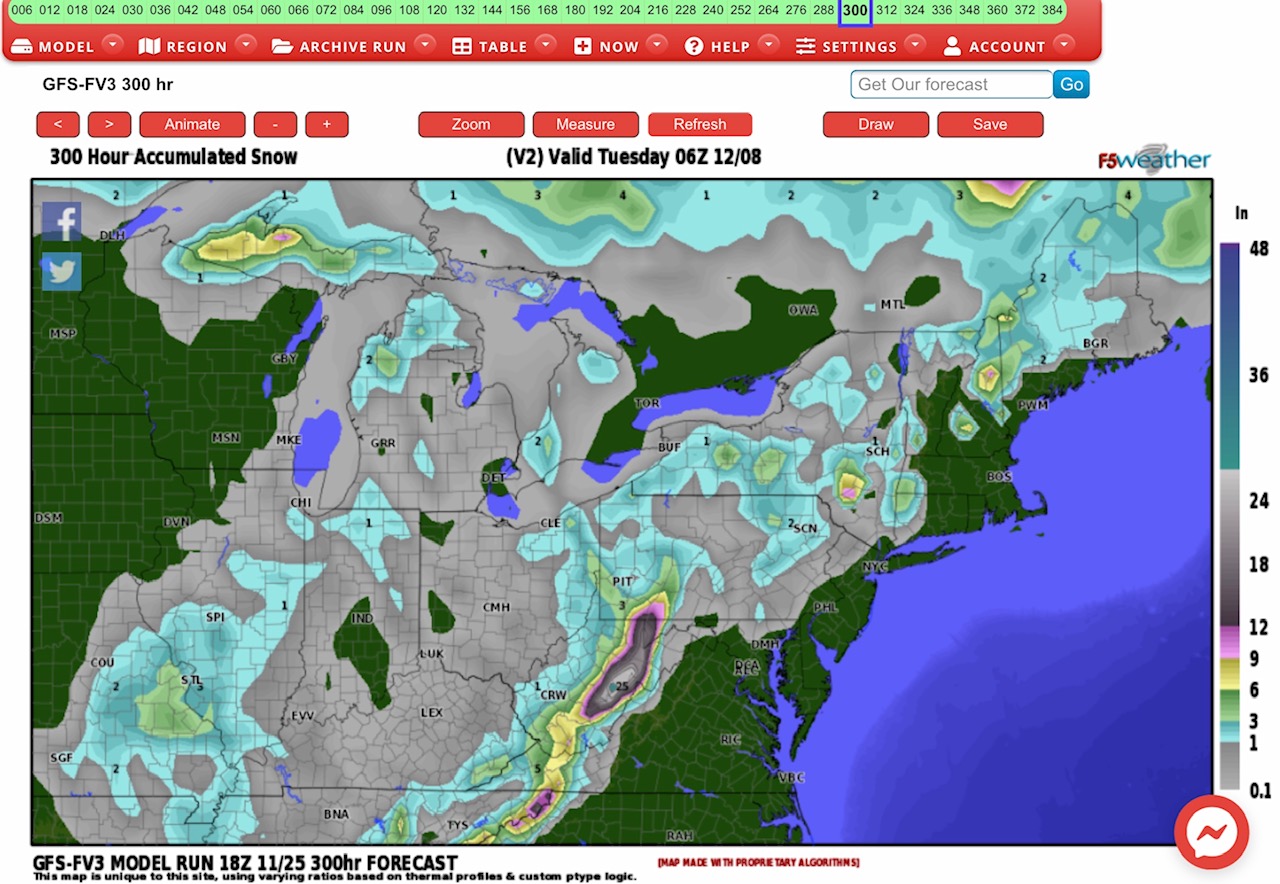
The first graphic is from the GFS-FV3 forecast model. It currently shows a potentially heavy snow event next Thursday, December 3rd, continuing through Monday or Tuesday, December 7-8. The GFS is forecasting heavy snow from 6” up to 25” in parts of far western NC, far eastern TN, western VA, the higher elevation areas of eastern WV, into parts of southwestern PA.
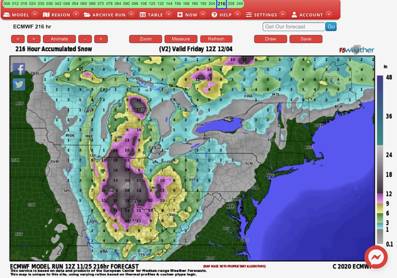
The second graphic is the Euro Model Forecast, and it is currently showing heavy snow a bit further west of where the GFS Model Forecast is showing, and on a shorter time frame - beginning Tuesday, December 1 and continuing through Friday, December 4. The Euro is also predicting a broader area of heavy snow, with from 6” to 20” possible across much of IN, western and central OH, central & northern KY, western WV, and much of MI. There could be lower amounts, in the 4” to 8” range, in parts of far eastern IL, northeastern TN, western NC, far western VA, far western PA, and the northwest part of the MI Upper Peninsula.
This storm system could last from 3 to 4 days, and is likely to be accompanied by some fairly strong winds.
I’ll watch this storm system closely, but wanted to give you an early heads-up for what could be a snowy first week in December. - Sid Sperry

 Show/hide attachments