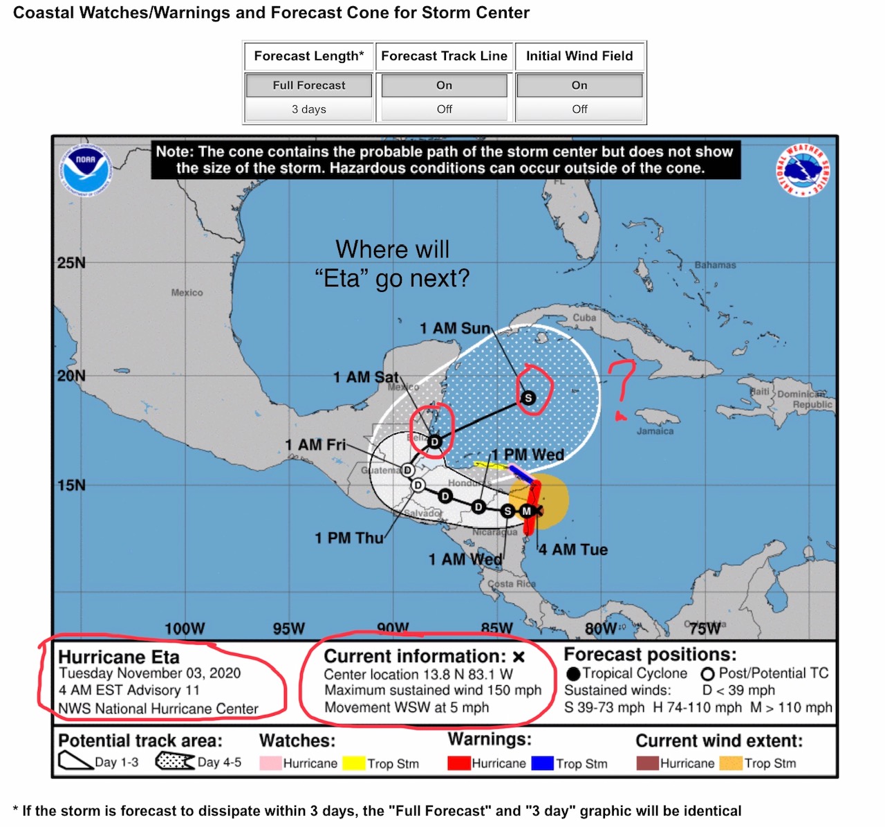
Where will Hurricane “Eta” go next after landfall in Nicaragua???
Sid Sperry 03 Nov 2020 11:22 UTC
Good Morning, All.

Election Day is here - if you haven’t voted already, please do so today!

Now to the $64 million question... Where will Hurricane “Eta” - which is now one of the most powerful hurricanes to ever develop in the Atlantic, with sustained winds in excess of 150 mph and gusts close to 200 mph - go next after brutalizing parts of Nicaragua, Honduras, Guatemala and Belize over the next four to five days? Note that by early morning Saturday, forecasters are predicting that “Eta” will be re-forming into a strong Tropical Depression, and re-entering the Caribbean Sea after exiting Belize. They are also predicting that “Eta” will move east-northeast toward the Cayman Islands and Cuba, POSSIBLY DEVELOPING INTO A SUB-TROPICAL STORM YET AGAIN. This would mean that “Eta” would once again gain strength from very warm waters and develop winds in the 39 to 73 mph range while in the central Caribbean Sea. Remember that hurricanes almost always eventually move toward the poles. Forecasters at present are predicting that “Eta” is likely to move east-northeast toward Cuba and COULD reform into another hurricane-force storm as it approaches Cuba by Monday or Tuesday of next week. Where “Eta” goes over the next 5-7 days should be worth watching closely. It all depends on the steering currents of the Upper atmosphere, plus how much energy “Eta” gains from very warm sea waters in the Caribbean. Some models have this storm entering the southern Gulf of Mexico. We need to pay attention to “Eta,” that is for sure. - Sid Sperry, OAEC

 Show/hide attachments