Good morning to all, from an ice-laden Oklahoma! (Currently 311,532 outages in OK!)
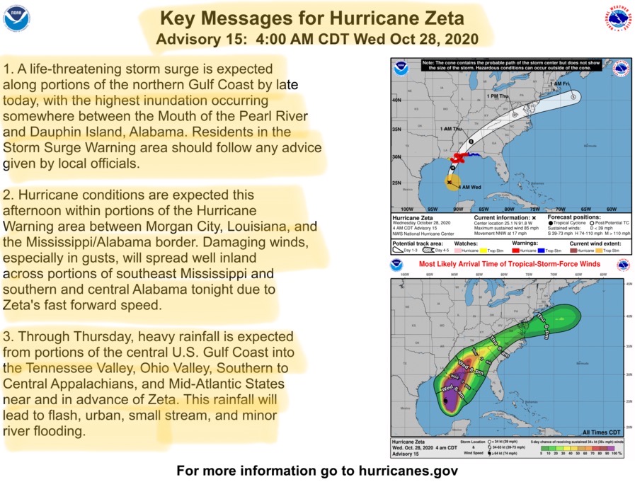
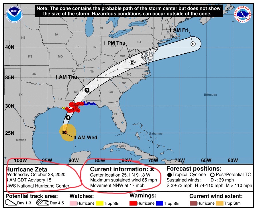
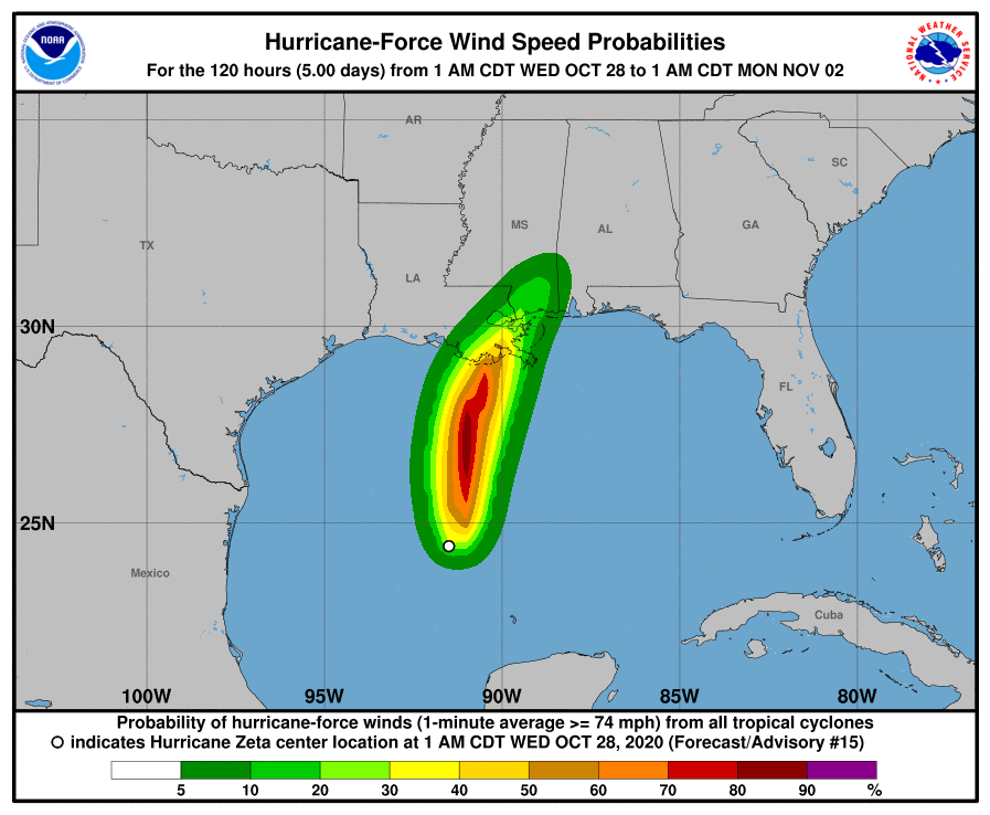
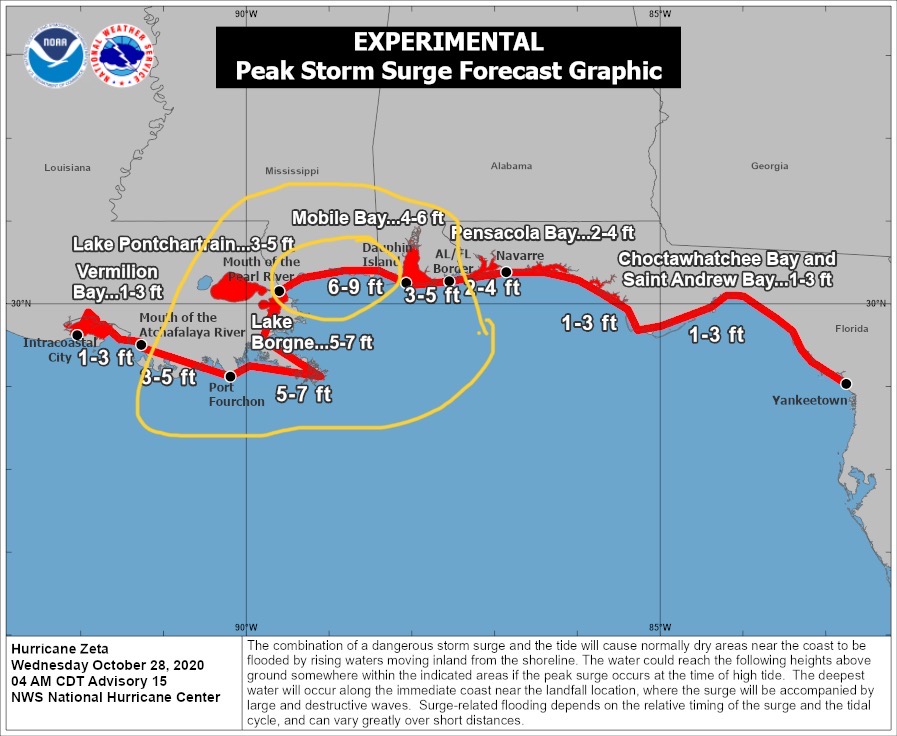
Hurricane Zeta will be increasing in intensity throughout today and will likely make landfall in parts of southeastern LA as a Category 2 Hurricane, with sustained winds of near 98 to 100 mph. Some weakening COULD occur shortly before this fast-moving hurricane makes landfall, but NHC forecasters think that landfall as a Category 2 storm is probable, and as such preparations should be made for a high wind, high surge event over the next 18-24 hours. Storm surge estimates are now in the 6’ to 9’ range from the Mouth of the Pearl River to Dauphin Island.
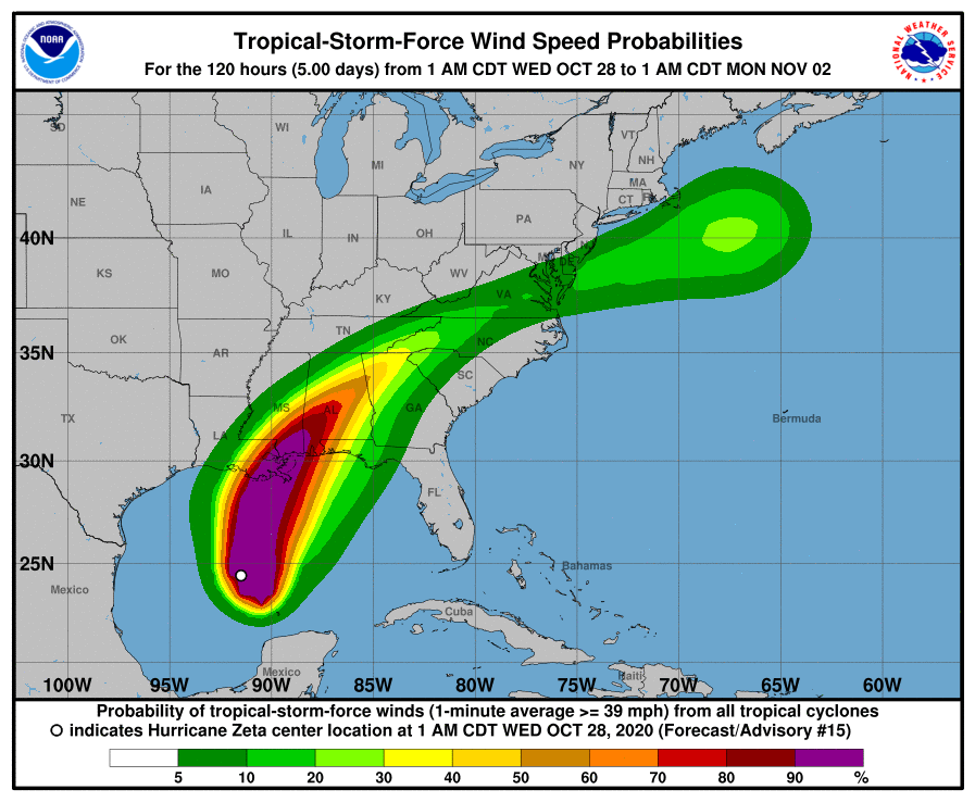
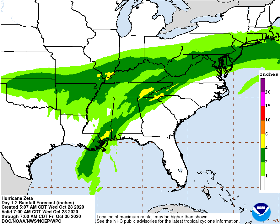
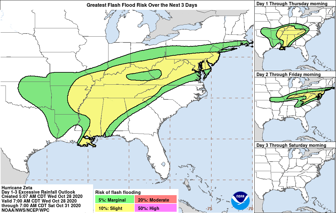
This storm system will be moving extremely fast after landfall late tonight. It should exit Alabama by Thursday morning, and will be well on its way to the east coast by mid-afternoon on Thursday. There is now a 50% chance or greater that Tropical Storm Force sustained winds (=/> 39 mph) will reach parts of northern and northwestern GA by mid-morning Thursday, and into North Carolina by mid-afternoon Thursday. Rainfall amounts could be in the 4” to 6”+ range for parts of se LA, southern MS, southern & central AL, and parts of eastern TN, northern GA, northwestern SC, and western NC over the next 36 hours. There is a high probability of localized flooding and flash flooding from Zeta after landfall.
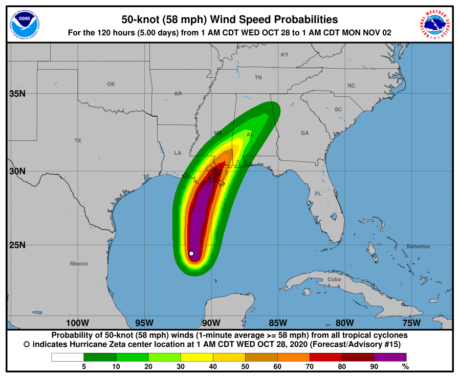
Sustained wind speeds across southern MS and AL will likely be in to 70 to 75 mph range tonight after landfall, and could be in the 55 to 65 mph range in parts of central AL by the early morning hours on Thursday. Winds of 40 to 50 mph are possible across parts of northwestern and northern GA, and could do significant damage to tree canopies in those areas. Because of this storm’s fast pace and relatively high wind speeds after landfall, tree damage could be excessive, and power outages related to tree damage are highly likely. - Sid Sperry, OAEC

 Show/hide attachments