Quick Overview of Weather Across the U.S. for Next 72-hours...
Sid Sperry 21 Oct 2020 11:36 UTC
Morning, everyone! Hope your Wednesday is a great one! Here is a quick overview of weather elements impacting all parts of the U.S. over the next 72-hours...
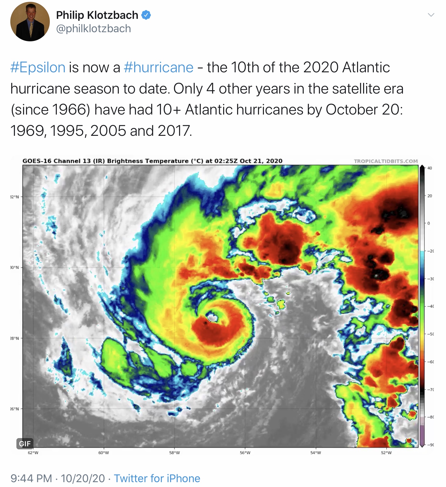
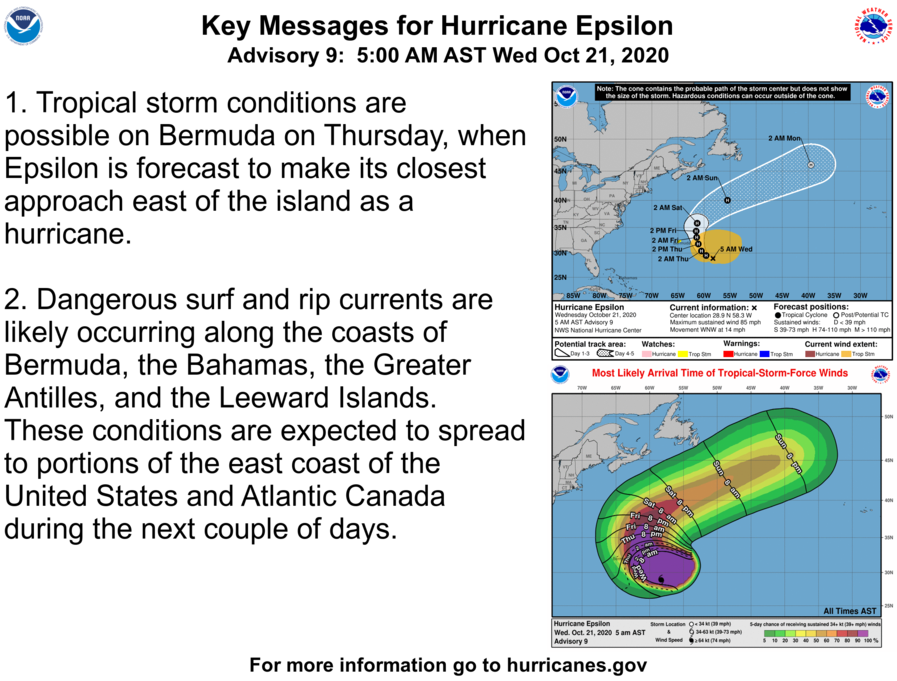
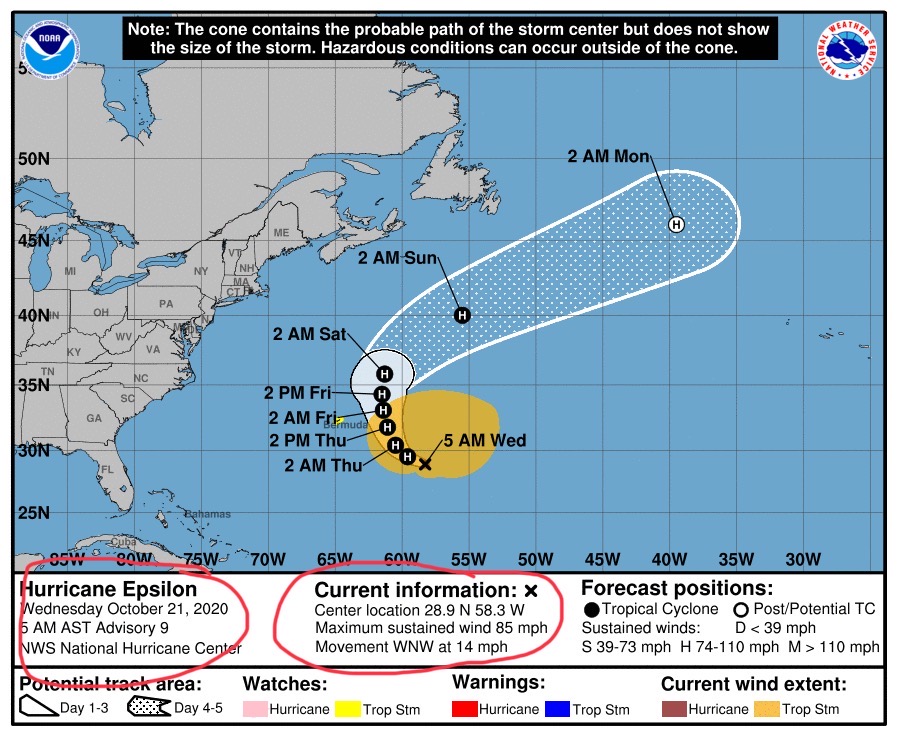
First, even though we now have Hurricane Epsilon, it will NOT be impacting the continental United States. It is, however, the 10th Atlantic Hurricane of the season. See tweet from noted hurricane researcher, Dr. Philip Klotzbach from Colorado State University below.
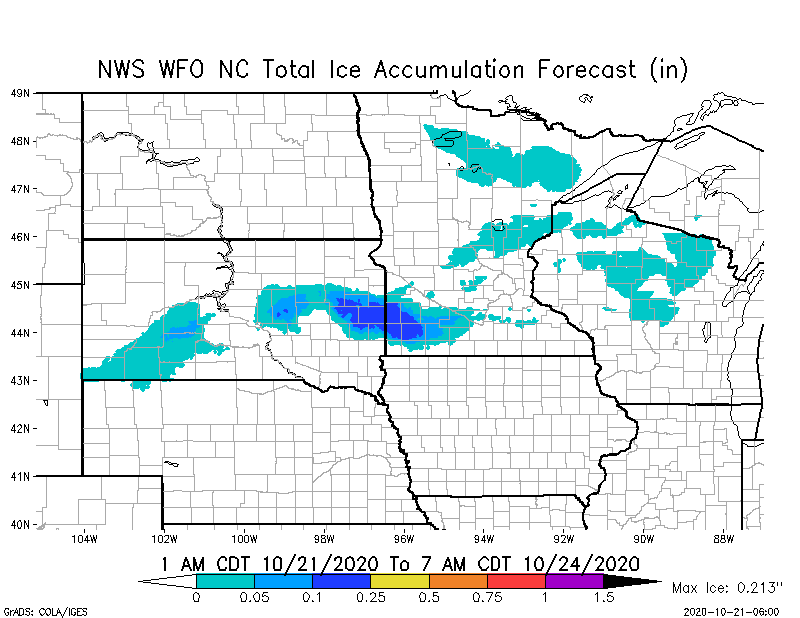
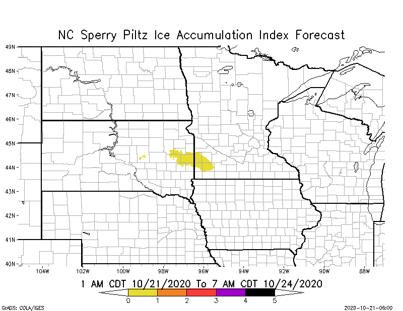
Then yes, there is a high probability of some light freezing rain and ice up to 0.213” across parts of eastern SD and southwestern MN over the next 72-hours. Combined with forecast sustained winds and forecast temperatures, this is forecast as a SPIA Ice Index Level 1 event - the lowest impact on our scale. A few outages may be expected.
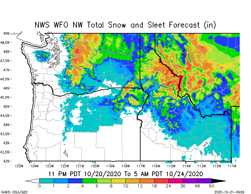
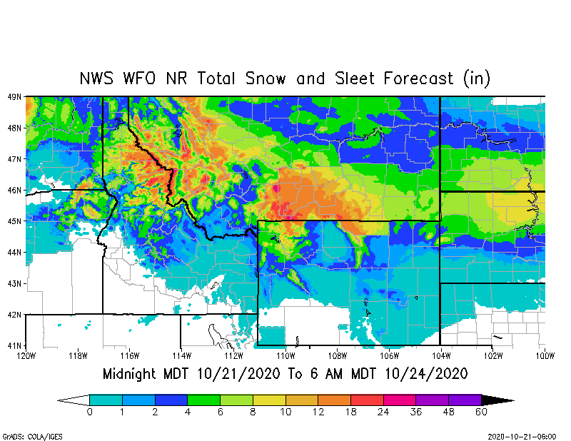
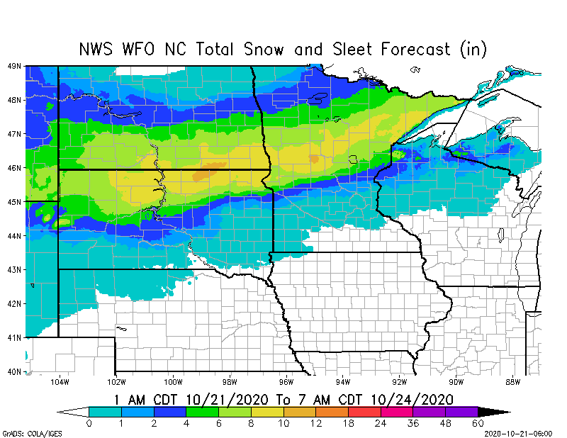
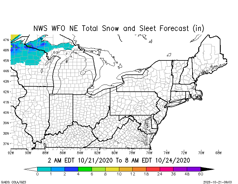
Snow is the dominant weather element in the Northwest states, the North Rockies states, and the North Central states, such as ND, SD & MN. From 4” to 12” is forecast in parts of those states over the next 72-hours.
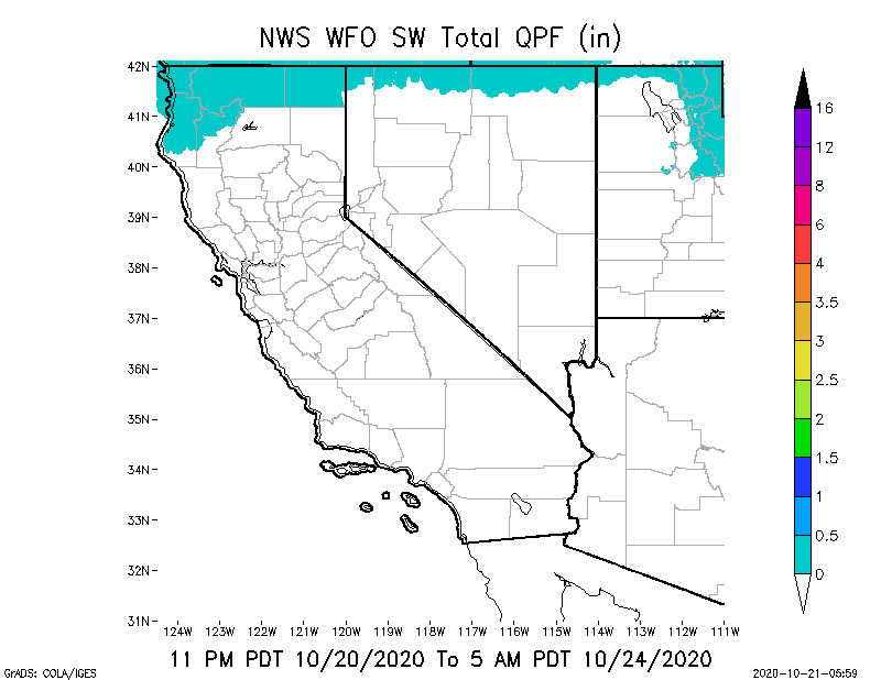
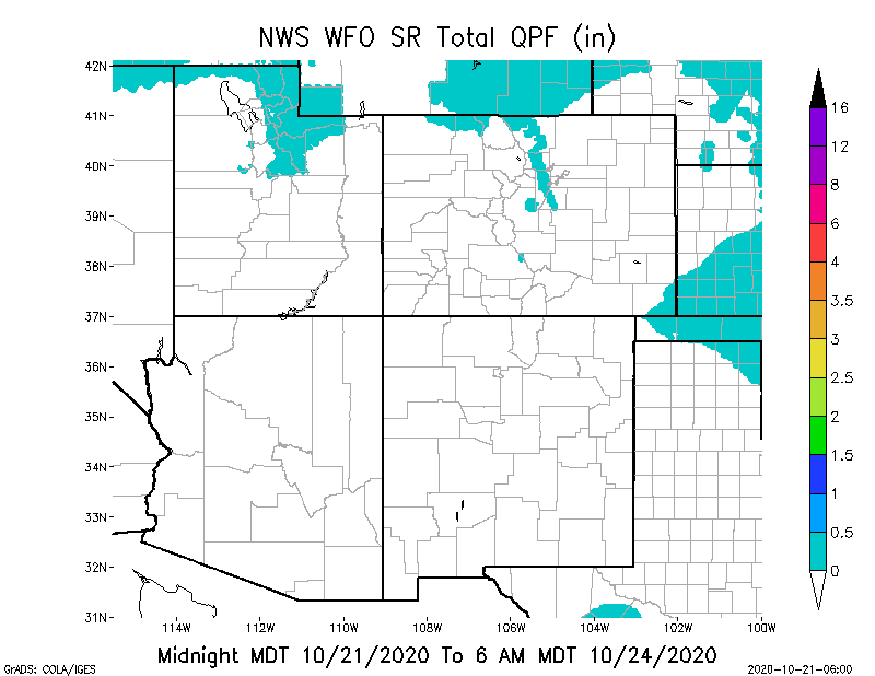
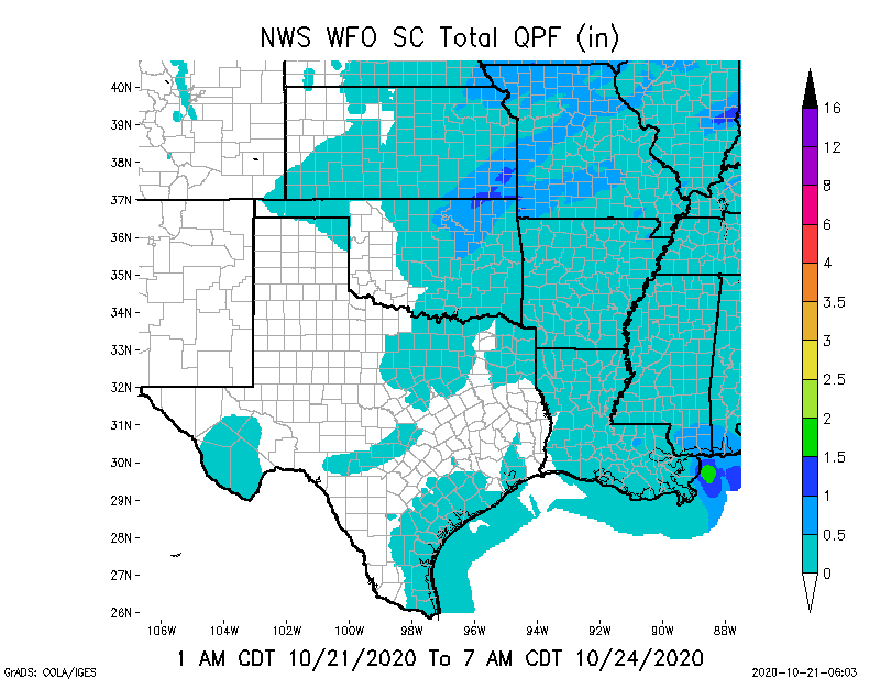
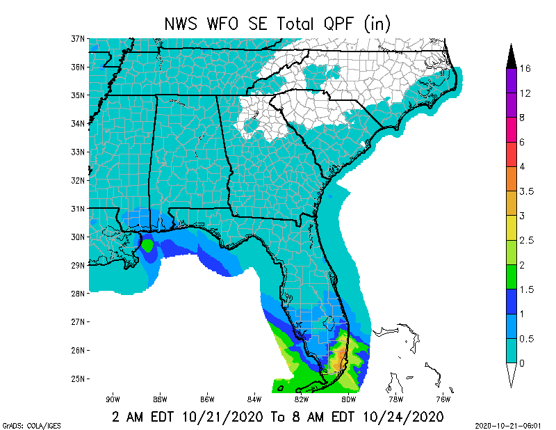
As for precipitation, there’s still not much in the forecast for the Southwestern states and the South Rockies states. Continued dry, with high fire danger and ongoing wildfires in CA and CO. Some light rainfall is expected in parts of OK and MO over the next 3 days, and parts of southern/southeastern FL could receive from 1” up to 3.5” of rain over the next 72-hours. (All forecasts are from the a National Weather Service and their National Digital Forecasting Database, except for the SPIA Index Ice Impact Algorithm.) - Sid Sperry
>
>

 Show/hide attachments