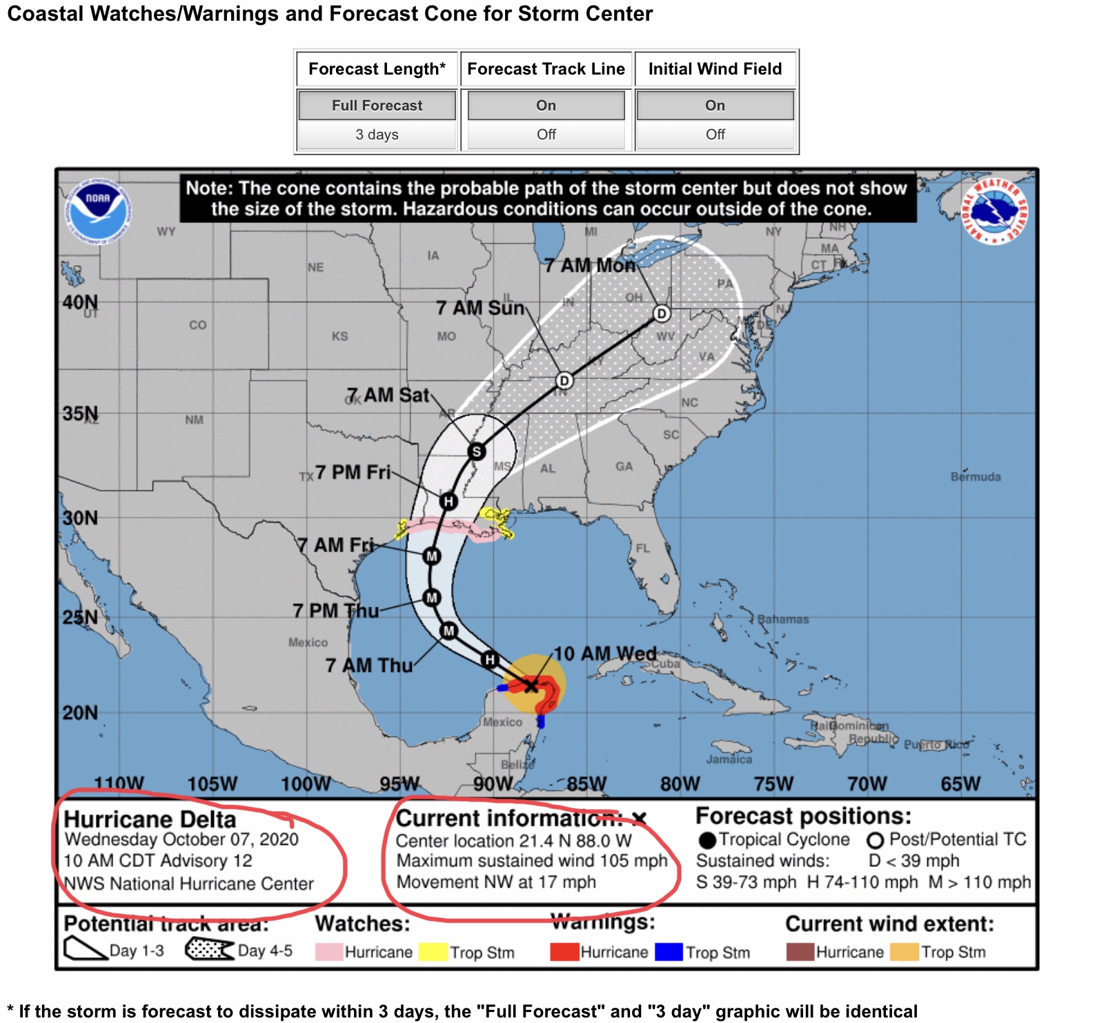
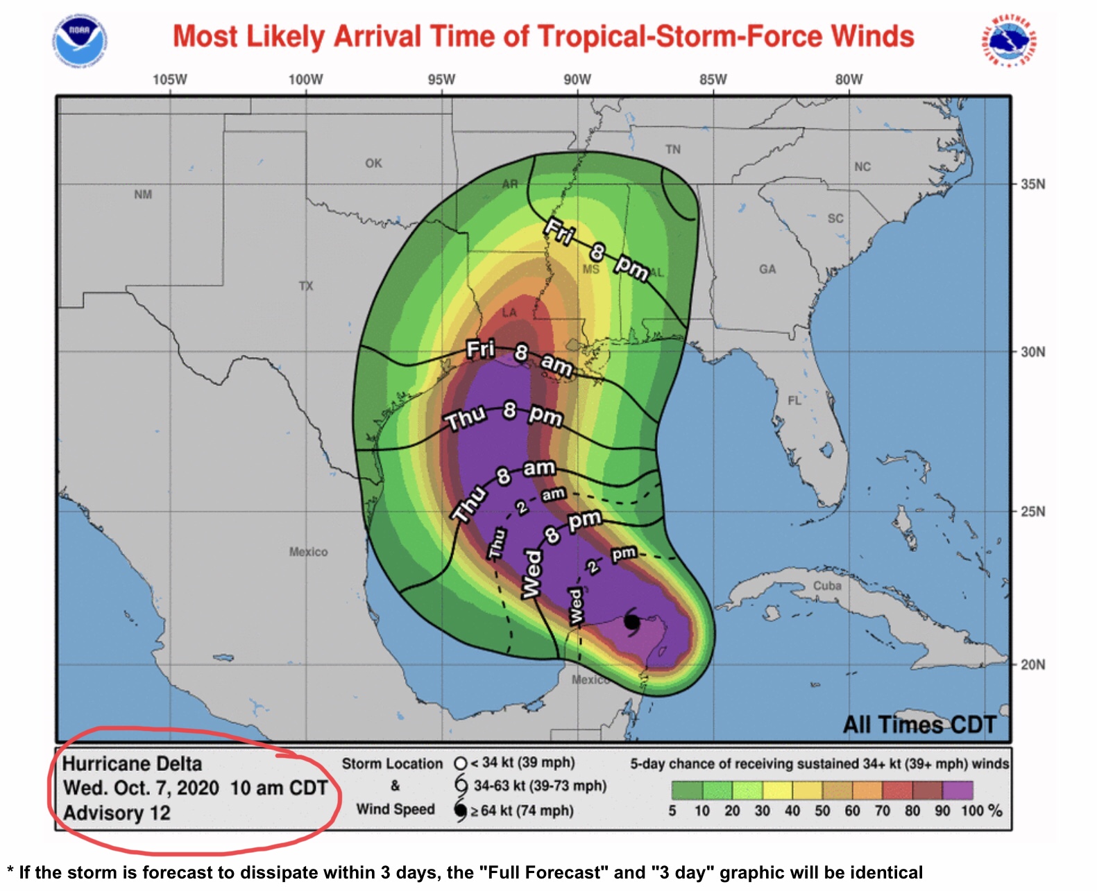
10:00am Update from NHC... Delta’s track shifts back to the west... likely landfall Friday afternoon in south-central Louisiana...
Sid Sperry 07 Oct 2020 16:17 UTC
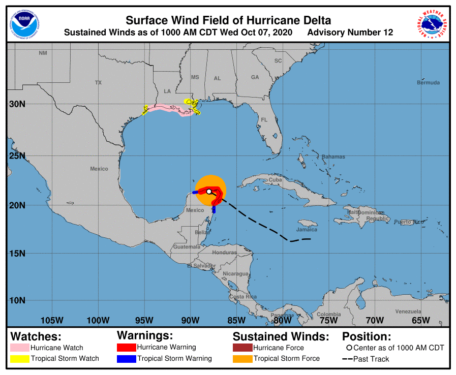
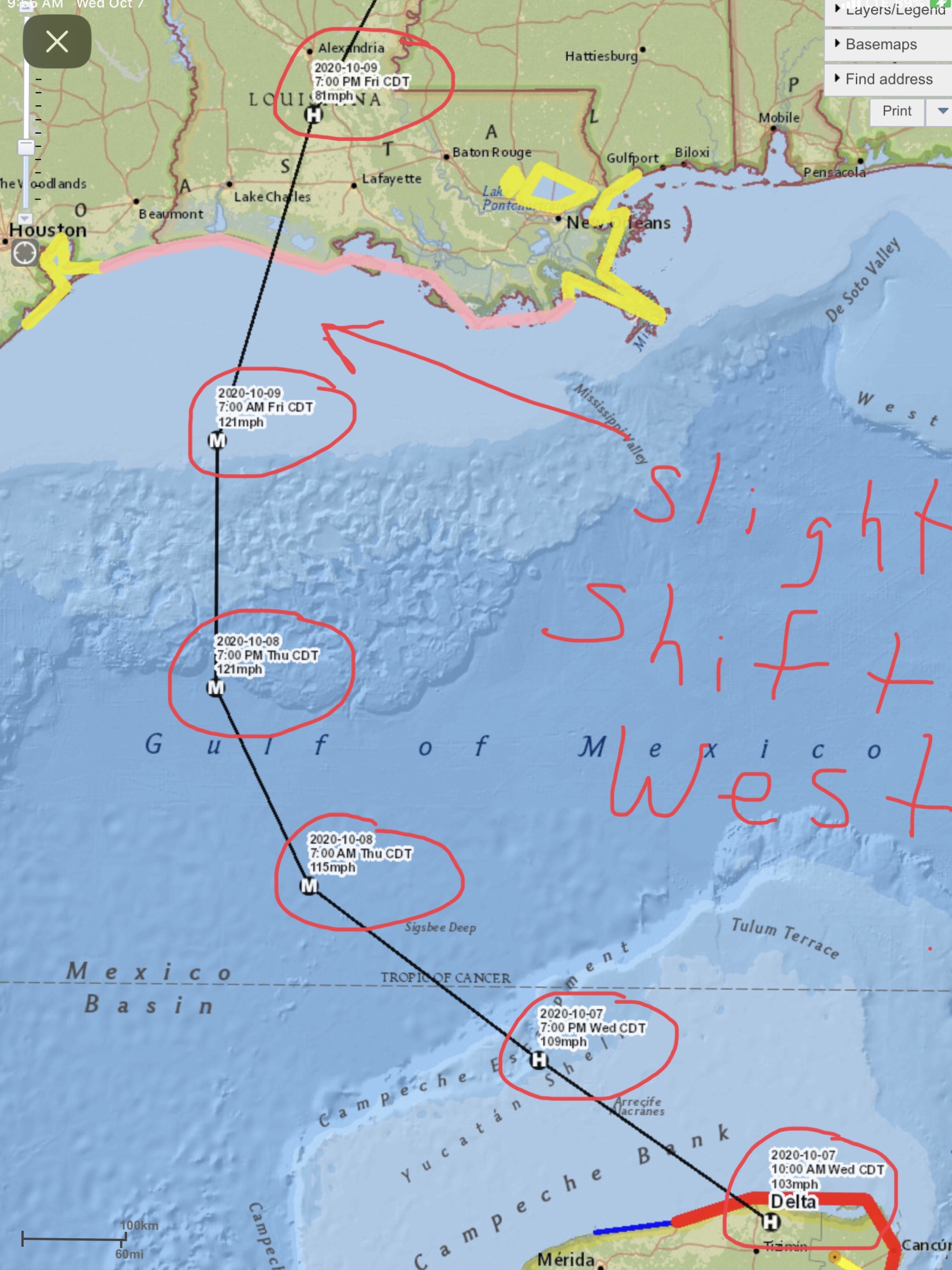
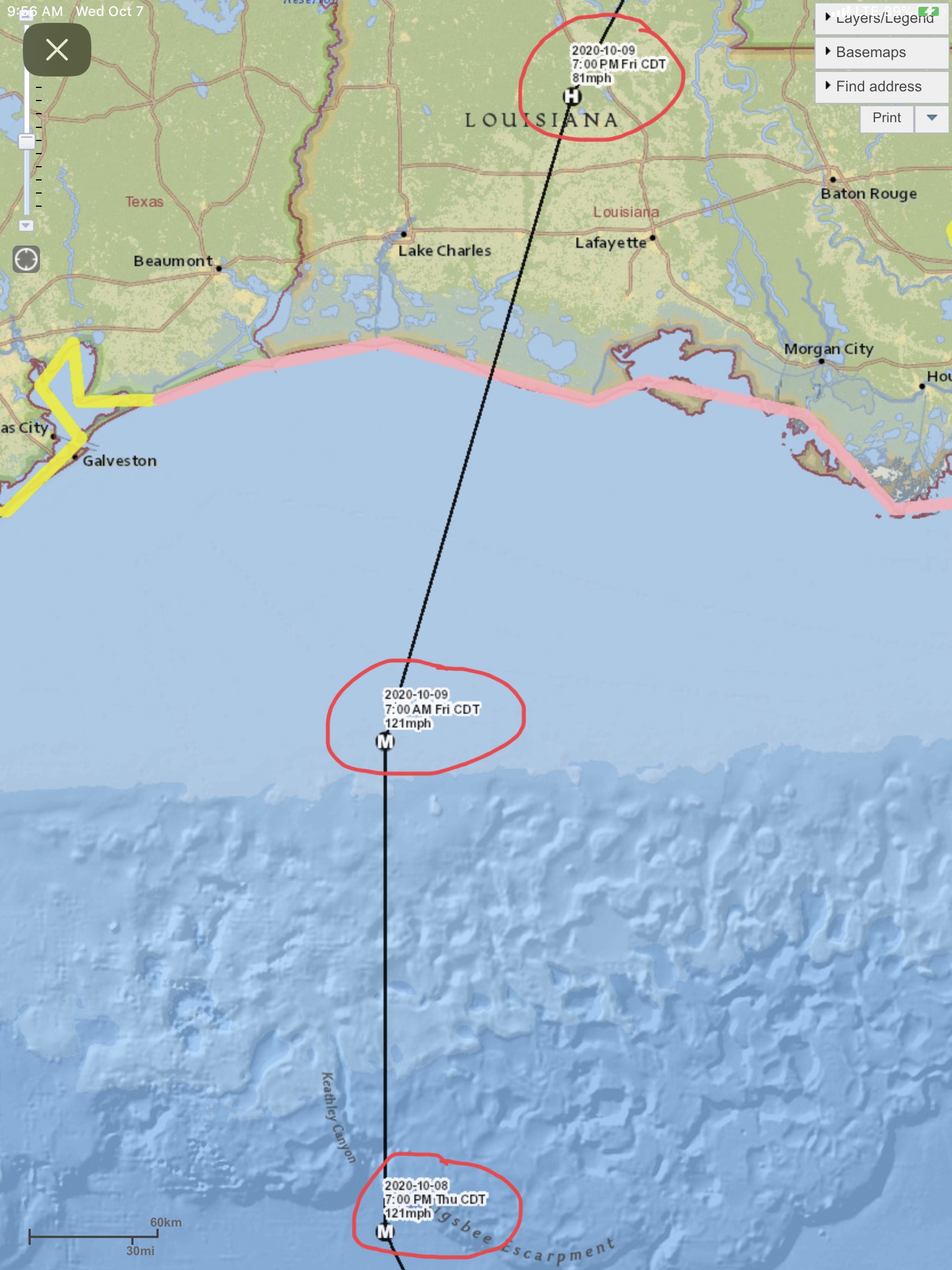
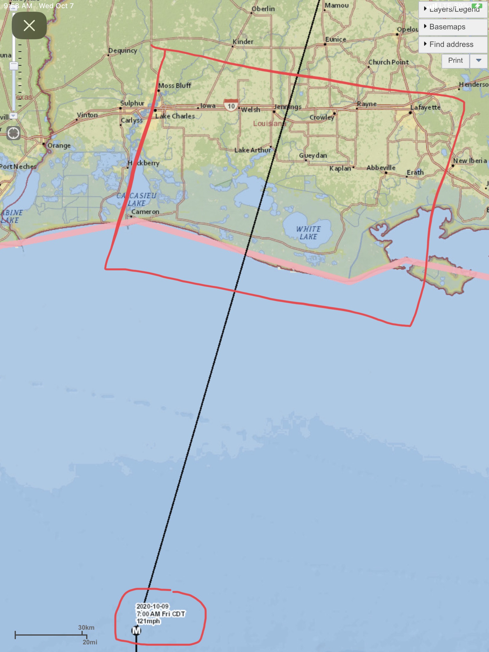
Latest forecast model runs have Delta’s track shifting a few miles back to the west, with potential landfall areas ranging between the Lake Calcasieu/Cameron area to Vermillion Bay and New Iberia. Since moving over the Yucatán Peninsula this morning, Delta has weakened a bit, but is expected to re-intensify into at least a Category 3 hurricane as it moves into the central Gulf of Mexico today and tomorrow. At present, Delta has 105 mph sustained winds and is moving northwest at 17 mph. It is expected to make landfall sometime mid-afternoon on Friday.
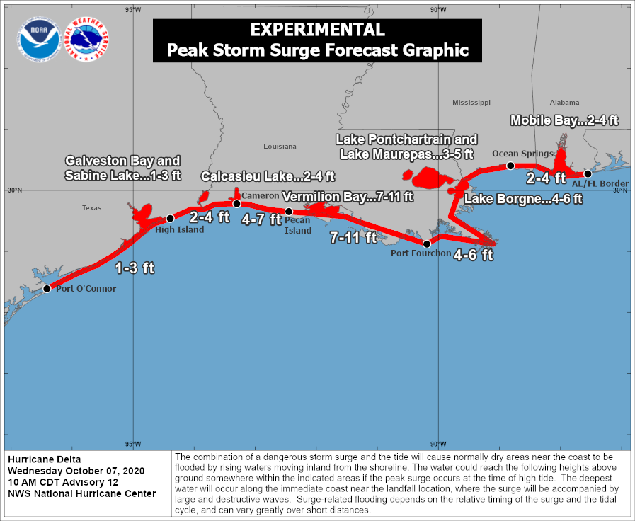
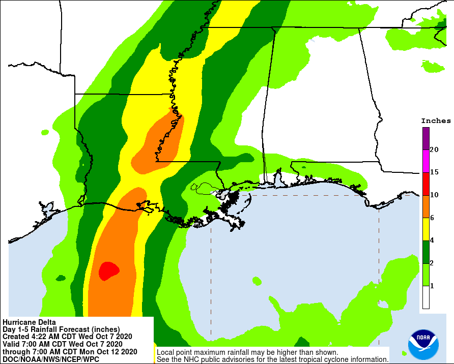
Storm surge is forecast to be from 2’ up to 11’ in some areas. Because of Delta’s fairly fast forward speed, rainfall amounts may vary, from a minimum of 2”-4” in some areas to 10”+ in parts of southern and northeastern LA and western MS. Sustained wind speeds at landfall on Friday are still projected to be in the 95 mph to 125 mph range, with higher gusts. - Sid Sperry, OAEC

 Show/hide attachments