Tropical Storm “Beta” to make landfall in Southeast Texas later today...
Sid Sperry 21 Sep 2020 11:27 UTC
Good morning all.
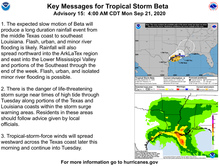
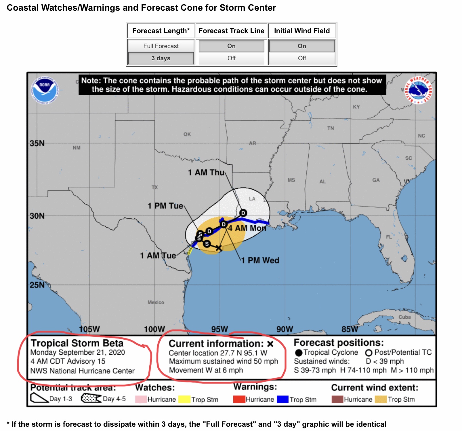
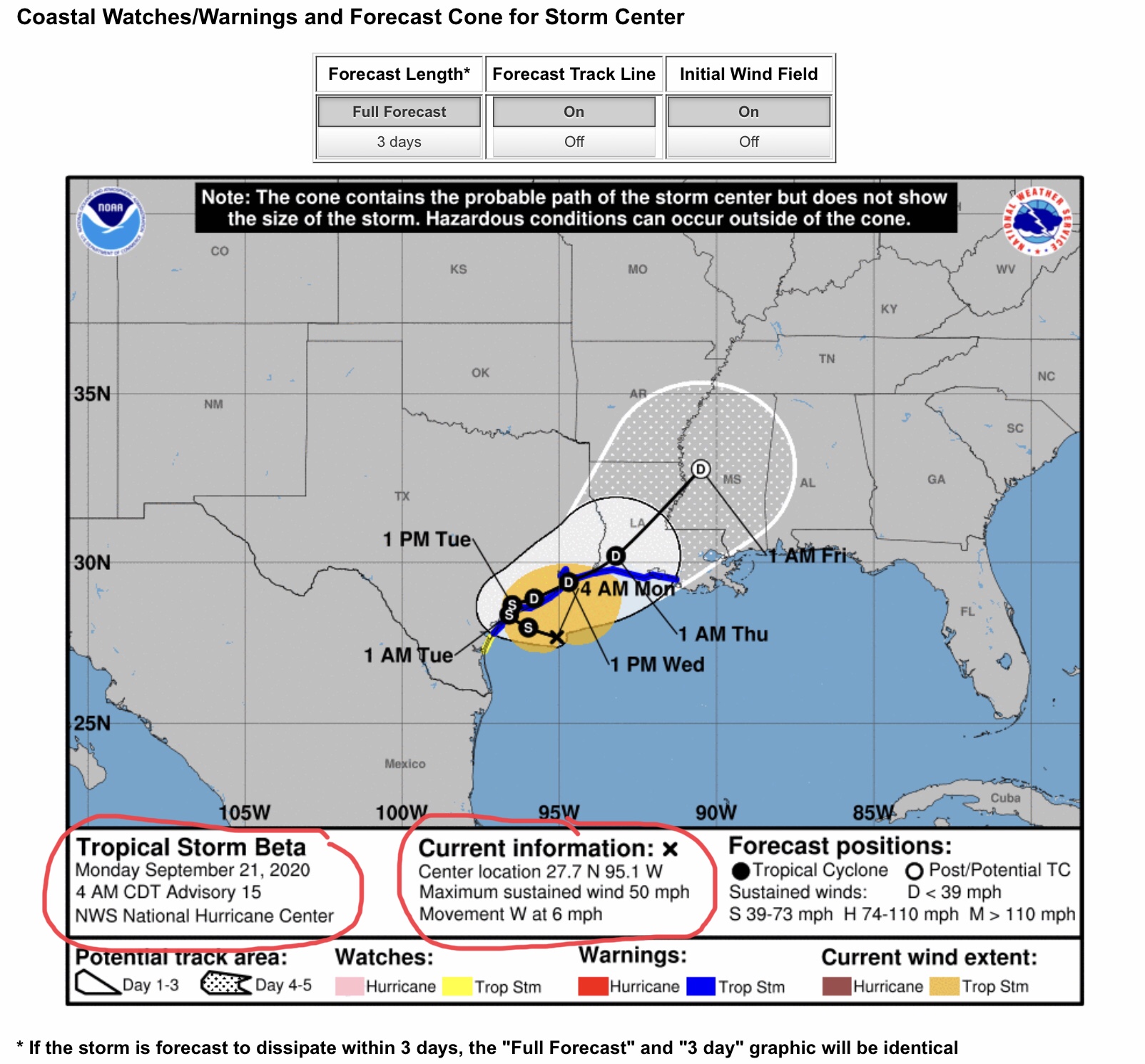
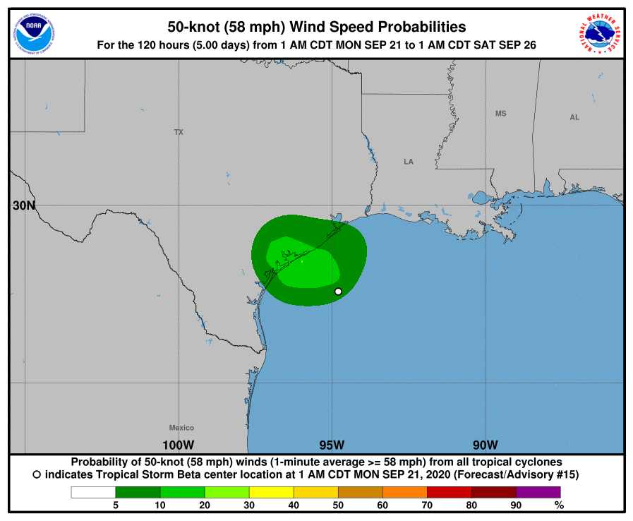
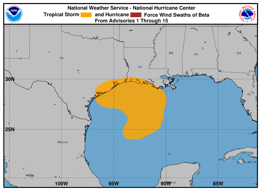
Here are the latest National Hurricane Center Forecasts for Tropical Storm “Beta.” It is expected to make landfall later today somewhere near or to the east of Matagorda Bay, Texas. Winds at landfall should be less than 60 mph, possibly in the 50-55 mph range.
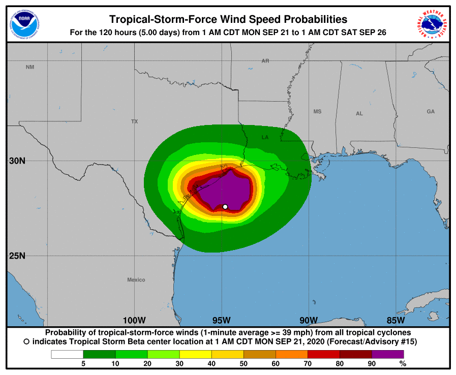
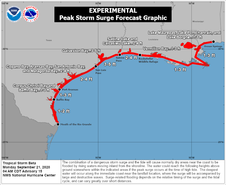
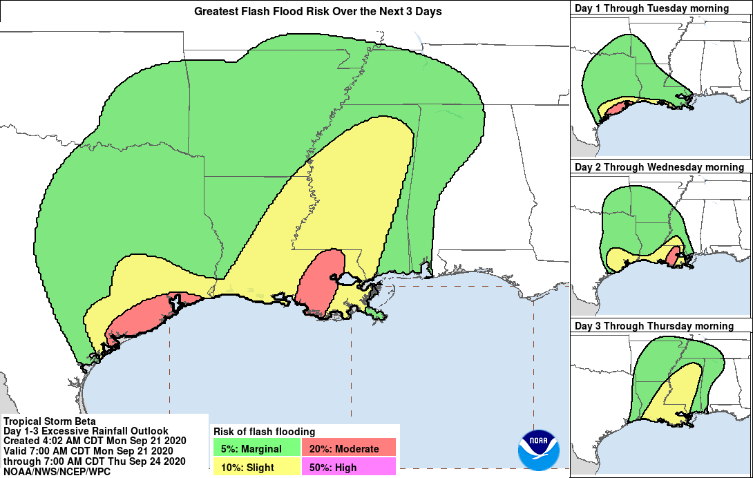
Parts of the southern and southeastern Texas coastlines are already experiencing storm surge and heavy rainfall. Peak storm surge is still being forecast to be in the 1’ to 5’ range for much of the Texas coastline, extending into southwestern Louisiana.
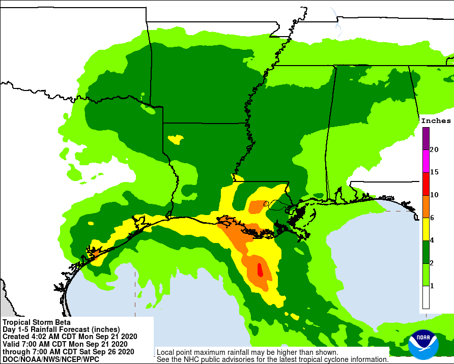
Storm Total Rainfall amounts are still being forecast to be in the 4” to 10” range for much of the southeastern Texas and southern Louisiana areas. From 2” to 4” can be expected across much of eastern TX, central and northern LA, southeastern OK, southern and central AR, southern and central MS, and northern AL as remnants of “Beta” move to the northeast as a Tropical Depression later this week, thru Friday. I will send a second email with projected rainfall totals and sustained wind speed forecasts from the local National Weather Service Offices in the region in just a few minutes.
- Sid Sperry, OAEC

 Show/hide attachments