All,
Here are the latest (4pm) forecast updates on Tropical Storm “Beta” from both the National Hurricane Center, and from local National Weather Service Forecast Offices.
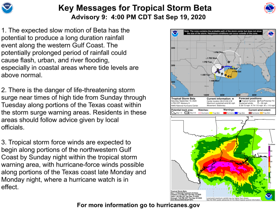
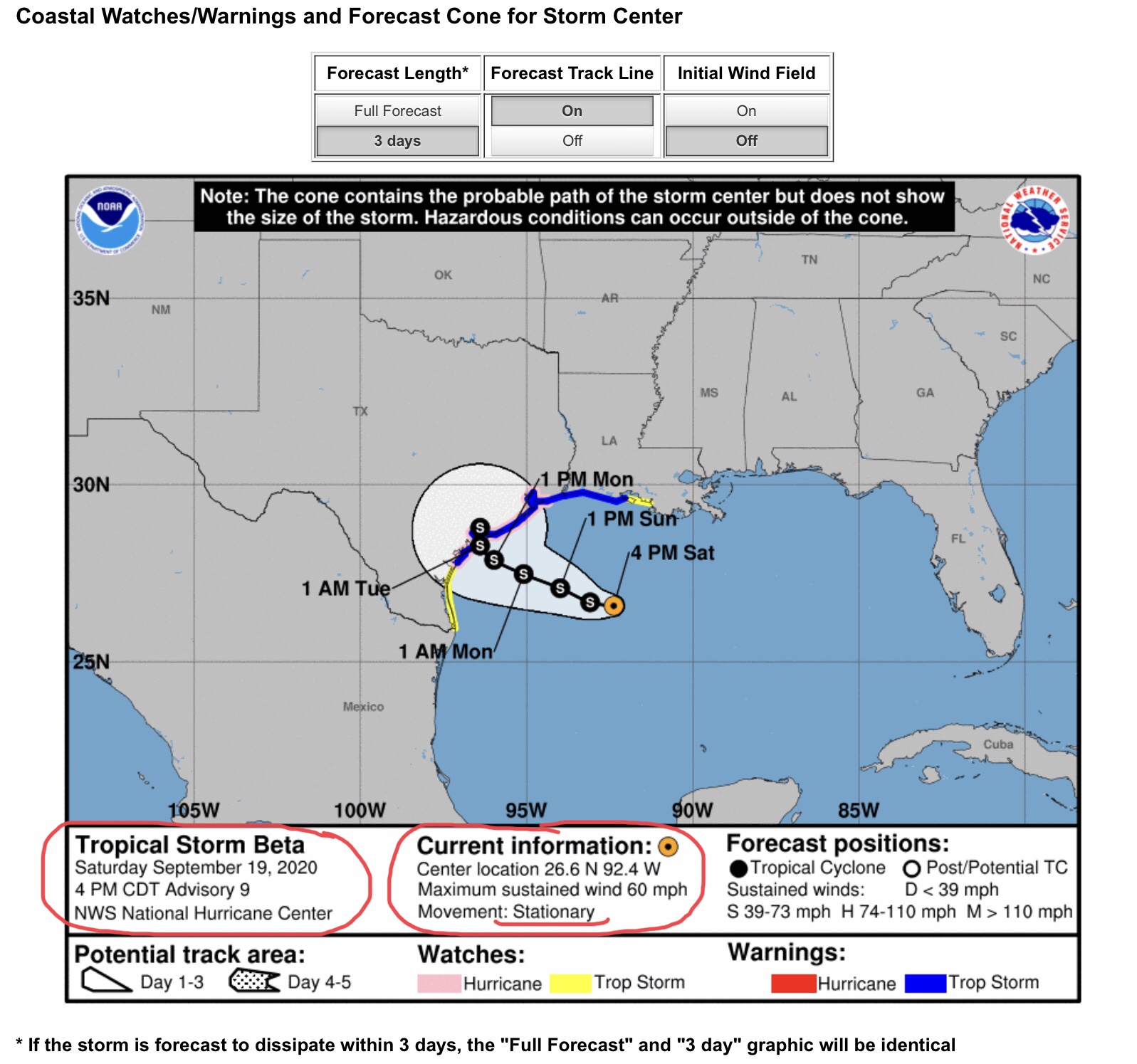
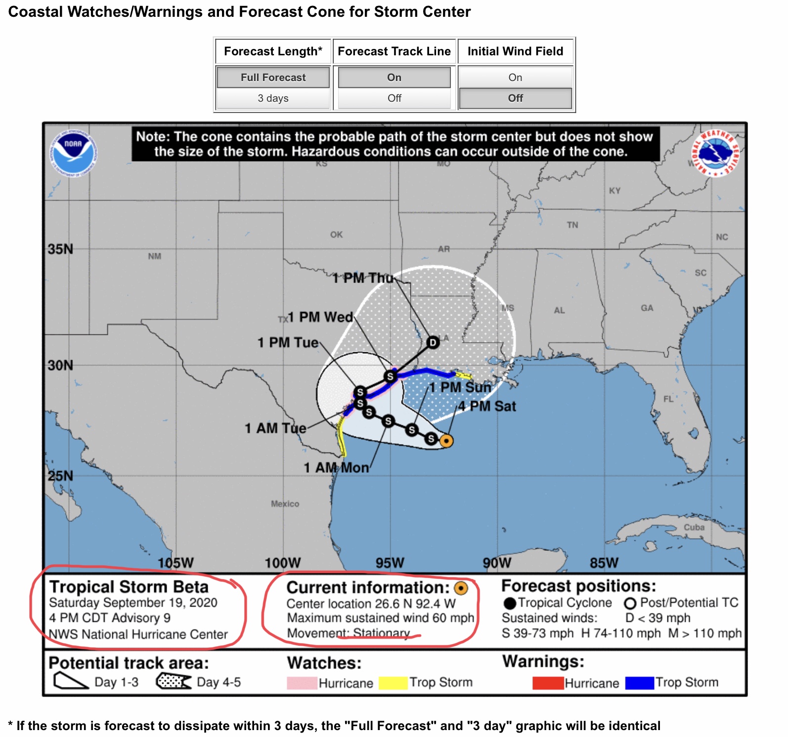
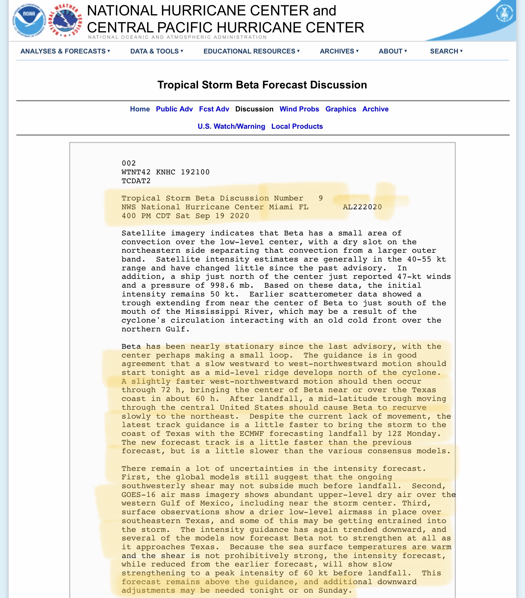
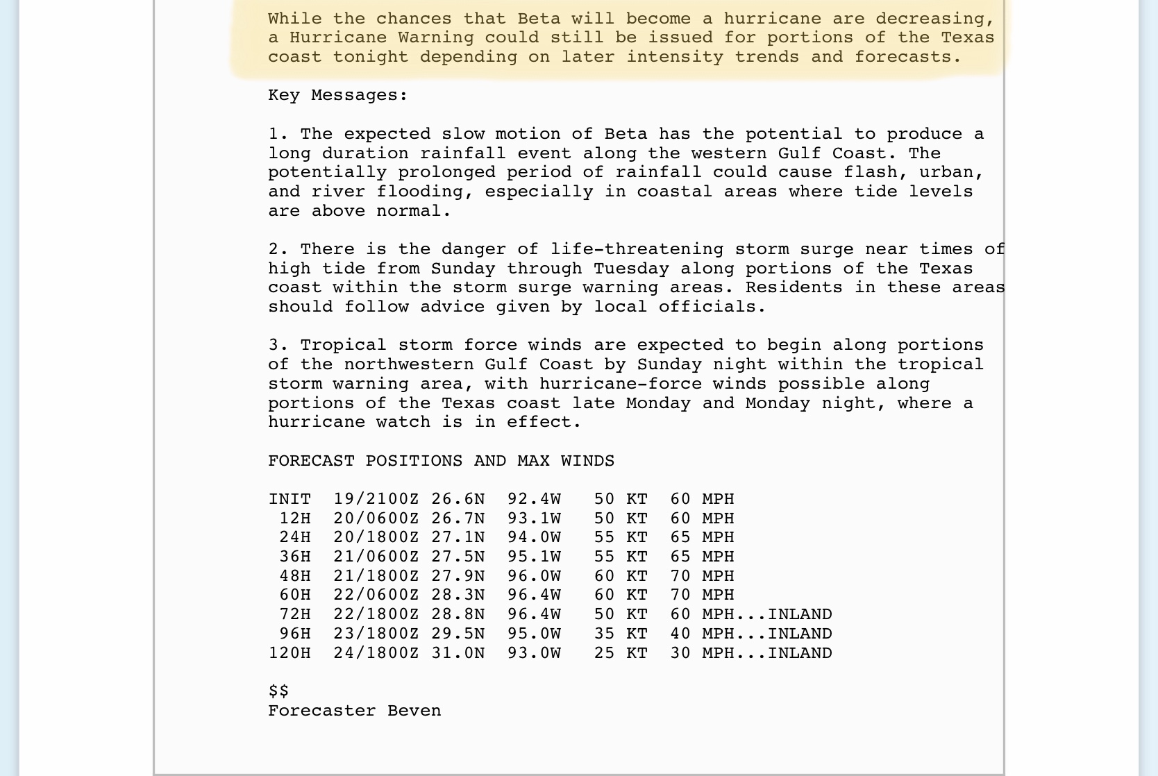
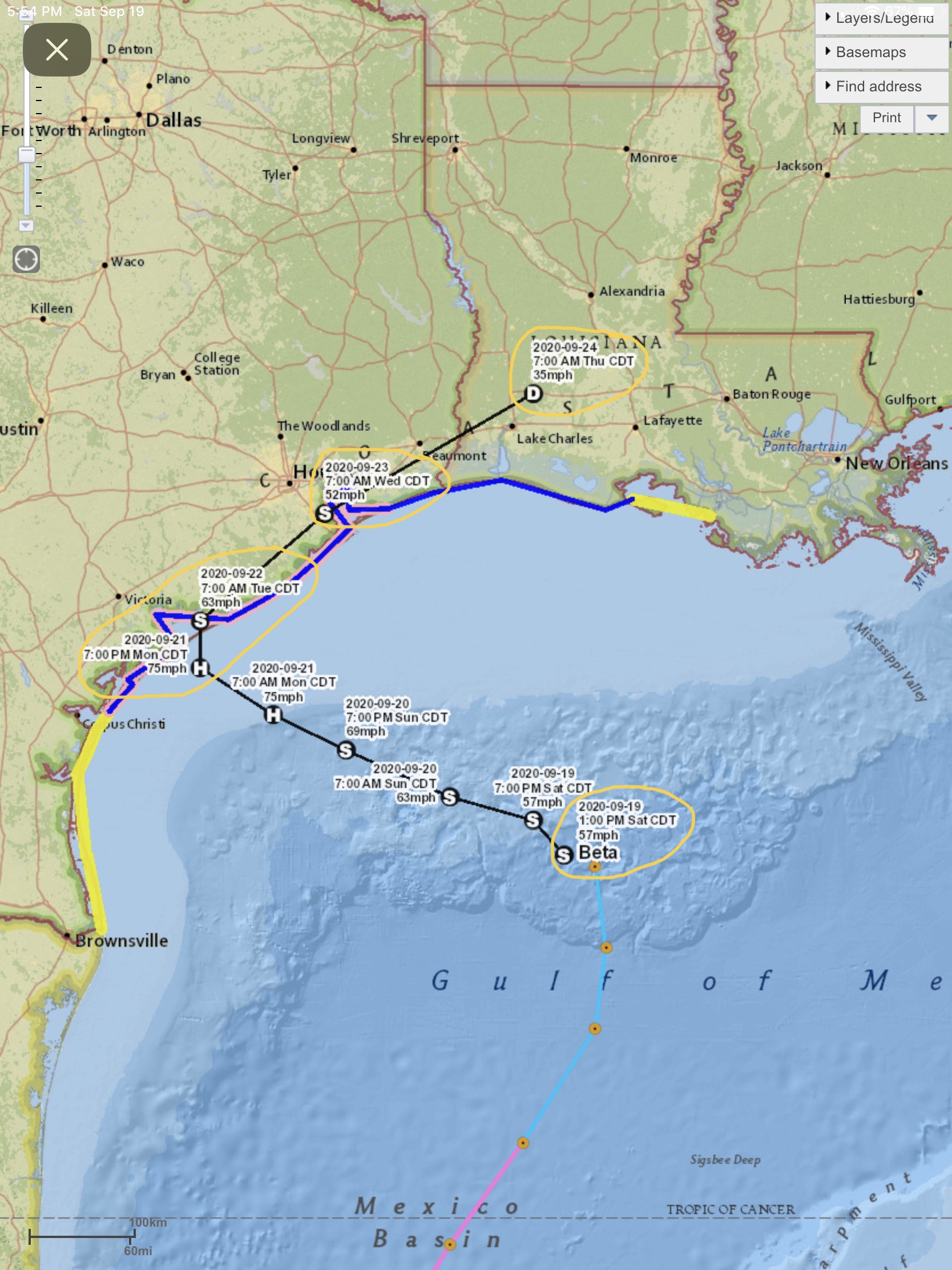
“Beta” has been relatively stationary, even performing a ‘loop’ around itself over the last 8 hours. It is expected to continue a slow crawl to the west through early Tuesday morning, possibly making a landfall as a Category 1 Hurricane with sustained winds of 74 mph, or as a strong Tropical Storm, with max sustained winds in the 70 to 73 mph range. Landfall is being projected just to the southeast of Victoria, TX, at this time, but that could change over the next 2 or 3 days.
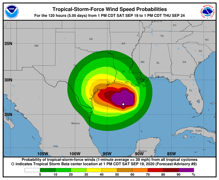
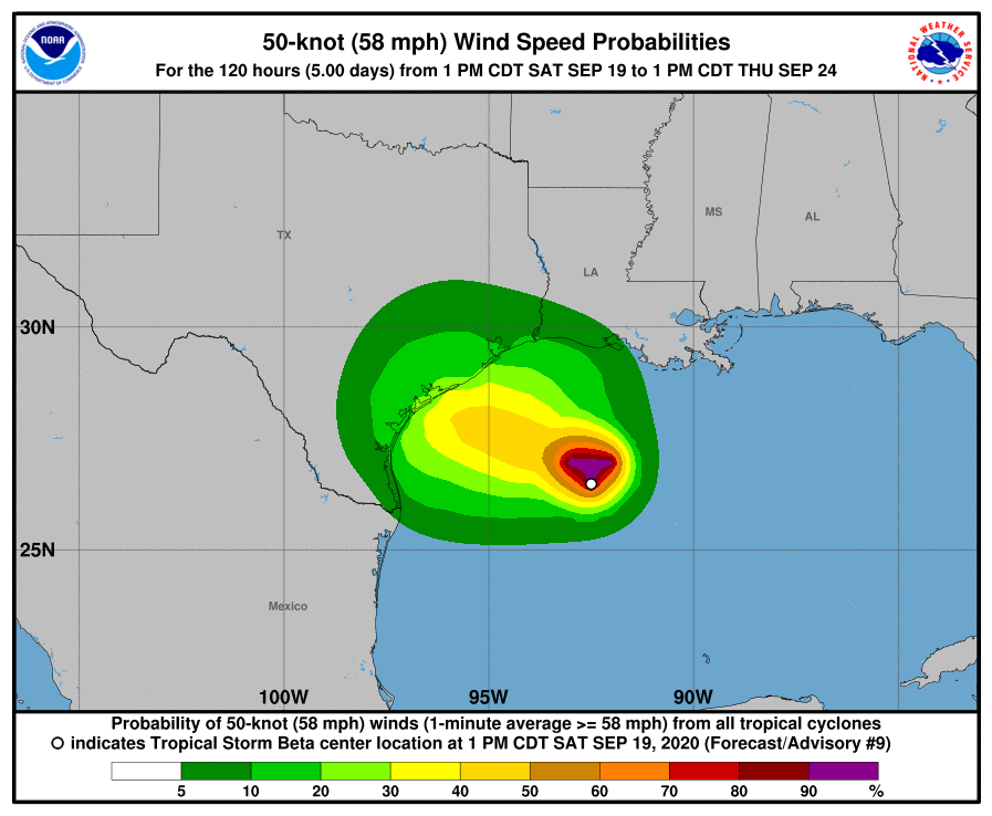
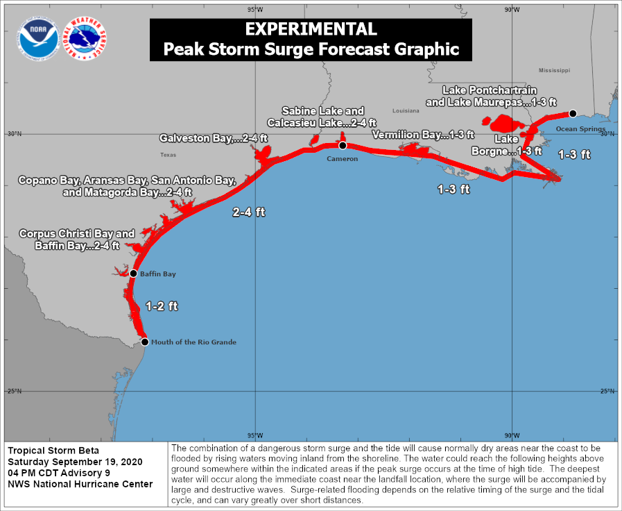
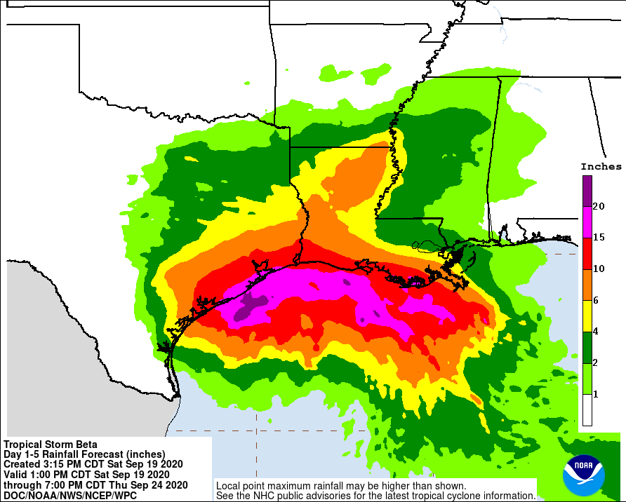
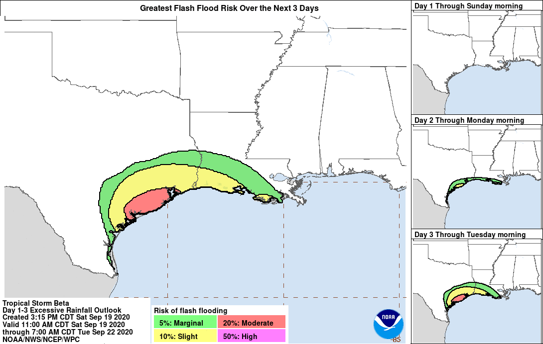
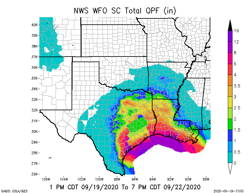
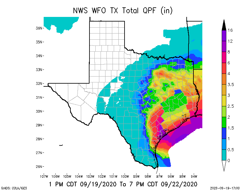
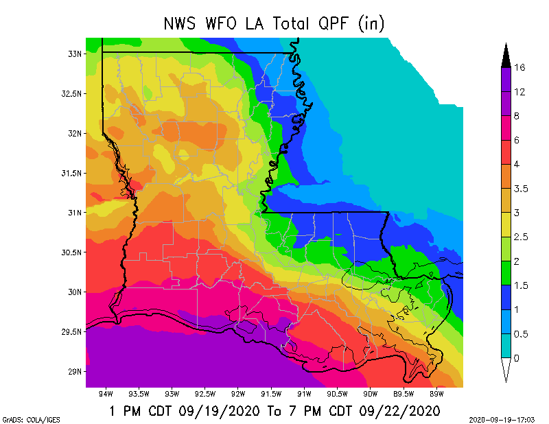
Forecaster concerns are storm surge, and heavy rainfall, from Corpus Christi, TX, to Morgan City, LA. Rainfall amounts from 4” to 20” are being forecast for parts of the southern and southeastern TX coastline, from 4” to 10” in parts of northern and central LA, and from 6” to 15” across southern portions of LA. Storm surge from 1’ to 4’ is still possible.
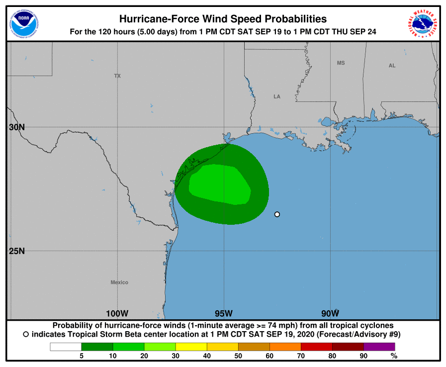
As for sustained winds, shortly after landfall they are expected to be in the 60-65 mph range, and Houston, TX, could experience sustained winds in the 45-55 mph range on Wednesday morning. By the time the Tropical Depression makes its way into west-central LA on Thursday, sustained winds are projected to be in the 30-35 mph range.
Here are the latest NHC and NWS forecast graphics. - Sid Sperry, OAEC

 Show/hide attachments