7 Active Tropical Storms in Atlantic & Gulf of Mexico - most since 1971. Sally shifts a bit East, still expected to be a Category 1 Hurricane at Landfall on Tuesday. Biggest concern now: HEAVY RAINFALL AND FLOODING/FLASH FLOODING in LA, MS & AL
Sid Sperry 14 Sep 2020 14:34 UTC
Wanted to get this latest NHC forecast update out to everyone ahead of our 10:00am conference call with Aaron and the folks from ALEC, plus for Gerald in MS and Michael in AL.
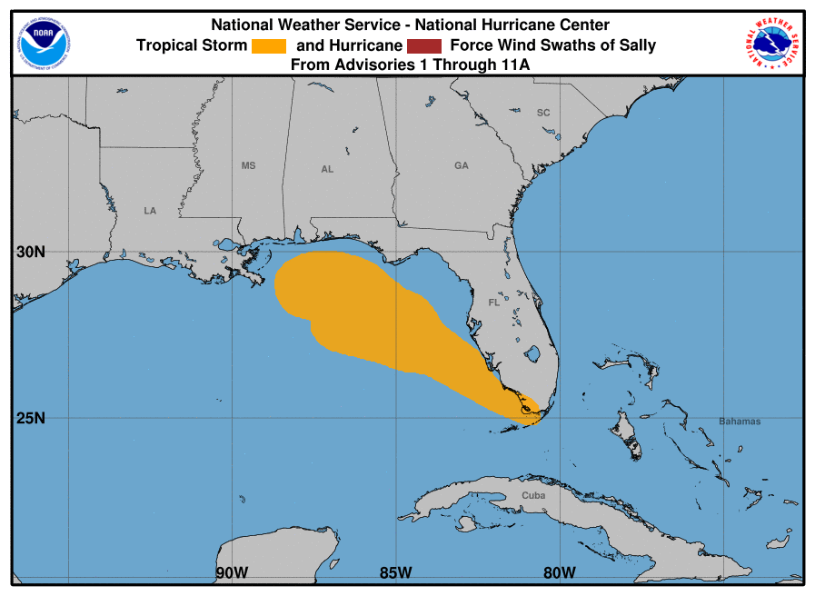
Seven active tropical storms at one time in the Atlantic & Gulf - most since 1971! (I was a freshman in high school!) our main concern for now is on Tropical Storm Sally, so my comments will focus on Sally from graphic #3 onward.
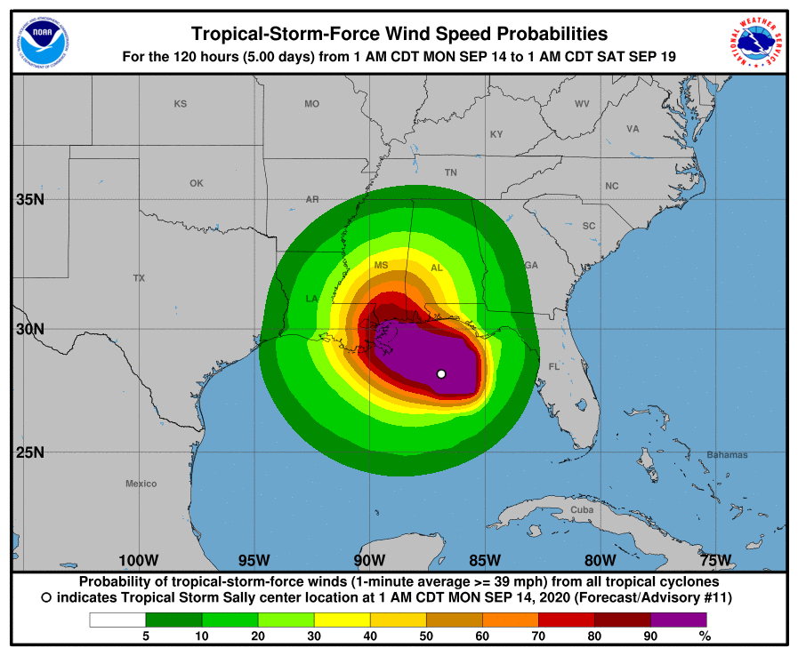
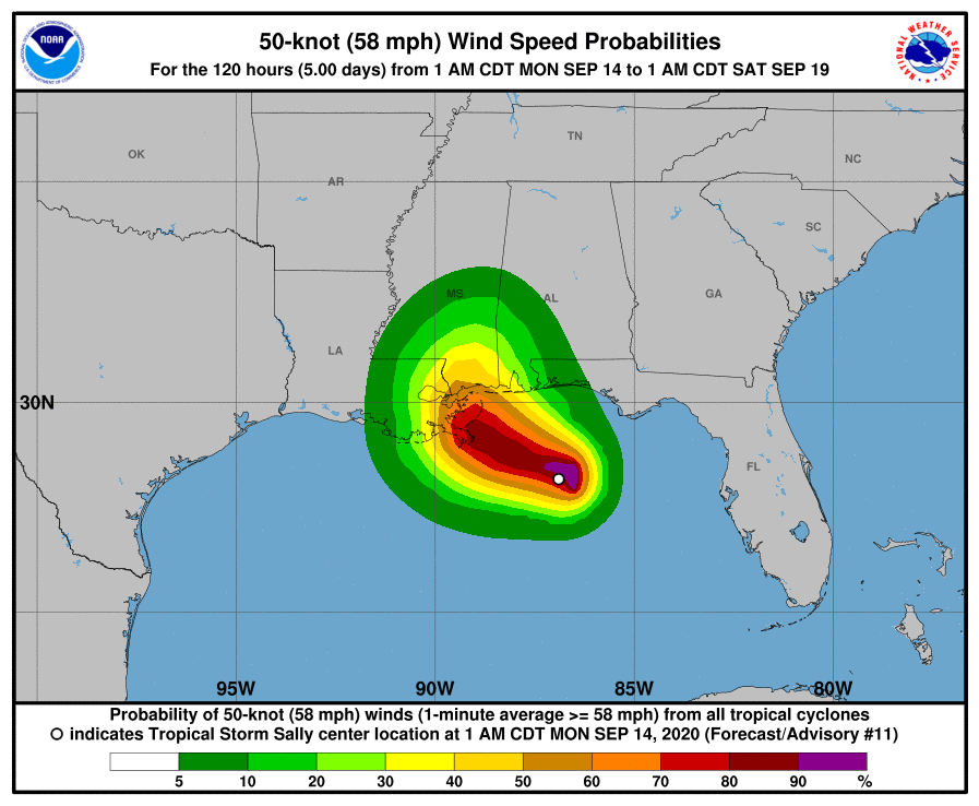
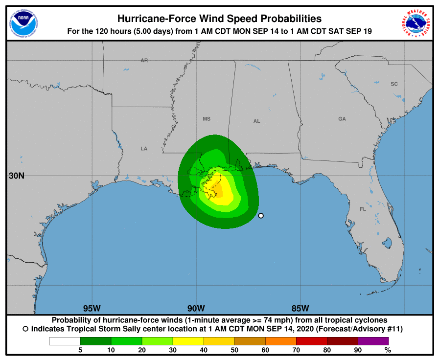
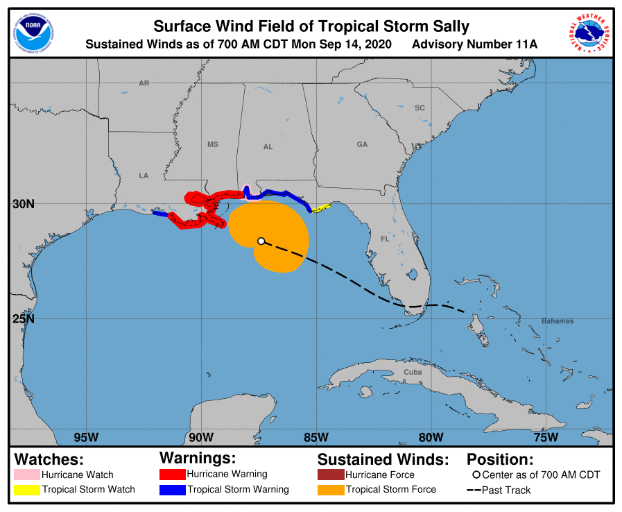
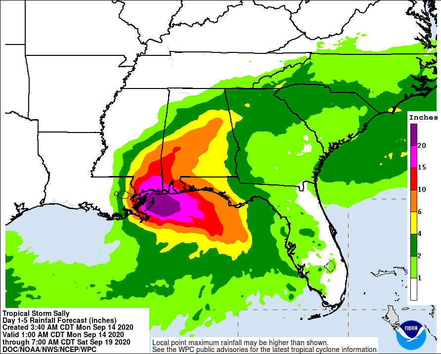
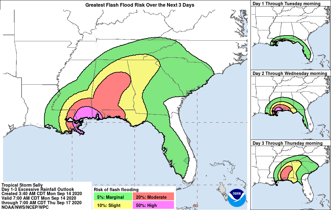
As of 7am, Sally has max sustained winds of 65 mph and is moving west-northwest at only 8 mph - it has slowed due to a high pressure ridge to its north and northwest, and frankly, this is not good because while it could reduce the hurricane intensity (a likely Category 1 instead of a Category 2), it will cause even more rainfall and rain “banding” that will cause flooding and flash flooding concerns from southeastern LA to the western Florida panhandle. Specifically, there are growing concerns about the possibility of major flooding in parts of southern Mississippi and parts of southern and western and now central Alabama. Storm Total Rainfall amounts are still in the 4” to 20”+ range according to both the NHC and the National Weather Service (NWS).
Landfall is still projected for sometime Tuesday morning, but because of this “slow down” trend, it could come later in the afternoon on Tuesday. Still a great deal of uncertainty with timing of landfall, AND with exact landfall location. The Gulfport and Biloxi areas now are getting the most attention, but that could easily shift back to being closer to New Orleans over the next 12 to 24 hours. More than likely, Sally will make landfall as a Category 1 hurricane, with sustained winds of 86 to 90 mph, with gusts in the 100 to 110 mph range.
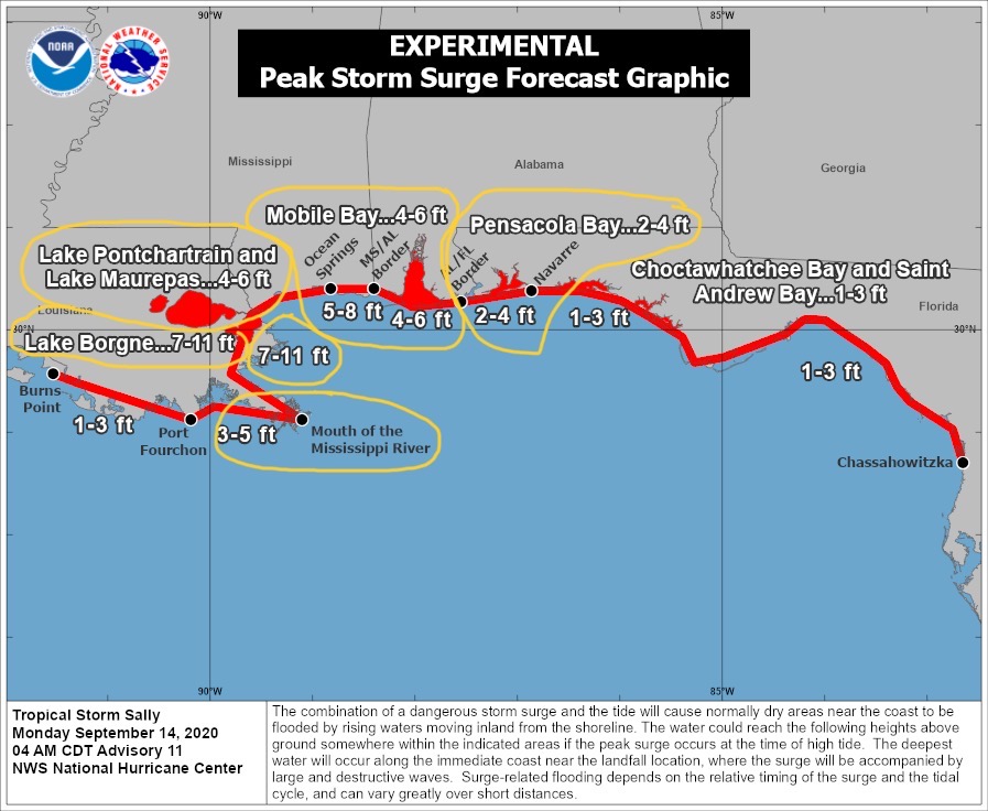
It should also be noted that with this track “shift” to the east, storm surge amounts along the coastal areas of Mississippi and Alabama have also increased, into the 4’ to 6’ and 5’ to 8’ range in some areas.
The service areas of Beauregard Electric and Jeff Davis Electric should experience very few impacts from this storm.
Sid Sperry
OAEC

 Show/hide attachments