8pm EDT Forecast Updates from National Hurricane Center & National Weather Service on Tropical Storm Sally...
Sid Sperry 14 Sep 2020 01:03 UTC
Last update until the 5am update tomorrow (Monday) morning.
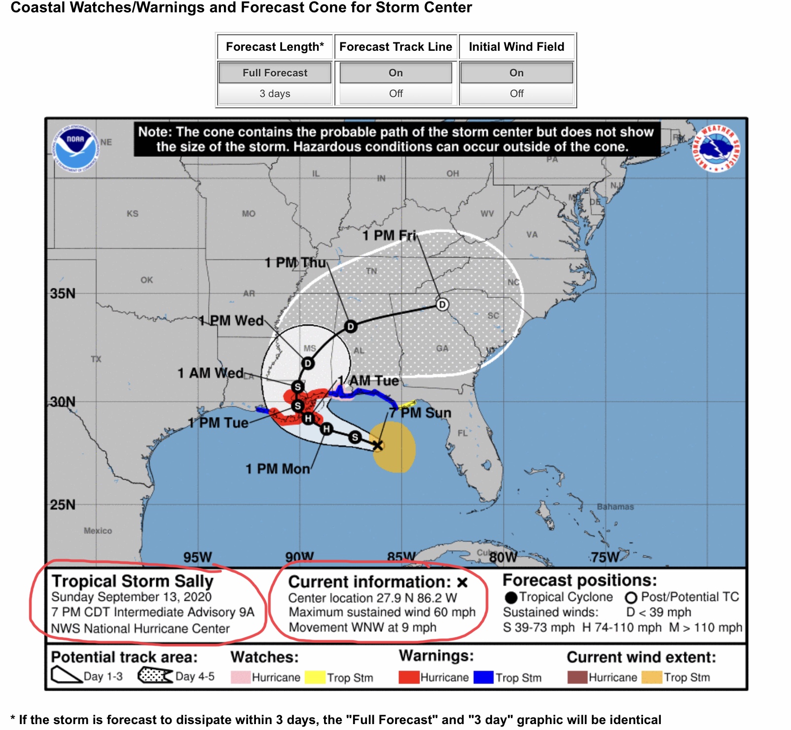
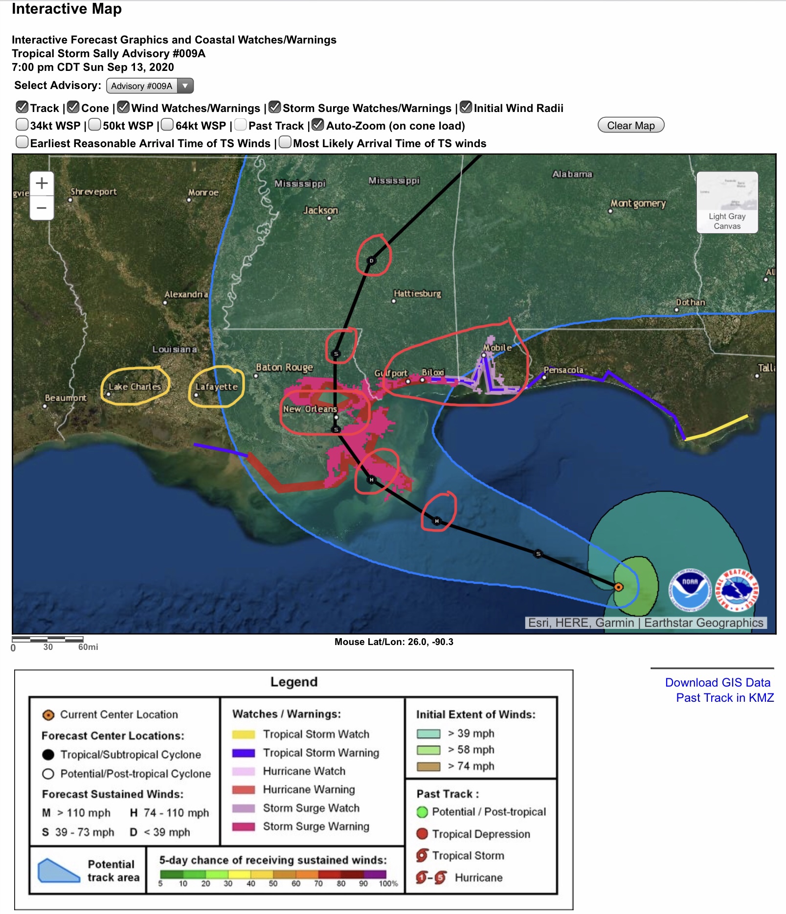
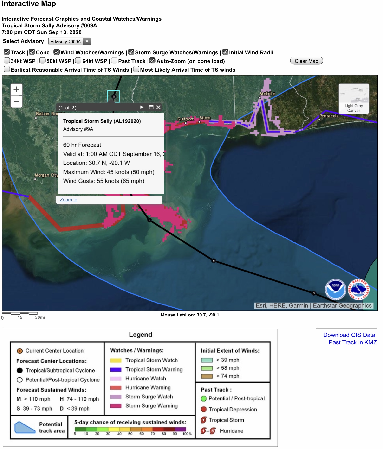
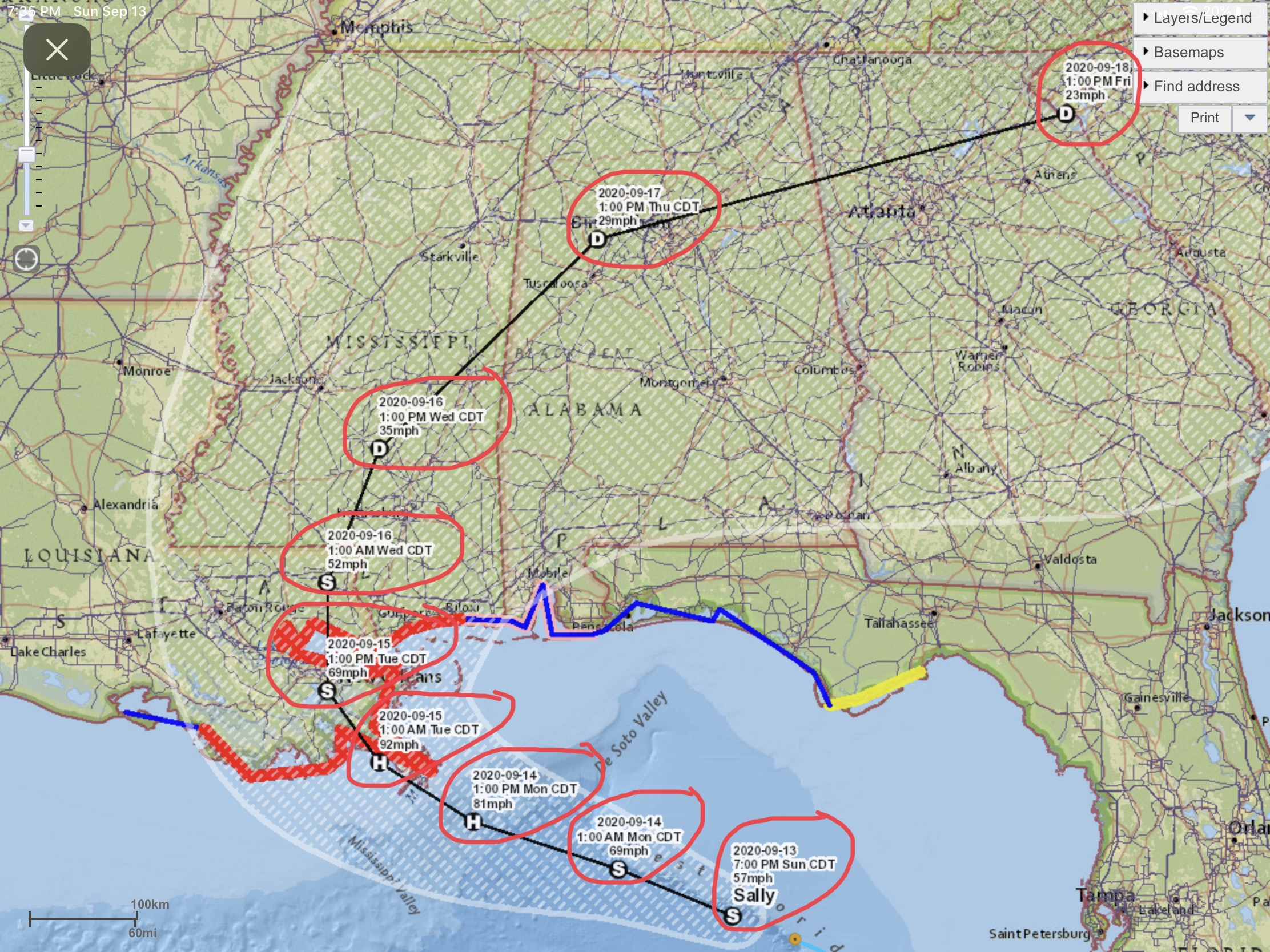
Track of Sally is essentially the same as the 5pm EDT update - track has moved slightly to the east, nearer to New Orleans. Note in graphic #2 that Lafayette and Lake Charles, LA, are no longer included within the NHC’s “Cone of Uncertainty.”
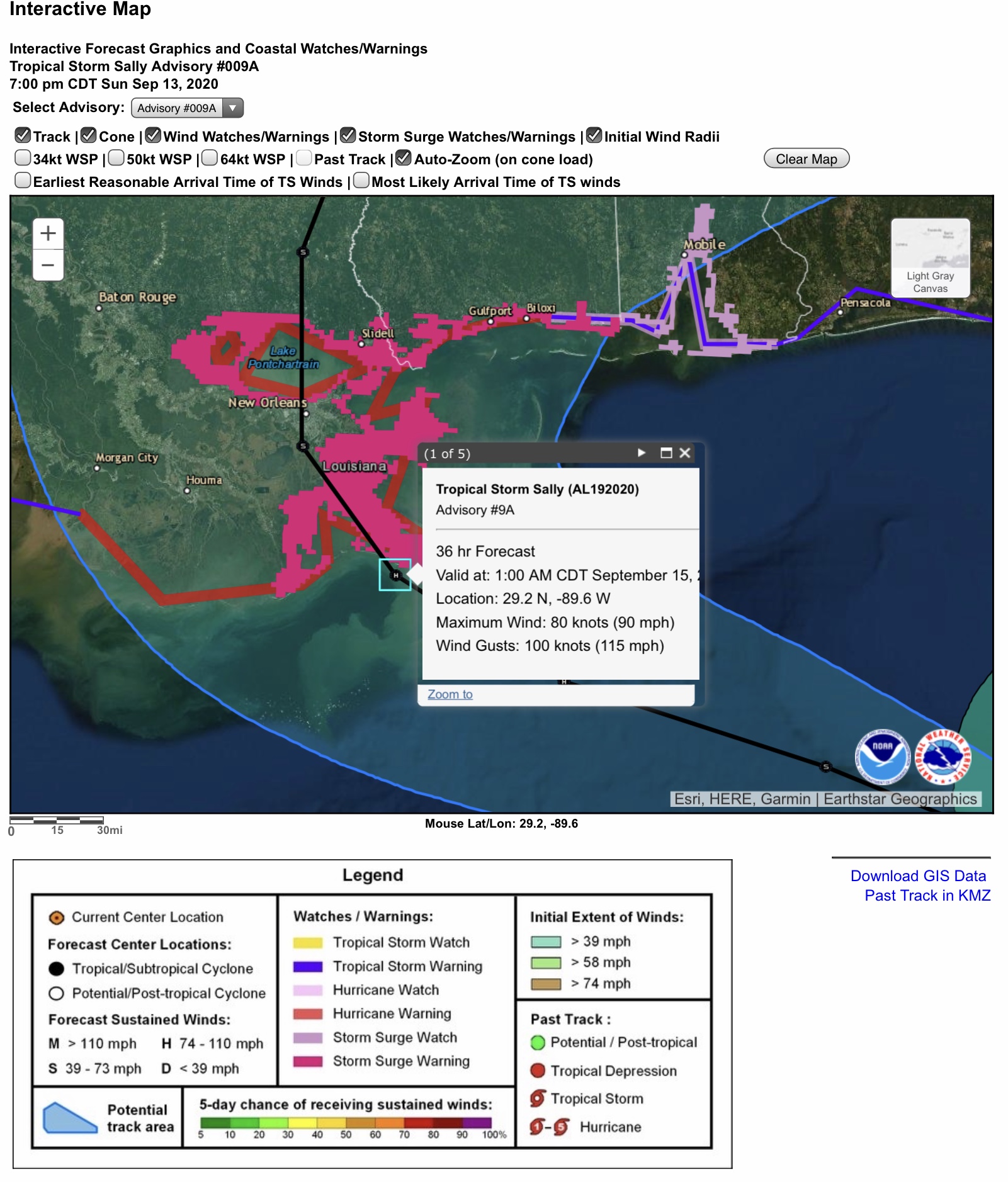
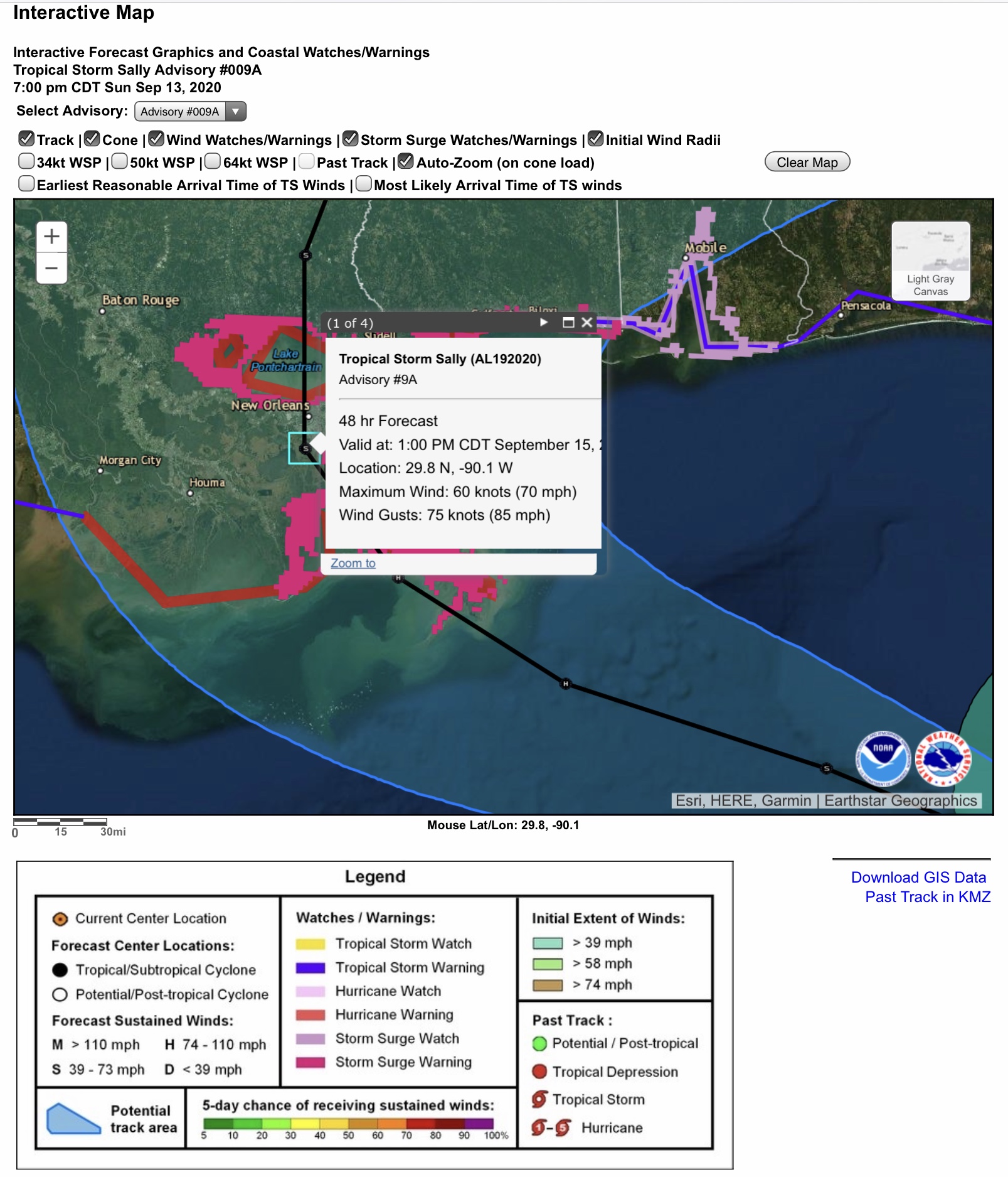
NHC is forecasting that Sally will make landfall sometime Tuesday morning or perhaps early afternoon as a high-end Category 1 Hurricane, with sustained wind speeds in the 90 to 92 mph range with gusts to 115 mph. Sustained winds are forecast to be in the 70 to 75 mph range when Sally approaches New Orleans, LA. By late Tuesday afternoon or early evening, Sally is forecast to be downgraded to a Tropical Storm, with sustained winds in the Covington & Franklinton, LA, areas of 50 mph with gusts to 65 mph. It will become a Tropical Depression by Wednesday afternoon, with sustained winds of 35 mph or less, in south-central MS.
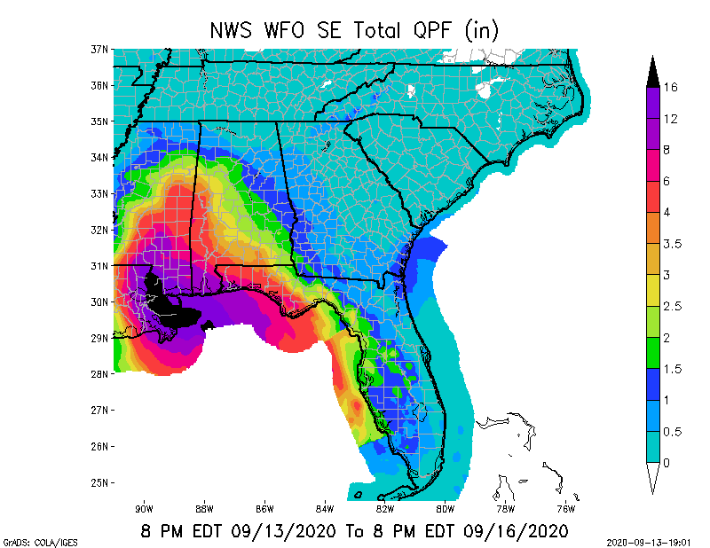
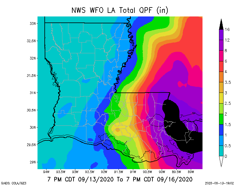
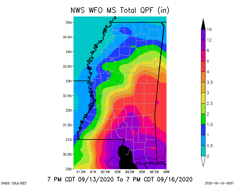
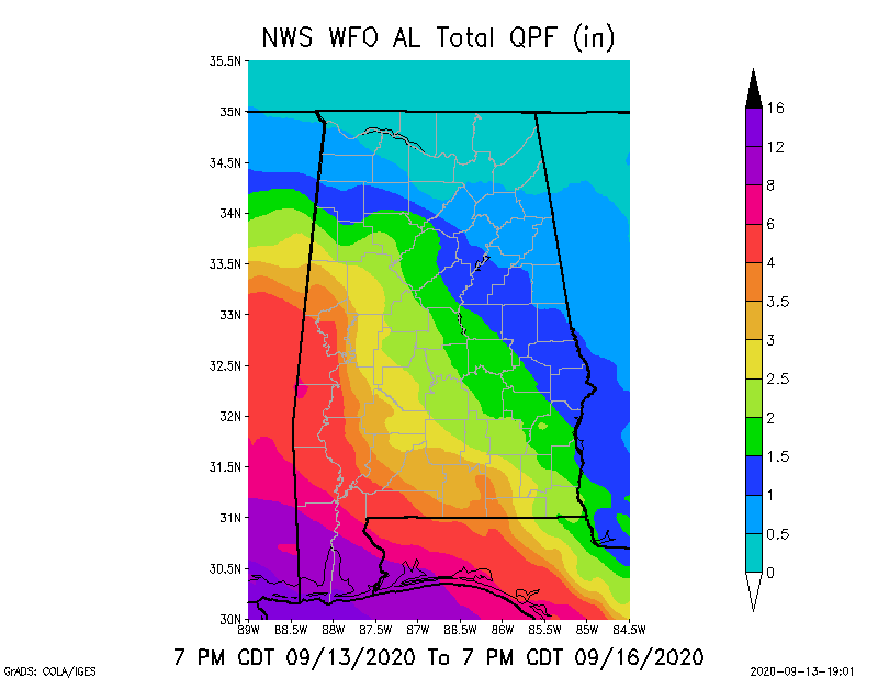
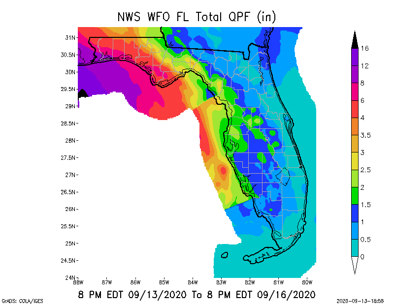
Note the increasing heavy rainfall amounts in southeastern LA, southern MS, and parts of western and southwestern AL. Storm total rainfall from Monday through Thursday is forecast to be in the 4” to 20”+ range in these areas, and 4” to 12” in the western FL panhandle.
The last graphic shows locations of some high voltage transmission lines, from 69kV to 500kV.
- Sid Sperry

 Show/hide attachments