 Show/hide attachments
IMG_6101.PNG (439K)
ATT00001.txt (4)
IMG_6102.PNG (83K)
ATT00002.txt (4)
IMG_6103.PNG (72K)
ATT00003.txt (4)
IMG_6104.PNG (66K)
ATT00004.txt (4)
IMG_6105.jpg (488K)
ATT00005.txt (4)
IMG_6106.PNG (57K)
ATT00006.txt (4)
IMG_6107.jpg (502K)
ATT00007.txt (4)
IMG_6108.jpg (731K)
ATT00008.txt (4)
IMG_6110.PNG (73K)
ATT00009.txt (4)
IMG_6111.PNG (176K)
ATT00010.txt (4)
IMG_6112.jpg (783K)
ATT00011.txt (4)
IMG_6113.GIF (44K)
ATT00012.txt (4)
IMG_6114.PNG (902K)
ATT00013.txt (6)
IMG_6115.PNG (35K)
ATT00014.txt (4)
IMG_6116.PNG (28K)
ATT00015.txt (4)
IMG_6117.PNG (29K)
ATT00016.txt (4)
IMG_6118.PNG (32K)
ATT00017.txt (4)
IMG_6119.PNG (47K)
ATT00018.txt (4)
IMG_6121.jpg (856K)
ATT00019.txt (19)
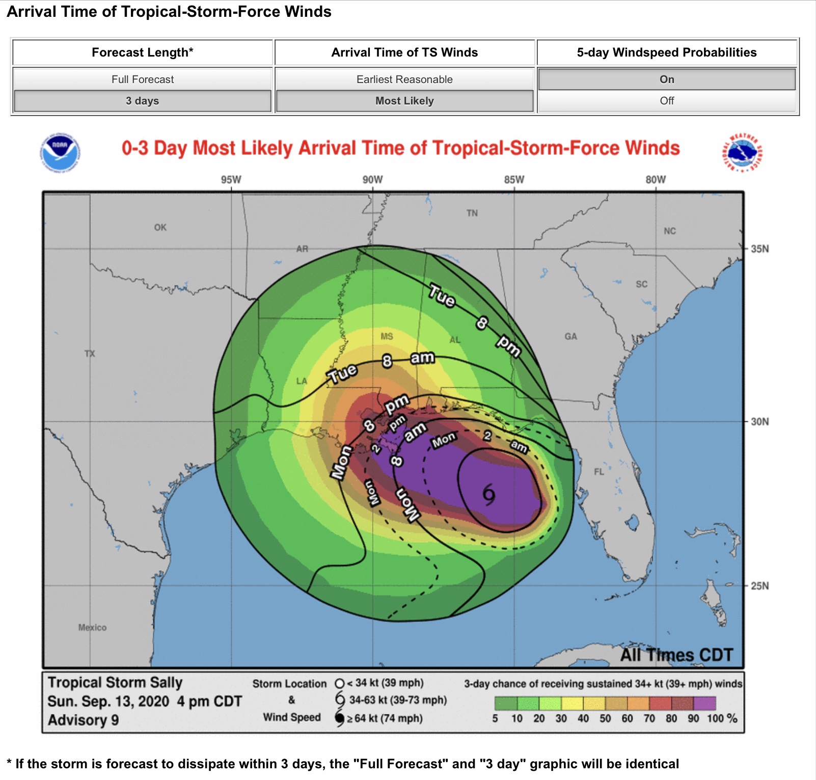
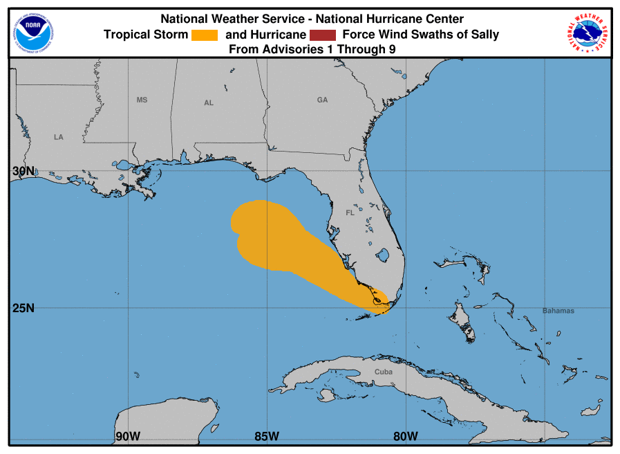
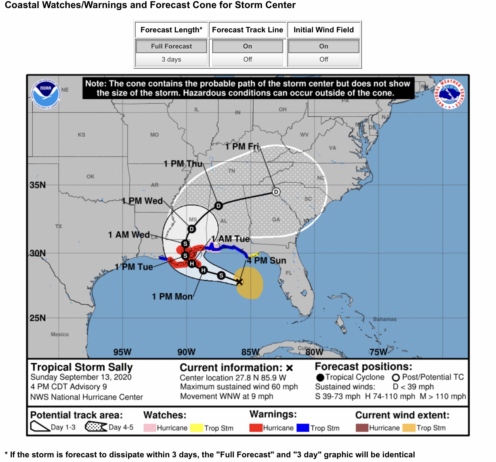
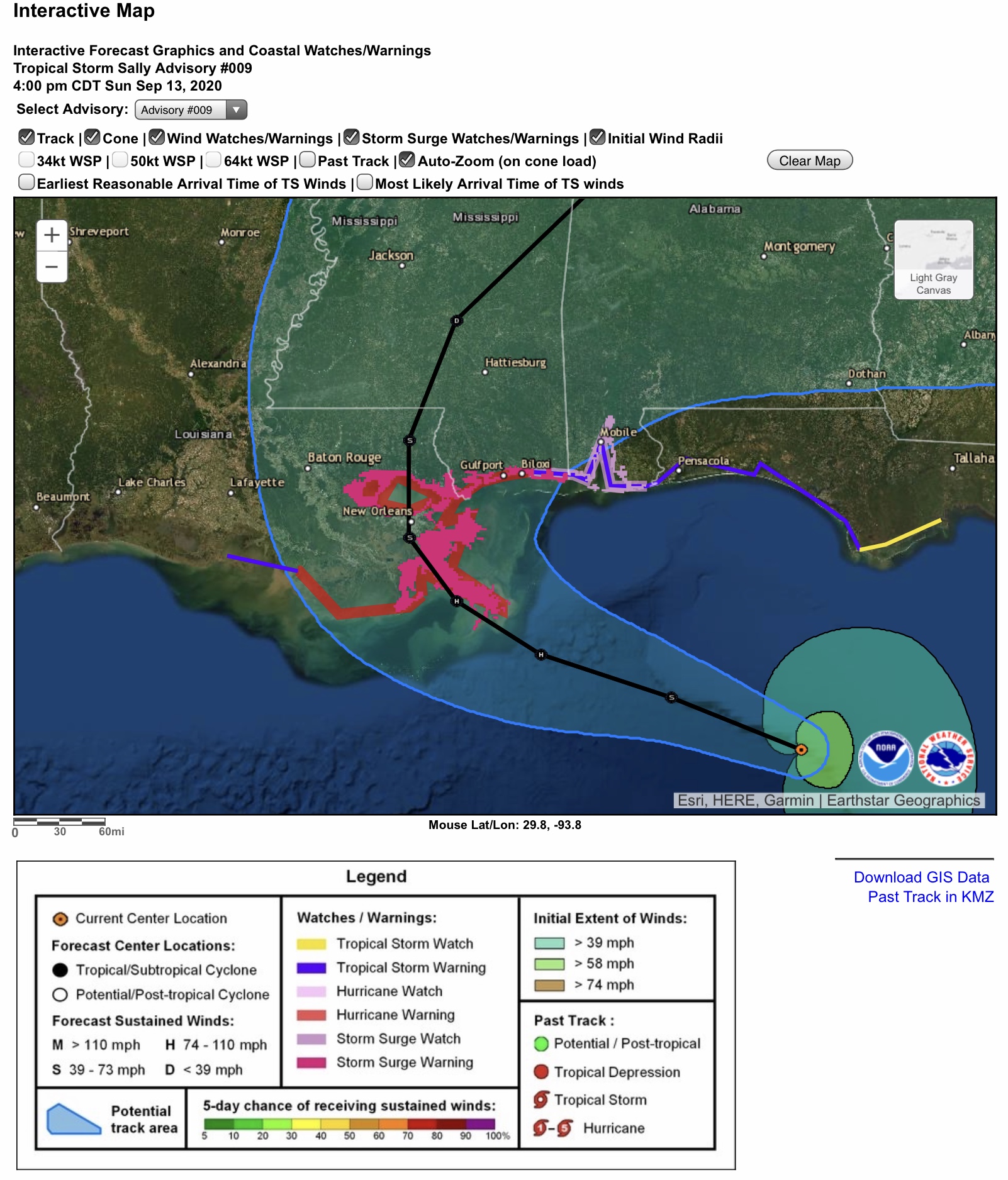
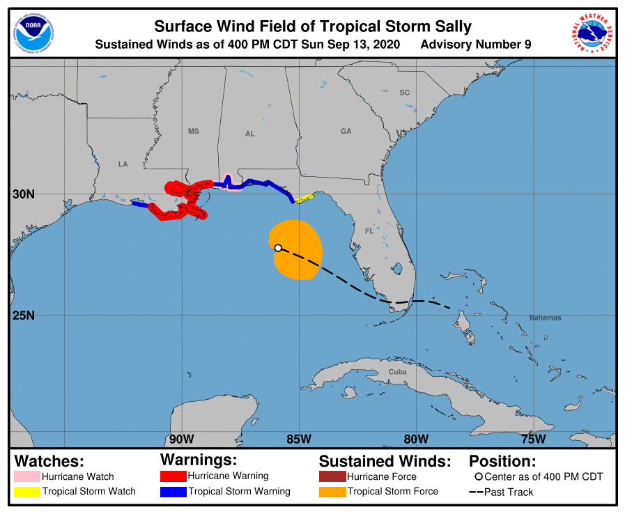
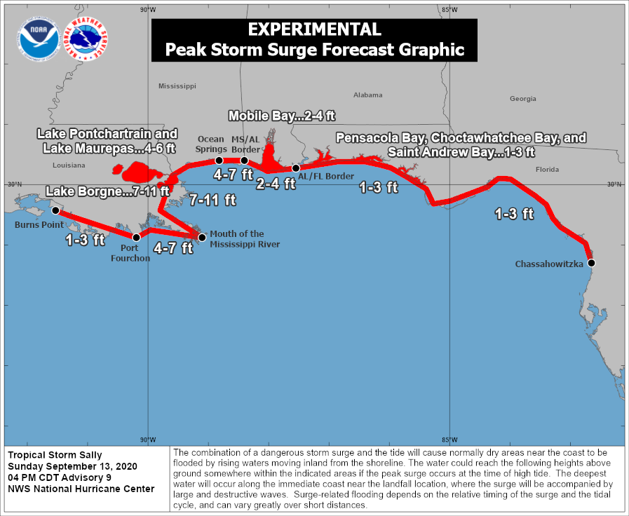
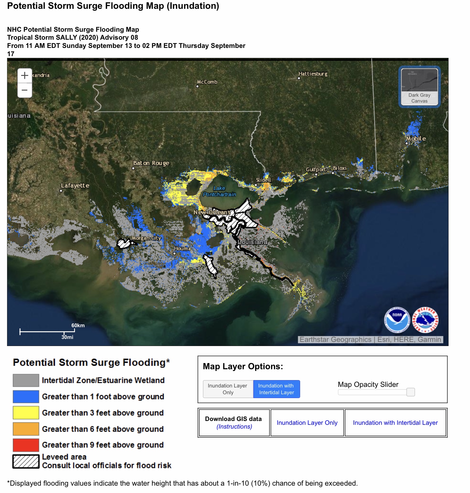
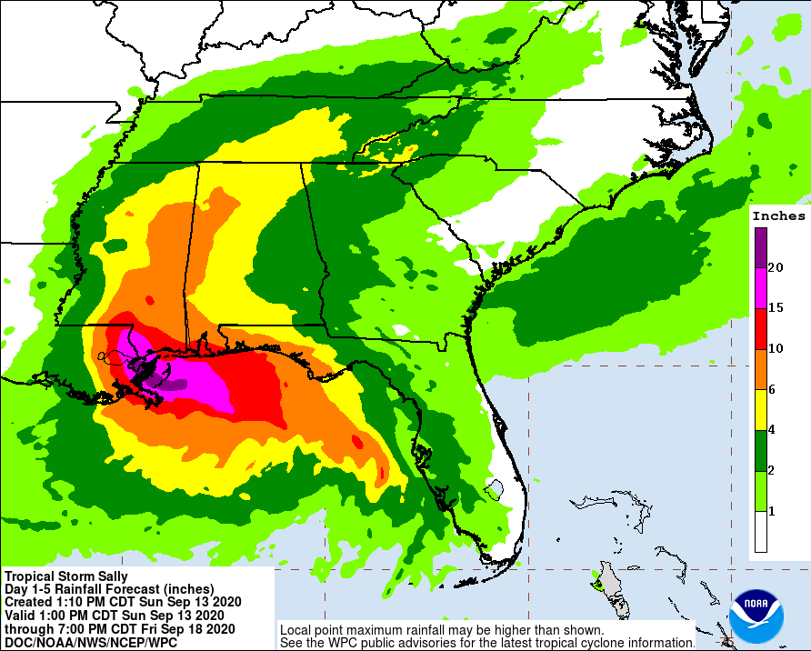
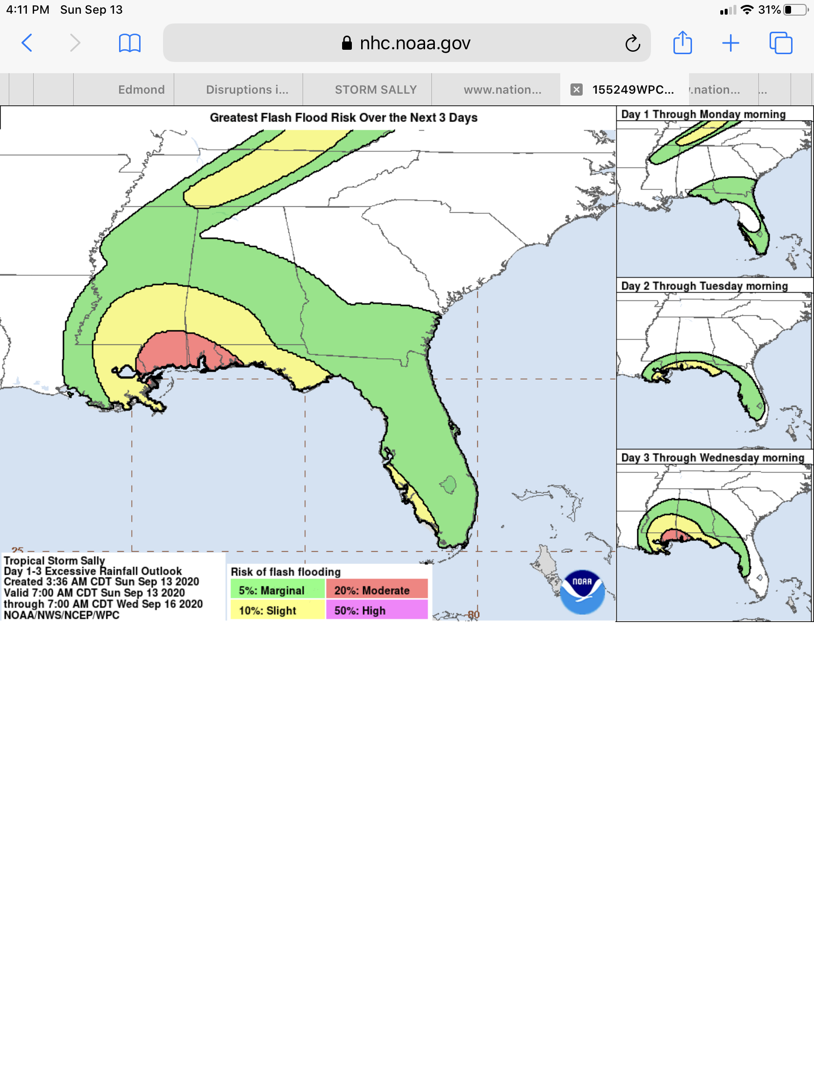
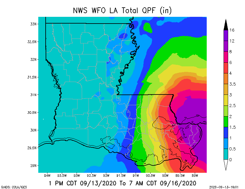
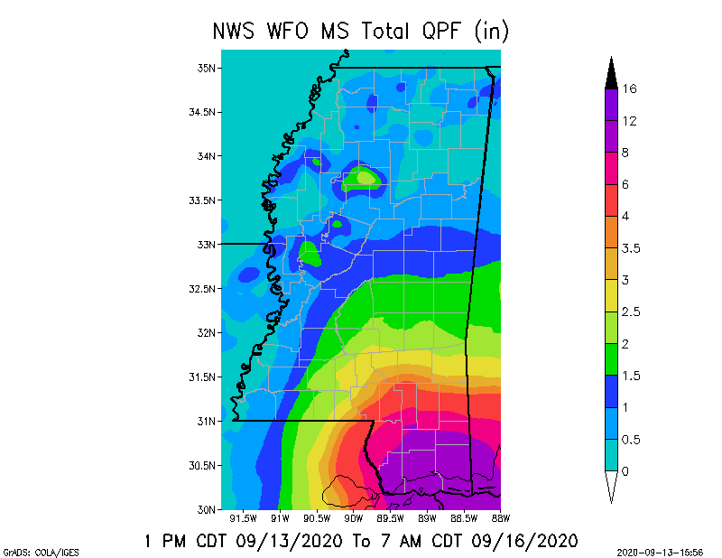
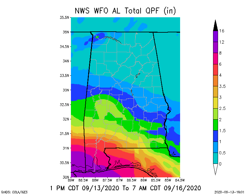
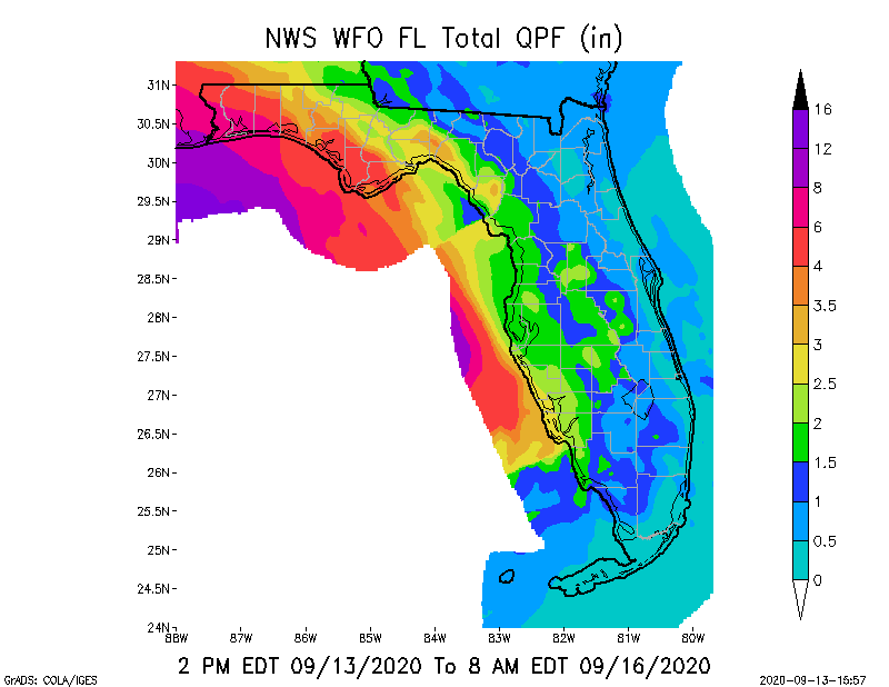
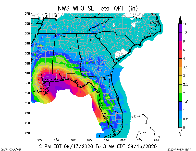
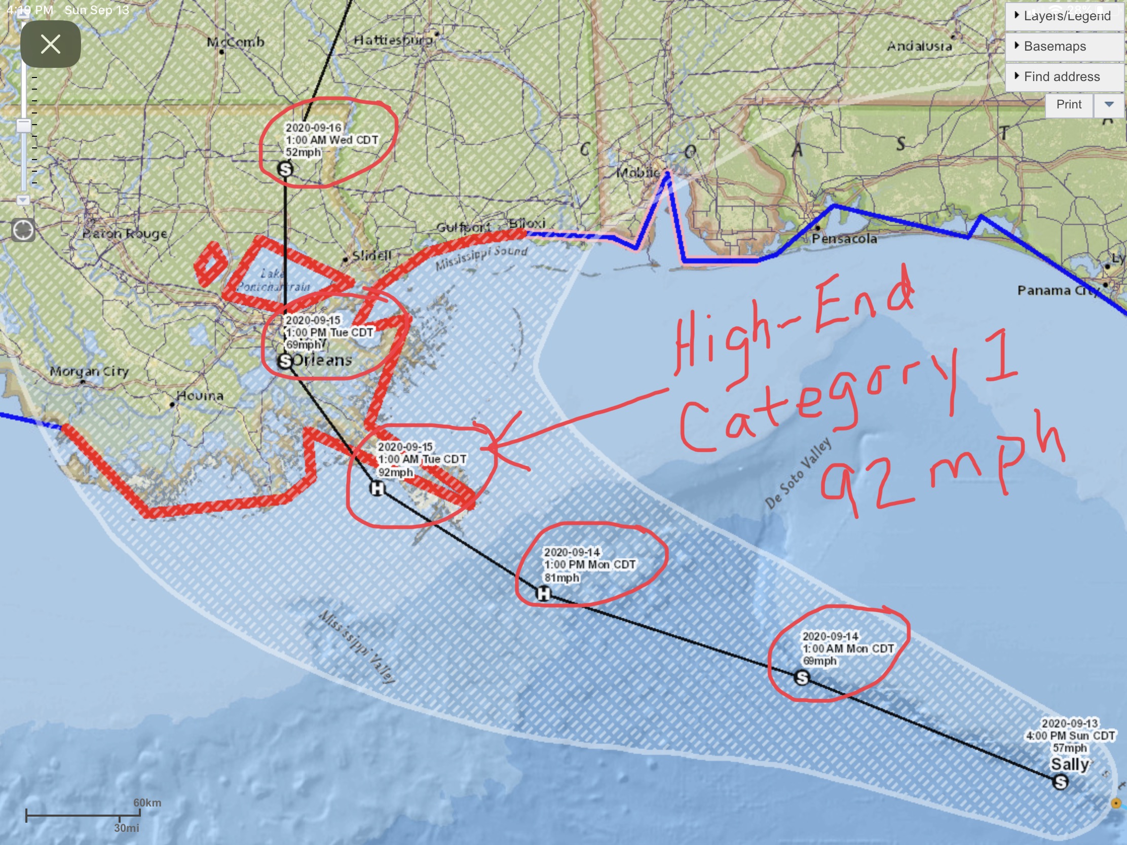
All,

Here are graphics from the 5pm EDT Forecasts of the National Hurricane Center (NHC) and the National Weather Service (NWS) local Weather Forecast Offices. Note that in this latest forecast the projected forecast track of soon-to-be Hurricane Sally has shifted slightly back to the east, with the “centerline” very close to downtown New Orleans, and splitting Lake Pontchartrain in half. This “wobbling” of the estimated track will likely continue over the next 12-24 hours as more forecast data is compiled on the atmospheric forces that will ultimately influence Sally’s actual track into southeastern Louisiana.

Note also that the NHC has lowered Sally’s status from a Category 2 to a Category 1 at landfall, even though the wind speed reductions are only by a few mph, from 98 to 92, which would be a “high-end” Category 1. Again, these “ratings” may vary slightly from forecast to forecast as more data comes in over the next 12 to 24 hours. Sally is still forecast to become a Category 1 Hurricane late tonight or sometime tomorrow morning, and could certainly be a Category 2 hurricane at Landfall on Tuesday.

Of equal if not greater concern are storm surge and Total Rainfall forecasts. Storm surge projections are still from 4’ to 11’ in areas of southeastern LA, from 4’ to 7’ near Ocean Springs, MS and the MS/AL border, and from 2’ to 4’ in Mobile Bay.

Storm Total Rainfall through Wednesday morning is estimated to be in the 4” to 16” range, and through 7pm Friday to be in the 4” to 20”+ range for parts of southeastern & eastern LA, southern & southwestern MS, and southern & southwestern AL. Parts of the western FL panhandle could receive from 4” to 10”+ in storm total rainfall.

Next NHC and NWS Forecast Updates will be at 8pm EDT tonight. - Sid Sperry, OAEC
