2pm National Hurricane Center and National Weather Service Forecast Updates...
Sid Sperry 13 Sep 2020 18:43 UTC
FYI...
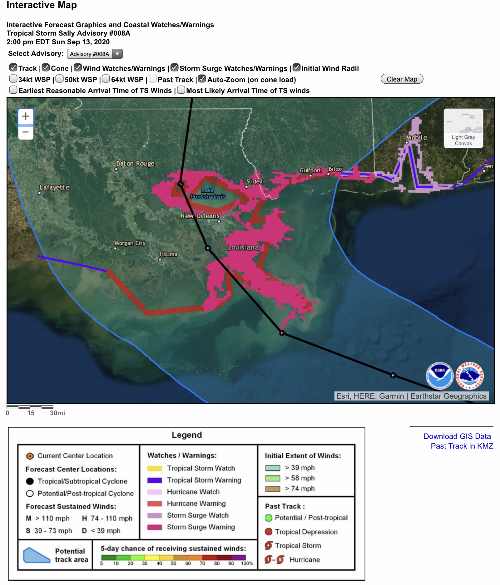
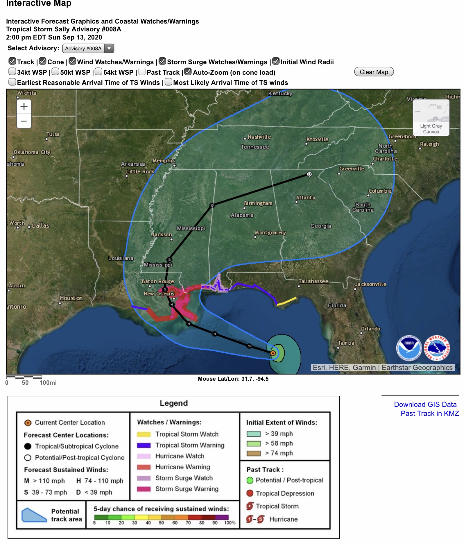
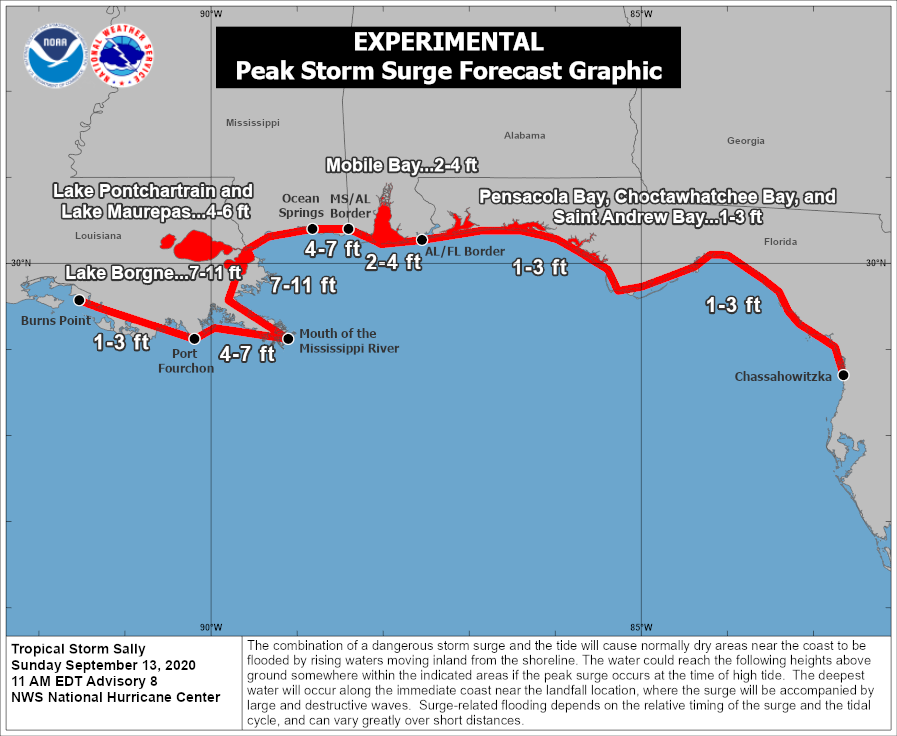
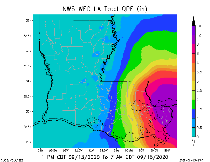
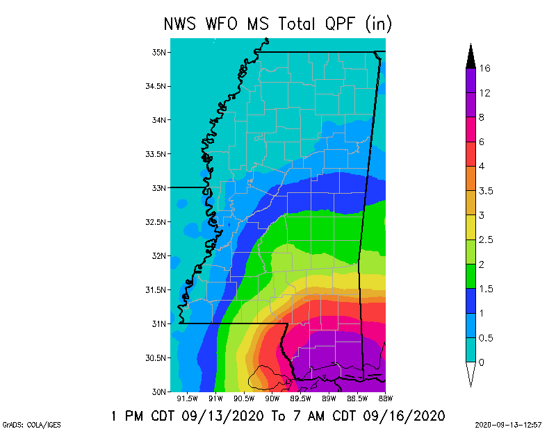
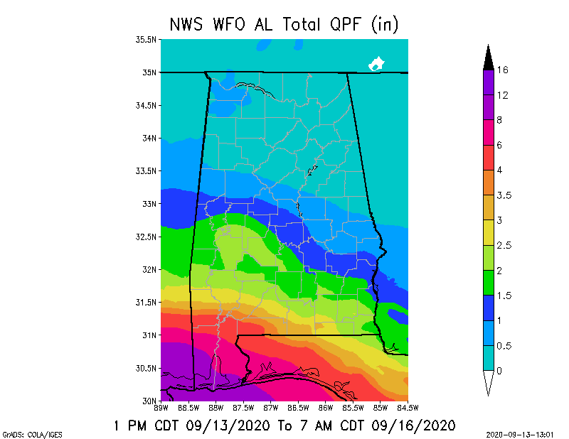
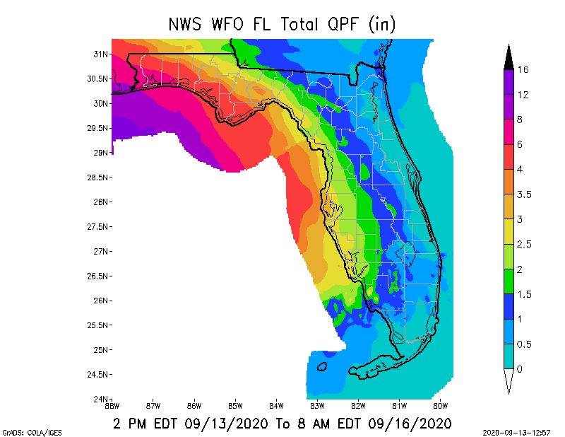
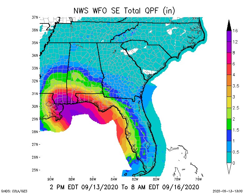
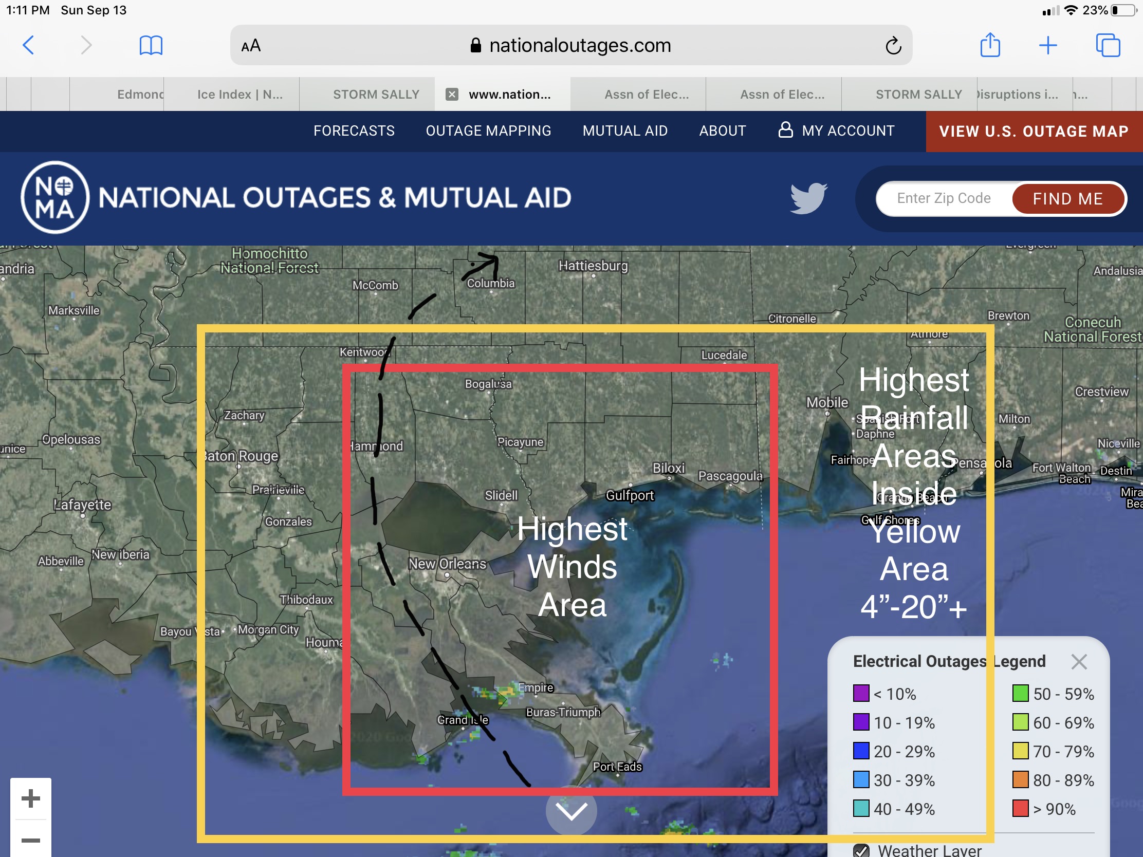
Track is now just west of New Orleans and Lake Pontchartrain. Baton Rouge, LA, is now included in a Tropical Storm Watch. Landfall projected to be Tuesday afternoon, near Grand Isle, LA, as a high pressure system to the north-northwest of the Lafayette & Baton Rouge areas will be forcing Sally to slow down slightly as it approaches the southeast Louisiana coast, then will help steer Sally to the north & northeast after landfall. This could mean MORE RAINFALL for areas to the east or right side of the forecast track. NWS New Orleans, LA, and NWS Mobile, AL, are both forecasting total rainfall amounts Sunday night through Thursday could be in the 4” up to 20” range, with some localized areas possibly receiving in excess of 20”. Flooding and flash flooding will be a major concern for areas from Baton Rouge to Morgan City and from Covington to Slidell in LA, and Gulfport and Biloxi in MS, and to Mobile in AL, possibly as far east as Pensacola, FL. Sally is still being forecast as a potential Category 2 hurricane, with landfall sustained wind speeds in the 96 to 102 mph range at this time.
- Sid Sperry

 Show/hide attachments