All,
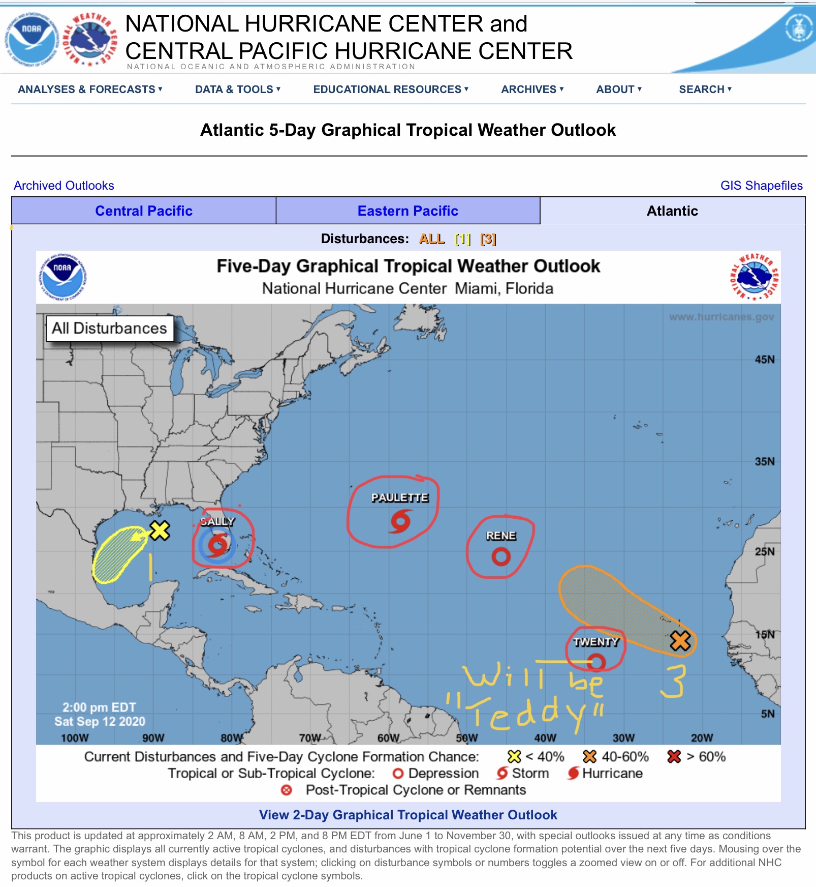
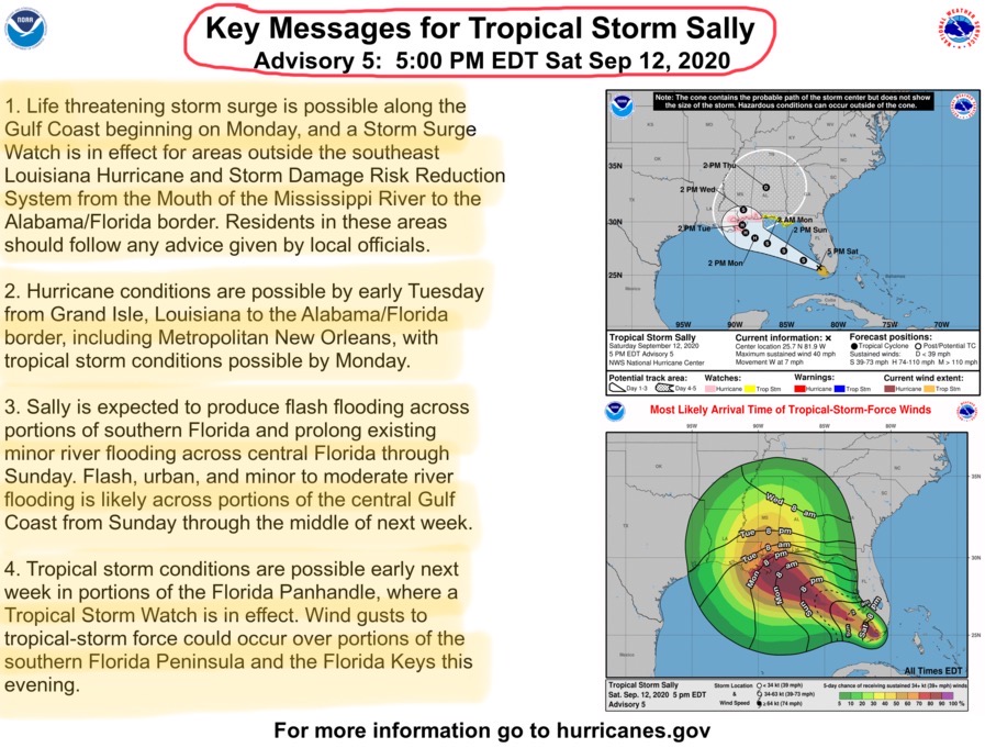
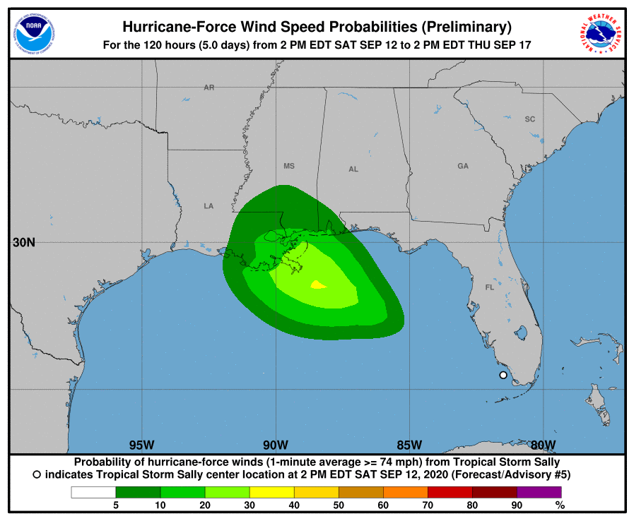
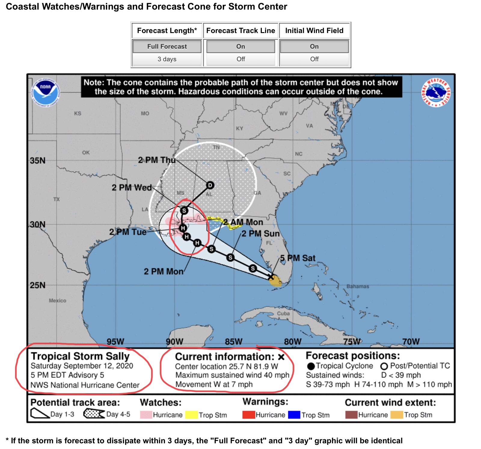
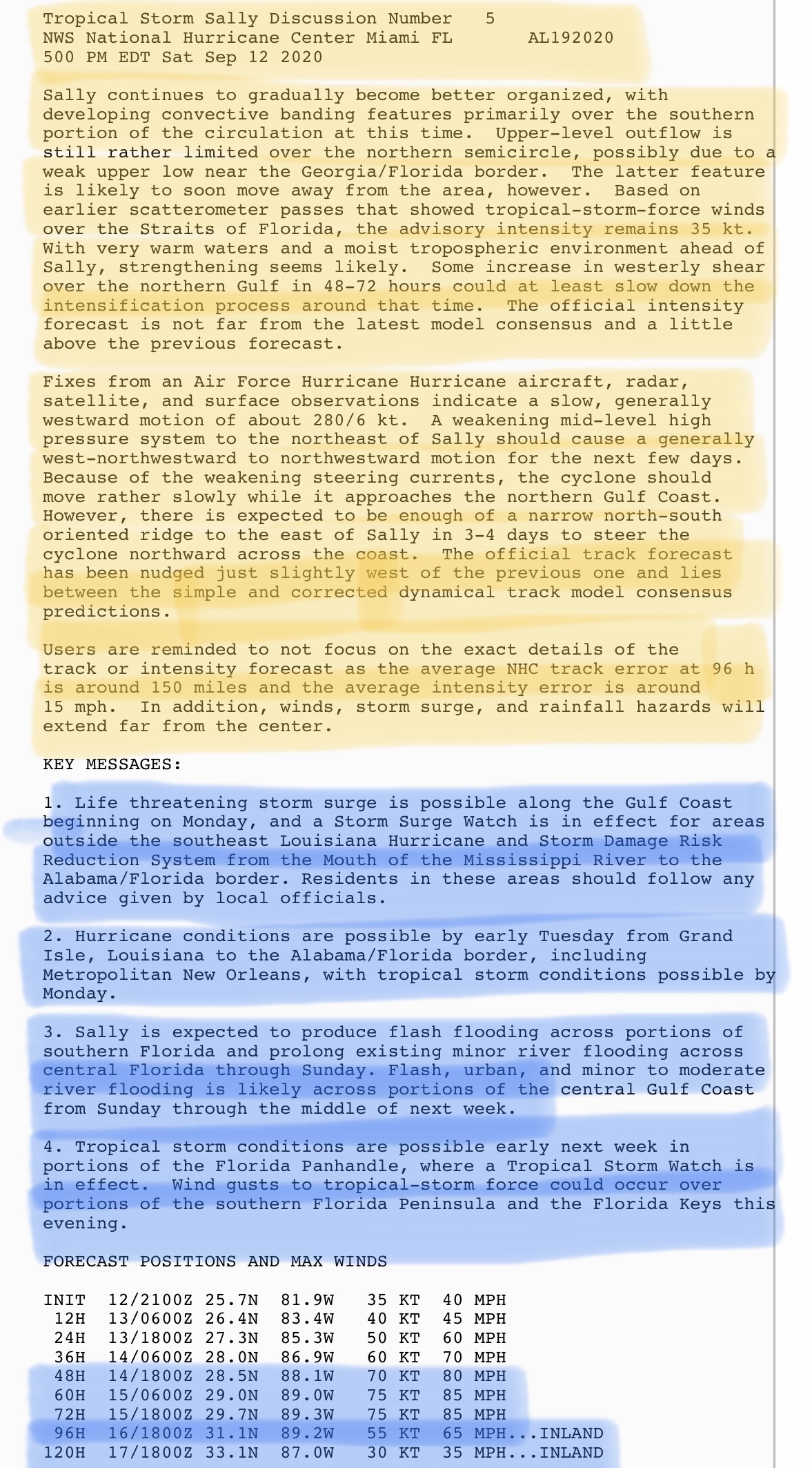
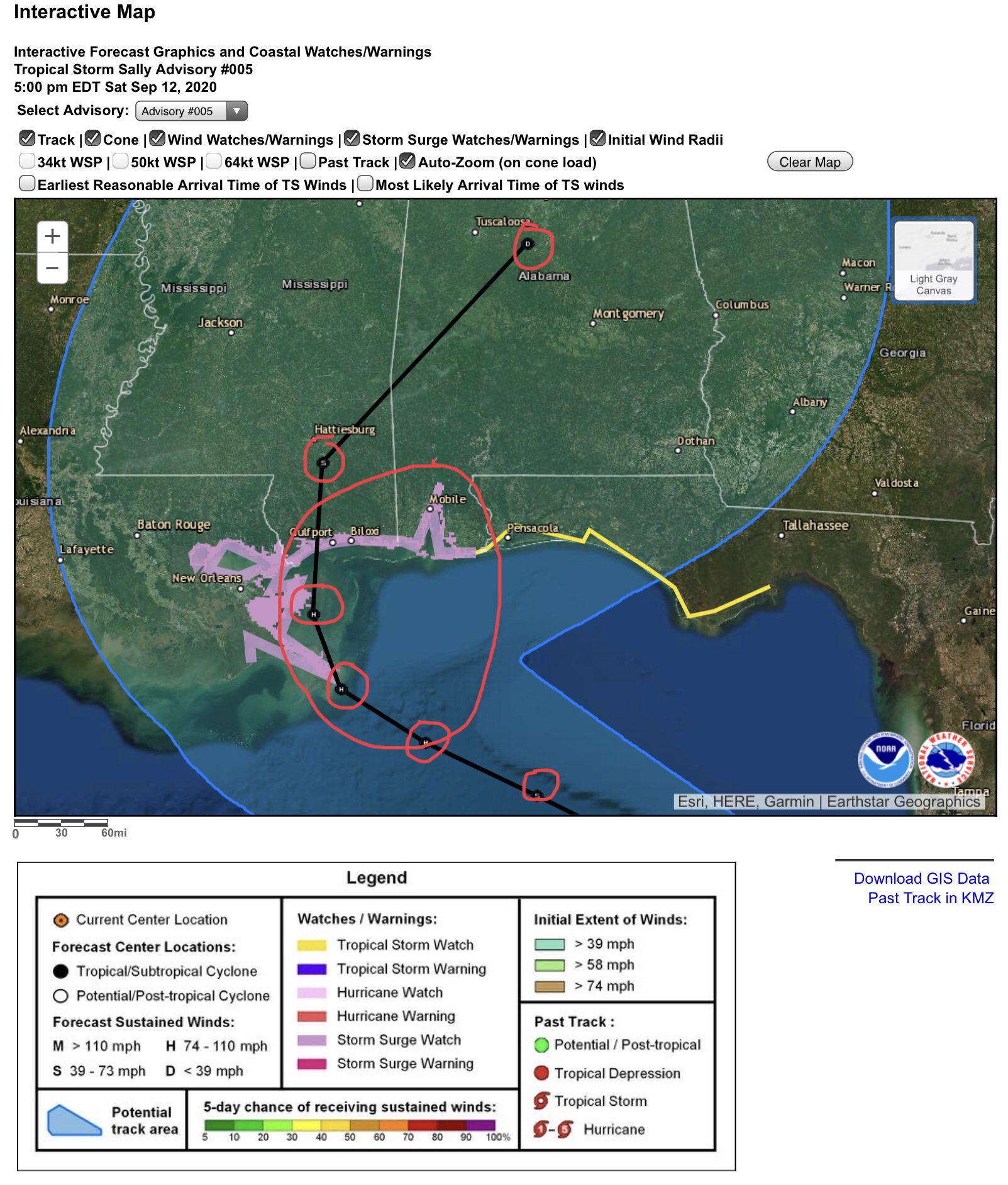
Well, things can certainly develop quickly when Tropical Depressions enter the Gulf of Mexico. And, after having only been a Tropical Depression for a few hours, Tropical Storm “SALLY” has now formed off the southwest coast of Florida. Max sustained winds have reached 40 mph and the storm’s movement is West at 7 mph. TS Sally IS NOW FORECAST to become at least a Category 1 Hurricane sometime Monday morning, and could possibly reach Category 2 status before landfall late morning or early afternoon on Tuesday, Sept. 15.
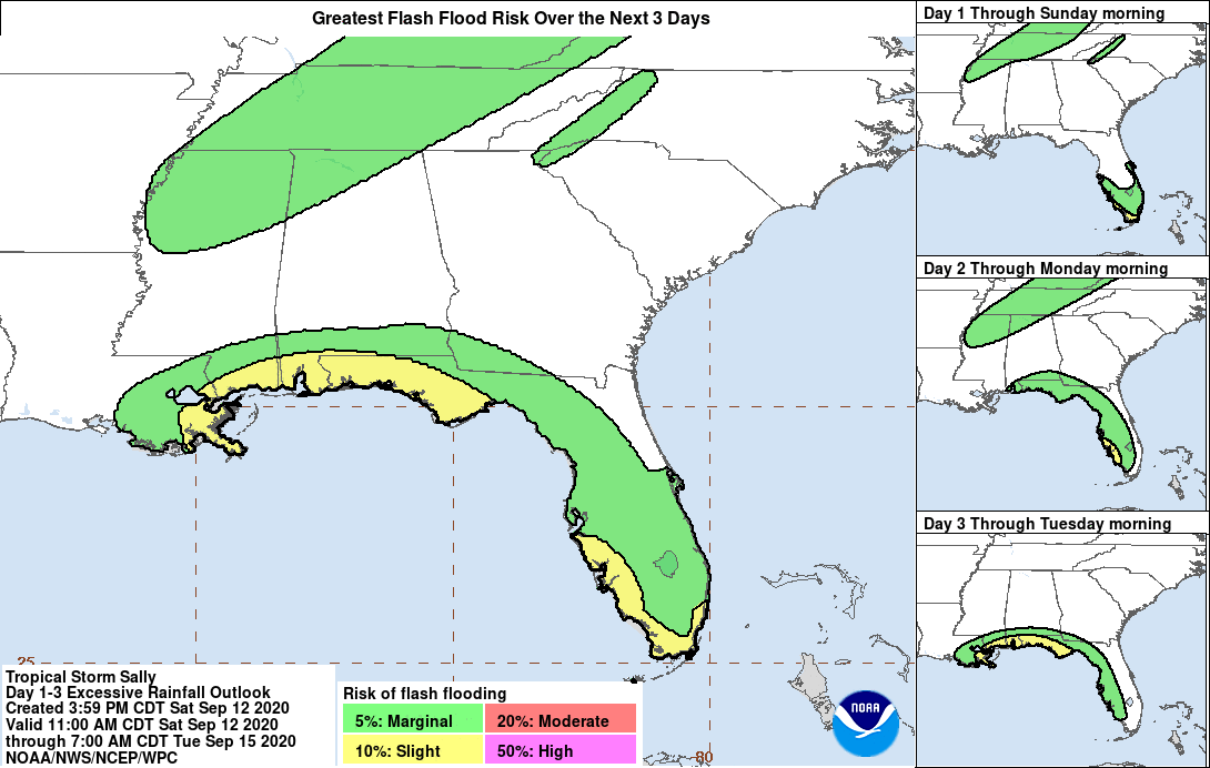
While there should be concerns should exist from Grand Isle, LA, to the AL/FL border, this storm is not expected to severely impact areas previously impacted by Hurricane Laura in late August. South-central Louisiana could receive from 2” to 4” of rainfall and there could be some flooding and flash flooding in the Jeff Davis Electric Cooperative and Beauregard Electric Cooperative Service areas, but strong winds above 35-40 mph are not expected in their respective areas at this time. (That could change if Sally’s track shifts further to the west.)
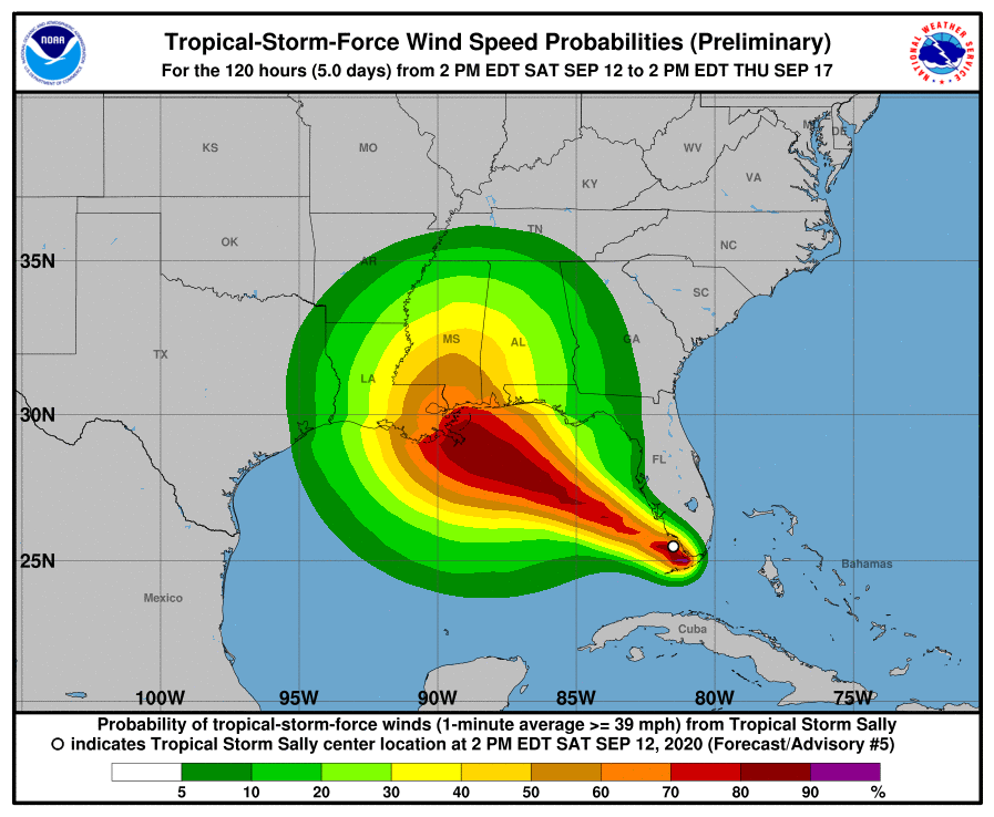
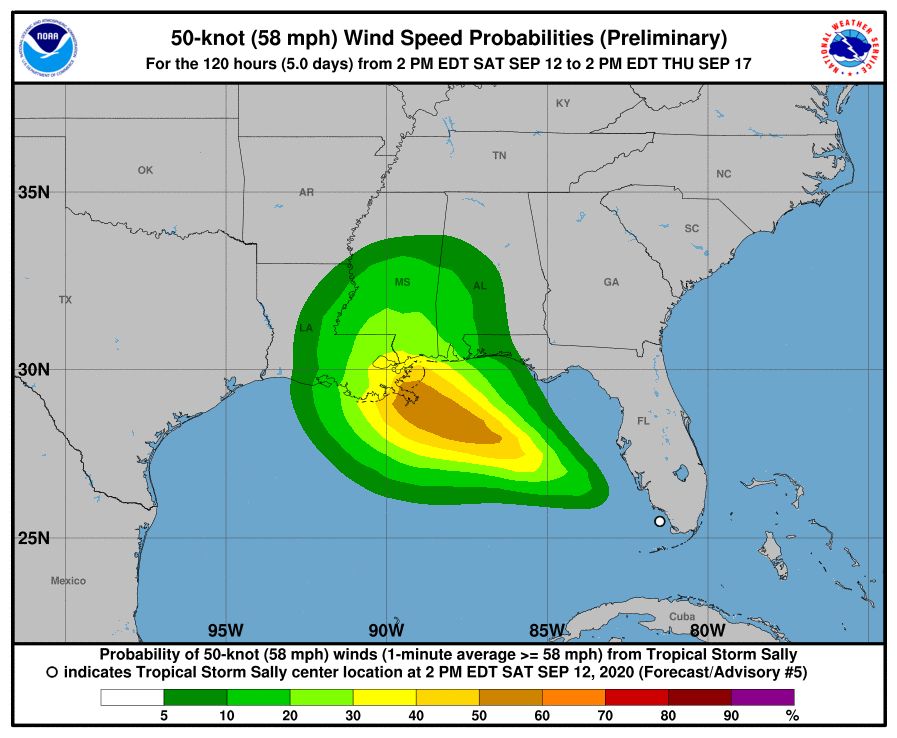
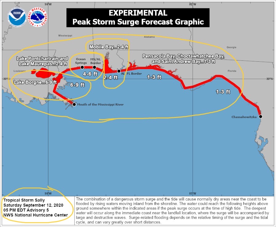
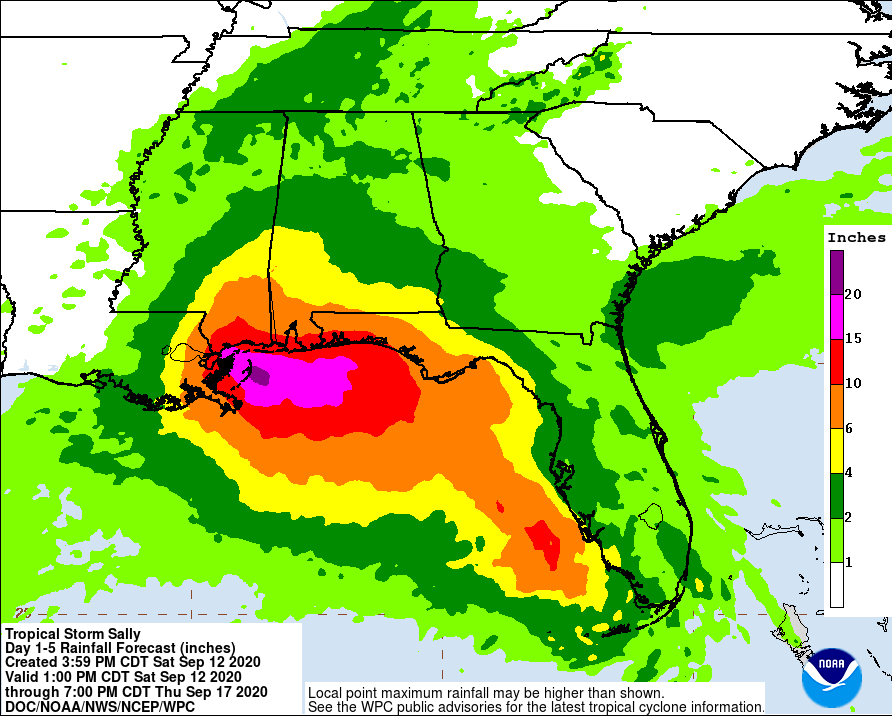
See graphics below for possible storm surge areas and heights, as well as the National Weather Service forecasts for storm total rainfall, which could exceed 6” to 15” or more in areas of southeastern LA, southern MS and southern AL, as well as the western half of the FL Panhandle.
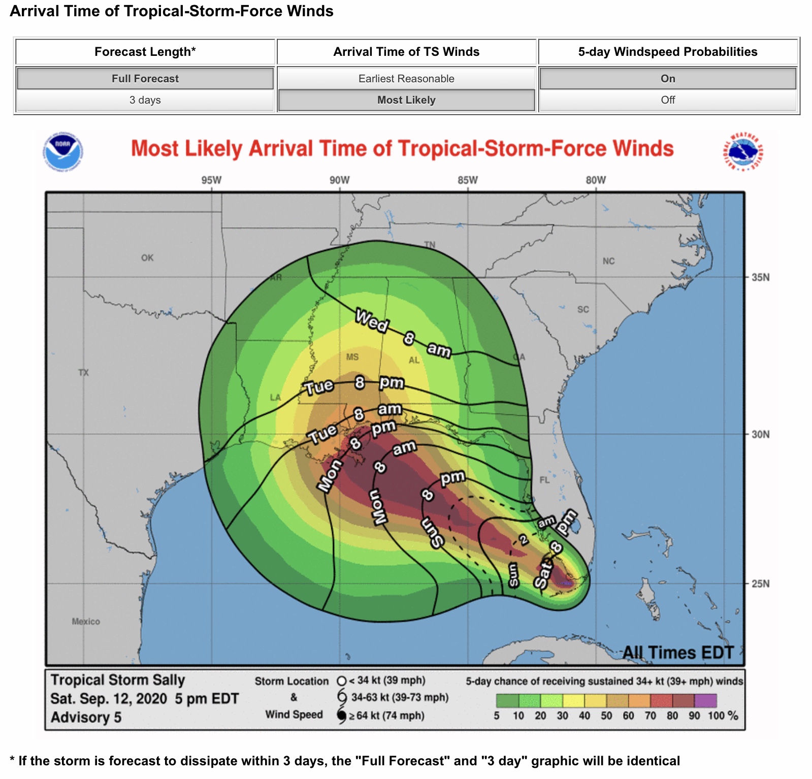
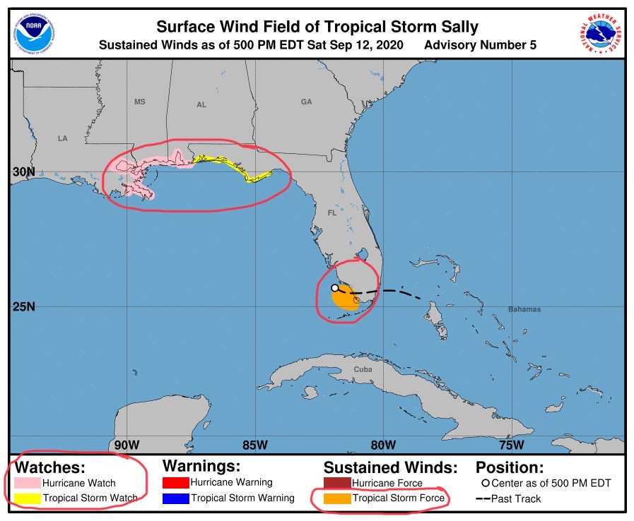
The present NHC forecast has Sally making landfall on Tuesday late morning or early afternoon with sustained winds of 80-85 mph and the eye coming ashore just west of Gulfport, MS. Strong eyewall winds would be on the east-northeast quadrant of Sally, which at this time would include the Gulfport and Biloxi areas, and potentially the Mobile area. Sally is expected to reduce in strength to a Tropical Storm on Tuesday evening, then into a Tropical Depression on Wednesday as it moves northward into south-central MS, then southwestern AL, with heavy rainfall expected. A Tropical Storm Watch has been posted for parts of the Florida Panhandle Coast, and a Hurricane Watch has been posted for areas from Grand Isle, LA, to the AL/FL border. - Sid Sperry

 Show/hide attachments