Tropical Depression #19 Will Likely Develop Into Tropical Storm “Sally” Later Today; Could Possibly Develop Category 1 Hurricane Strength by Monday, Sept. 14.
Sid Sperry 12 Sep 2020 11:58 UTC
All,
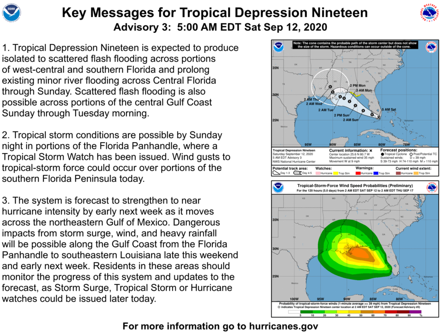
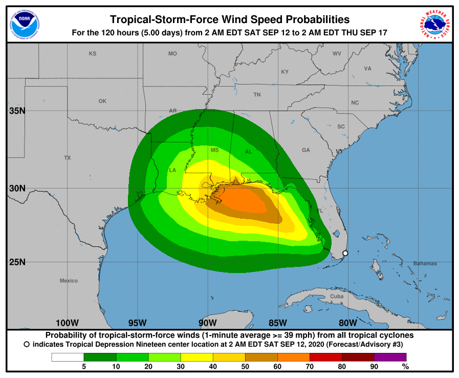
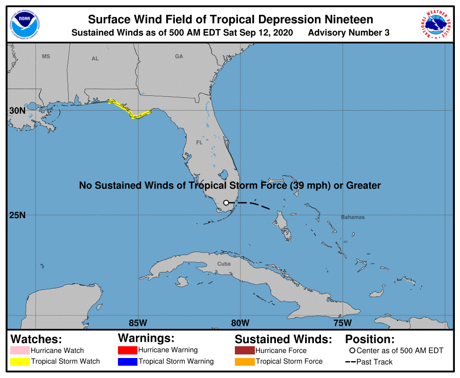
Here are the latest (5am) forecast graphics from the National Hurricane Center in Miami for Tropical Depression #19, which is currently located in far southern Florida. It is expected to develop into a Tropical Storm (S) by later today, and enter the eastern Gulf of Mexico waters by later this evening. A “Tropical Storm Watch” has been posted along the Florida Panhandle coastline. Max Sustained Wind Speed is 35 mph currently, and movement is westerly at 9 mph.
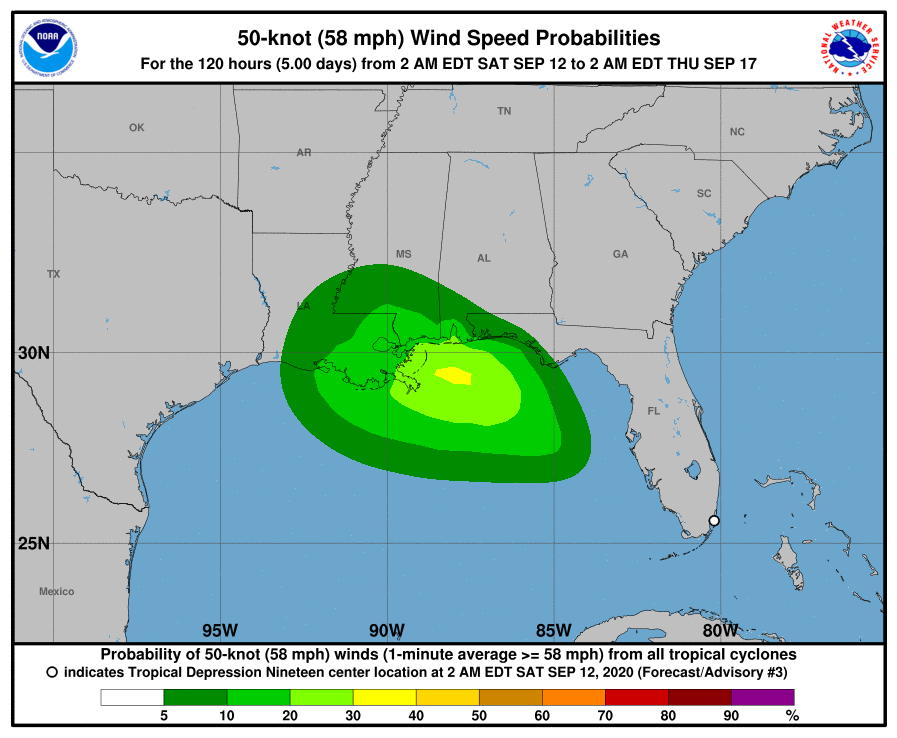
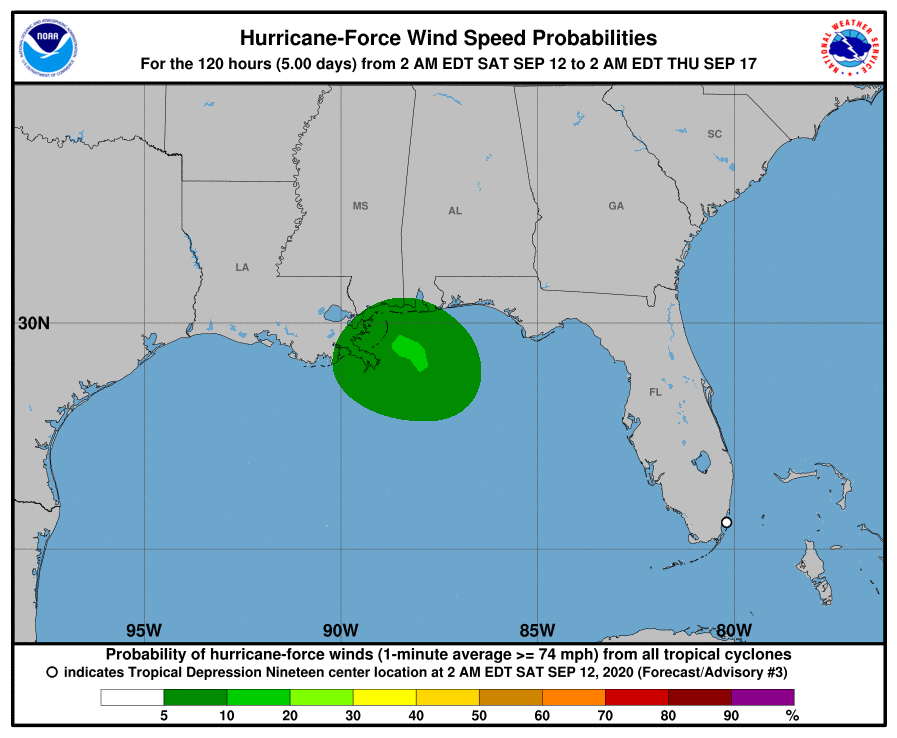
There is growing concern among NHC forecasters that this Tropical Depression - soon to become Tropical Storm “SALLY,” could strengthen into a Category 1 Hurricane (winds of 74 mph and greater) by sometime Monday afternoon, September 14. It’s current projected path takes it just northeast of New Orleans and just to the southwest of the Gulfport-Biloxi area, with a potential for “landfall” sometime around Noon on Tuesday, September 15. Its relatively slow movement means it could be over warm Gulf Waters for the next 3 days, increasing the odds for its development into a Category 1 Hurricane.
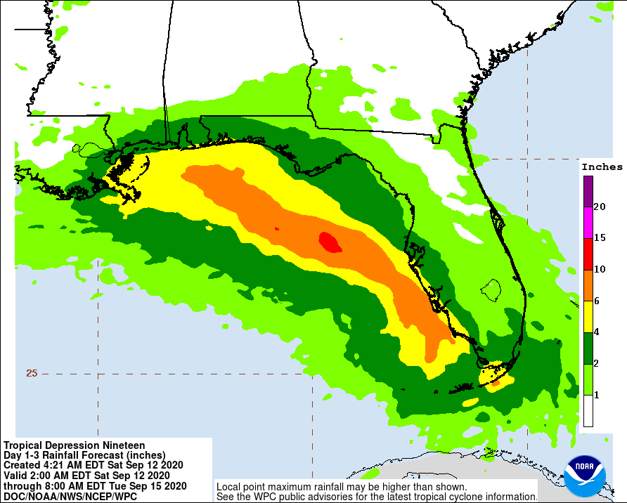
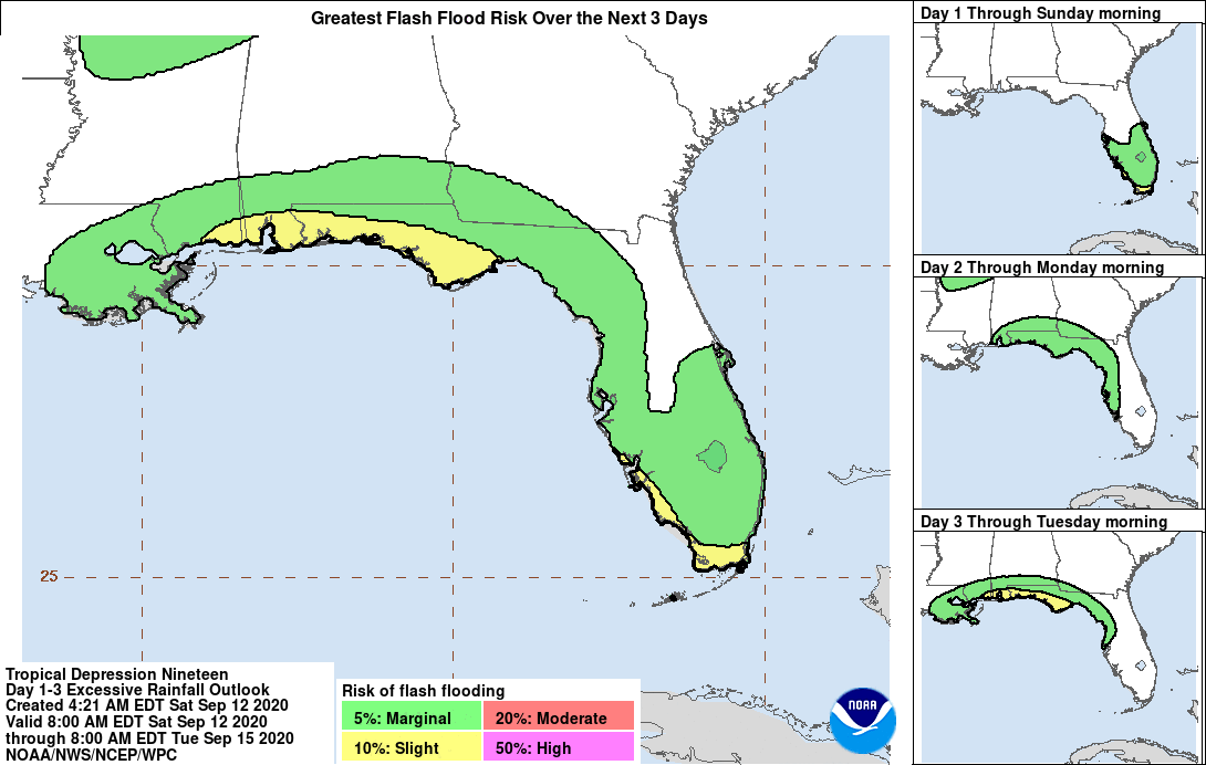
After a potential landfall on Tuesday, the storm should dissipate into a Tropical Depression in southwestern Mississippi. Heavy rainfall of from 4” to 10”+ could be expected with this storm, potentially causing flooding and flash flooding along the Florida panhandle, southern Alabama, southern Mississippi, and southeastern Louisiana coastal areas. Storm surge could also be of concern in southeastern LA, southern MS, and southern AL. This storm should be watched closely for further developments once it enters the eastern Gulf of Mexico later today. - Sid Sperry, OAEC

 Show/hide attachments